Mercer
Hopewell Township
Woosamonsa Ridge Preserve
Hopewell Township, NJ


Last Updated: 06/18/2024
Overview of Selected Trail
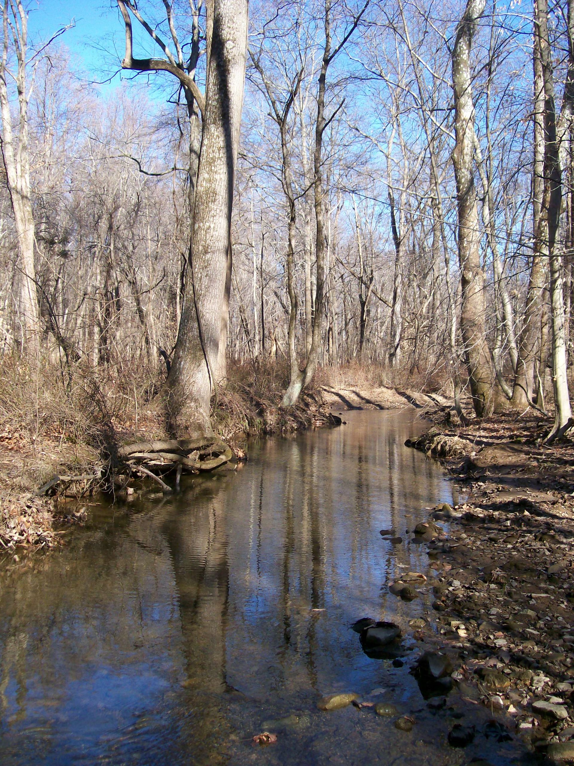
The 146-acre Woosamonsa Ridge Preserve, with almost three miles of trails, boasts exceptional natural features — a mature hardwood forest, steep ridges, and the upper reaches of Jacobs Creek running through a valley flanked by those ridges.
NOTE: Trail users must stay on the marked trails. Trails on this preserve come very close to the preserve boundaries with neighboring private property. Do not wander off the trails, or “explore” off trail in the nearby woods; you will be trespassing, and subject to legal action. Just as serious: you will be undermining the partnerships and cooperation with preserve neighbors that are essential to successful land stewardship.
-
-
Distance:
Ridge Trail: 1.5 miles
Valley Trail: 3/4 mile
Creekside Trail: 1/3 mile
Hollow Brook Trail: less than a quarter mileNote: The above trails in combination form several loops that hikers can choose depending on their own inclinations.
Time:
Ridge and Valley Trail loop: 90 minutes
Ridge, Creekside, and Valley Trail loop: 60 minutes
Ridge, Hollow Brook, and Valley Trail loop: 30 minutesMarkings:
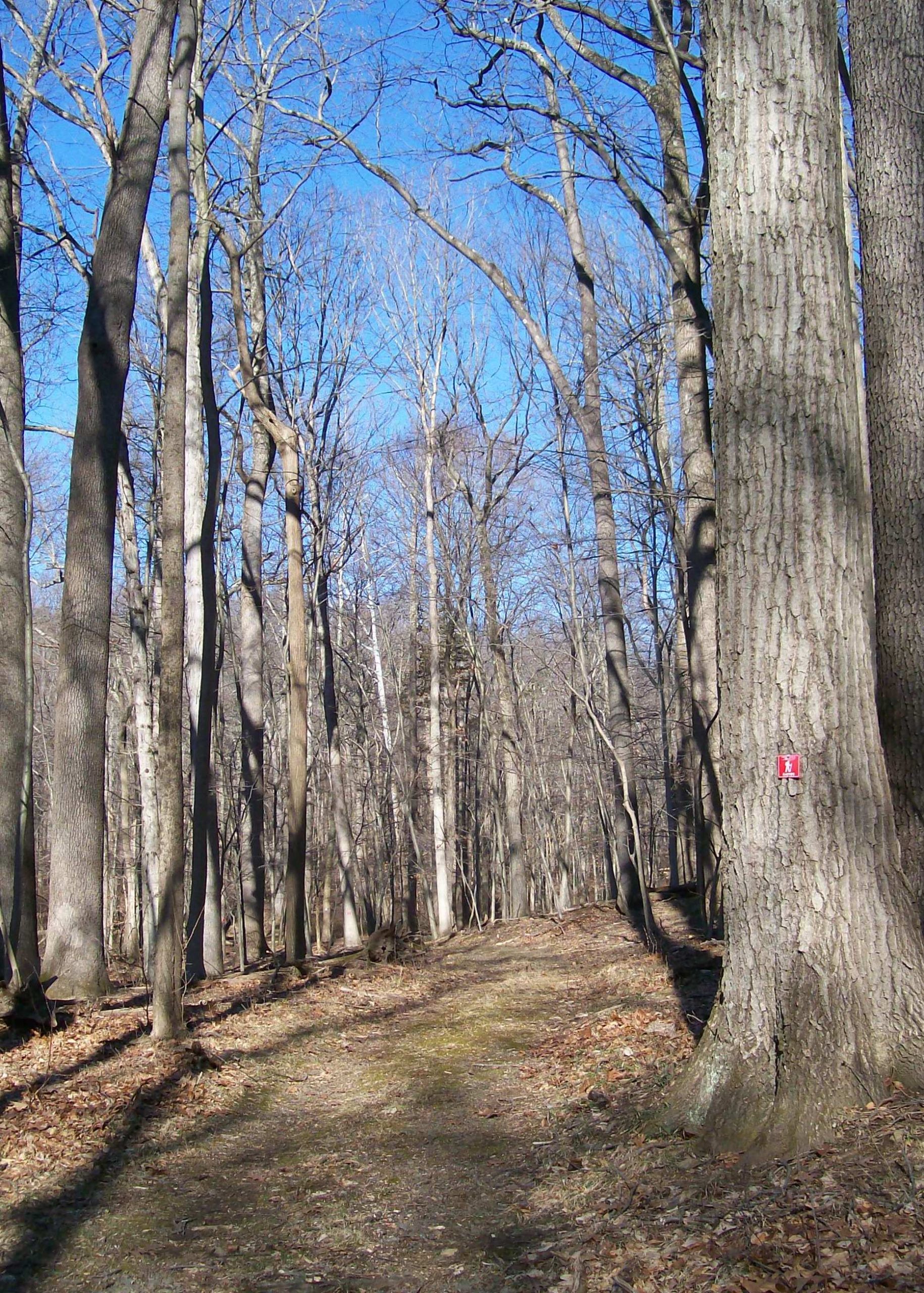
Markers are attached to trees along the trails:
White for the Ridge Trail
Red for the Valley Trail
Blue for the Creekside Trail
Yellow for the Hollow Brook TrailTrail Usage:
This is a walking/hiking trail. No ATVs, bikes, other wheeled vehicles, or horses are permitted. It is not designed for equestrian use. Dogs must be kept on leash for the benefit of wildlife and fellow hikers. Hunting is permitted on the property during hunting season by permit only. For safety, wear orange or yellow safety vests and hats.
Elevation:
There are some steep grades on the Ridge Trail and Hollow Brook Trail. Other trails are flat with some moderate slopes.
Difficulty:
Easy to moderately strenuous.
Parking:
A parking lot for 6-7 cars that will be located at the trailhead off Woosamonsa Road is being developed in spring 2020.
Tips:
This preserve offers hikers several loop routes of varying distance and topography. Hikers should study the trail map before heading out to decide which loop they want to take.
On the Ridge Trail, there are two “stepping-stone crossings” of Jacobs Creek and Hollow Brook, which after a heavy rain or at times of heavy spring runoff could be impassable.
NOTE: Trail users must stay on the marked trails. Trails on this preserve come very close to the preserve boundaries with neighboring private property. Do not wander off the trails, or “explore” off trail in the nearby woods; you will be trespassing, and subject to legal action. Just as serious: you will be undermining the partnerships and cooperation with preserve neighbors that are essential to successful land stewardship.
Deer Management: As part of a Hopewell Township-wide effort to control the deer population, managed hunting occurs on the Preserve. During hunting season (September through February), hunting may occur any day except Sunday. The hunting schedule is posted at the trailhead and on the Friends of Hopewell Valley Open Space website (www.fohvos.org). The Preserve remains open to hikers every day, including hunting days, but hikers are strongly urged to wear a bright color (e.g. orange or yellow) during hunting season, which is by permit only.
Amenities:
A kiosk with trail information is located at the parking area.
Directions:
The entrance to the preserve is from Woosamonsa Road, approximately one mile west of Poor Farm Road and two miles west of Route 31. From Trenton-Harbourton Road, the Preserve is approximately one mile heading east on Woosamonsa Road.
-
Ridge Trail – Starting at the parking lot, this trail first follows the base of a high ridge to the east of the trail. It makes a gradual ascent up the flank of the ridge, then dips down to meet with the Hollow Brook Trail. Beyond that trail, the Ridge Trail continues across some shallow swales and descends to a crossing of Hollow Brook on steppingstones. From there, the trail makes a steep ascent, reaching almost the highest point of a second ridge. After skirting the ridge top, the trail descends to join the Creekside Trail near Jacobs Creek. A short distance farther, the Ridge Trail crosses Jacobs Creek — at this point a narrow brook — and ascends part way up another ridge that forms the north side of the Jacobs Creek valley. At its end, the trail joins the Valley Trail, which can be taken back to the parking area. This trail, in combination with the Valley Trail for the return, offers the longest hiking loop.
Valley Trail – This trail branches off to the left (west) from the Ridge Trail about a quarter mile from the parking area. From the Ridge Trail, the trail makes a short descent to the “floor” of the Jacobs Creek valley. After passing Hollow Brook Trail, the trail meets up with the Creekside Trail. At that point, the Valley Trail makes a sharp left turn, and in about 25 yards it crosses a wide wooden bridge over Jacobs Creek. From there the trail goes straight up an incline to connect with the Ridge Trail.
Creekside Trail — This flat and relatively short scenic trail offers some close-up views of Jacobs Creek. Both the Ridge and Valley trails provide access to the Creekside Trail which can be hiked as part of a loop with those trails.
Hollow Brook Trail — This short trail, which is moderately steep, connects the Ridge and Valley trails. This trail and the Ridge and Valley trails combine to offer the shortest hiking loop.
-
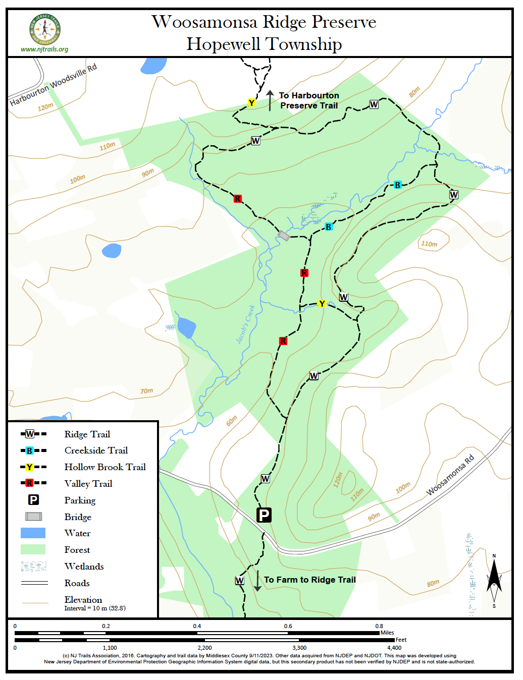
The entire preserve is covered by a mature hardwood forest, which features soaring, 80-100 foot tulip poplars, oaks, and ashes along with other hardwoods. A well- preserved understory of native trees complements this large stand of native hardwoods. In the fall, wild turkeys can be heard clucking and calling to each other and can often be seen from up on the Ridge Trail as they move across the valley floor below.
Do you have information about this trail?
Click Here to contribute.
-
The name Woosamonsa is derived from a word used by the Lenape Indians who inhabited the area. The earliest spelling of the native American word, recorded in 1689, was “Wissomency” and is thought to mean “place of wrinkled trees.”* The word may have referred to the bark of a certain tree species. A later spelling of the word was Wissamonson. The current anglicized spelling came into use in the 19th century when Woosamonsa Road was laid out.**
D&R Greenway Land Trust, in partnership with Friends of Hopewell Valley Open Space (FoHVOS) and Hopewell Township, acquired the 146-acre preserve from the Harbourton Foundation in 2018. The Foundation had been established by Jay and Amy Regan, who had owned the preserve’s land as part of a large estate where they lived. The Regans donated the subdivided, 146-acre forested portion of their estate to the Foundation with the intent that it be sold to the present owners and preserved forever. That sale was concluded, and the resulting funds became available to the foundation for use in further conservation efforts.
The forested land of the preserve had been used for horseback riding on bridle paths. These paths extended from the land-owners’ horse barn to the far reaches of the site. These wide bridle paths provided the basis for the network of trails which now exist throughout the preserve.
Funds utilized for the acquisition of the preserve were provided by the NJ Green Acres Program, Mercer County, and Hopewell Township. The Preserve is owned and jointly managed by D&R Greenway Land Trust and FoHVOS.
*Grume, Robert S., Beyond Manhattan: A Gazetteer of Delaware Indian History Reflected in Modern-Day Place Names, New York State Education Department, 2014.
**Hunter, Richard and Porter, Richard, Hopewell: A Geographical History, The Township of Hopewell, 1990.
Do you have information about this trail?
Click Here to contribute.
-
Photos
Videos
