Somerset
Montgomery
Schoolhouse Trail
Montgomery, NJ 08558


Last Updated: 12/08/2014
Overview of Selected Trail
The Schoolhouse Trail parallels the meandering Back Brook, a tributary of the Beden Brook. Additionally, a small parcel of forest behind Orchard Hill Elementary School can be accessed from the trail. A small one-room schoolhouse sits at the edge of these woods. The trail provides an important link in the township’s pathways plan to link the Sourland Mountains and the Delaware and Raritan Canal via trails.
For more information on Sourland Mountain and preservation efforts go to Sourlands Planning Council.
-
-
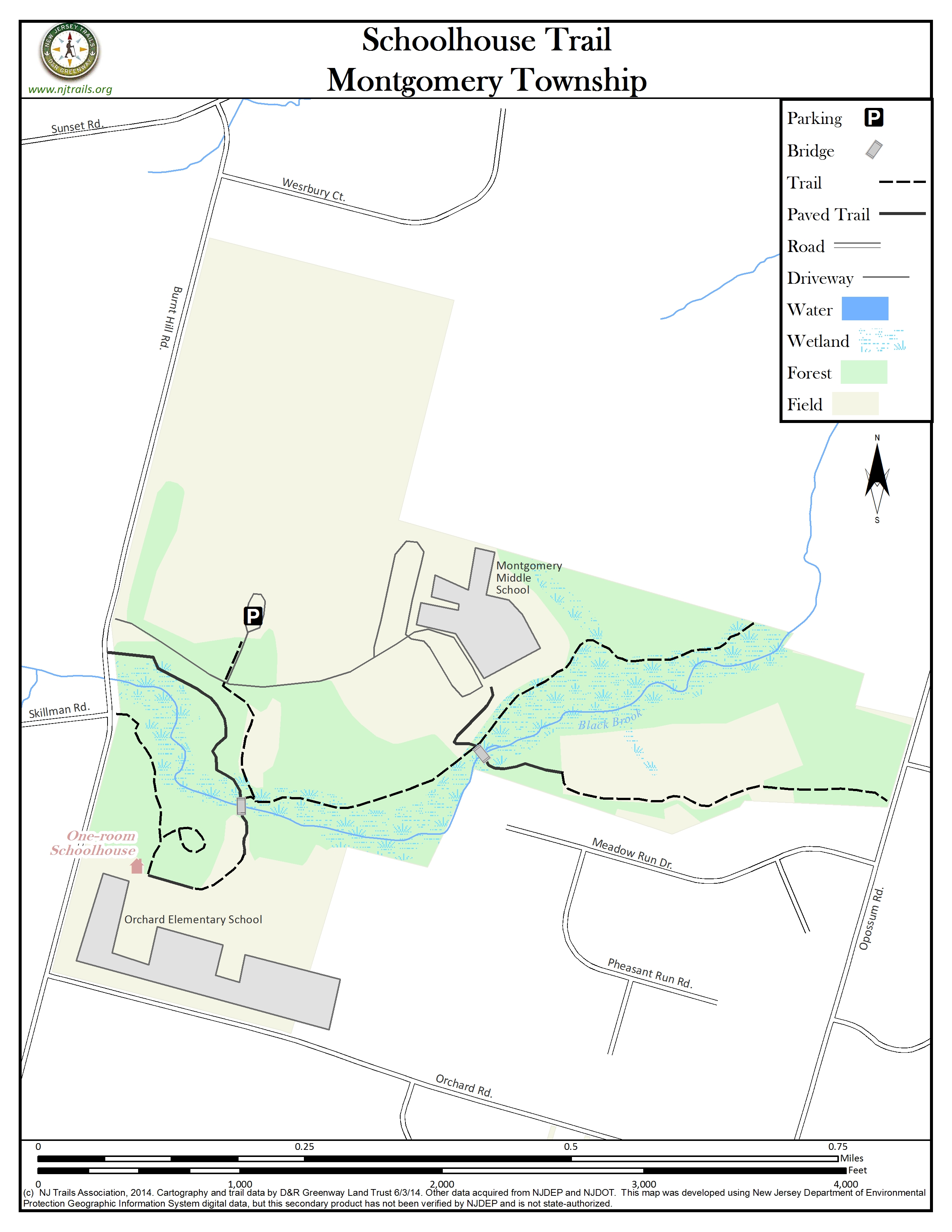
Distance:
Entire trail: 0.7 miles
Burnt Hill Road to first bridge: 0.2 miles
First bridge to second bridge: 0.2 miles
Second bridge to property boundary: 0.3 miles
Time:
30 – 60 minutes, depending on pace
Markings:
“Montgomery Pathways” signs mark the path.
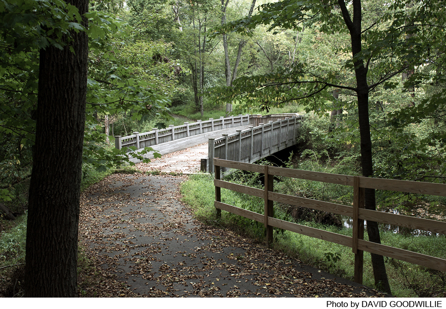
Portions of the trail are paved; others are laid with crushed stone.
Trail Usage:
Walking/Hiking, Accessible by wheelchair and baby stroller, Dogs permitted on leash
Elevation:
Minimal
Difficulty:
Easy. Schoolhouse Trail is a short jaunt – perfect for a lunchtime break. A portion of the trail is paved. The unpaved section can be very muddy, so boots are recommended.
Parking:
Available in the parking area adjacent to Montgomery Middle School (Lower Campus) athletic fields.
Tips:
To learn about other trails to walk in the area, please go to Stonybrook Millstone Watershed Association.
Other preserved lands have walking trails as well. Go to D&R Greenway Land Trust.
Amenities:
There is a portajohn near the athletic fields that is sometimes kept open for sports events.
Directions:
From Hopewell:
Take Route 518 East out of Hopewell Borough. Cross over Route 601 (Great Road) and continue on 518 East. Make your second left onto Burnt Hill Road (approximately 0.9 miles from Rt. 601). Continue on Burnt Hill Road past the entrance to the Village School on the grounds of the former North Princeton Developmental Center on your left. Pass Orchard Road further up on your right. Pass by Skillman Road on your left and there will be a slight dip in the road. Make a right into the driveway for Montgomery Middle School. Make your first left into the parking area by the athletic fields.
From Princeton:
Follow the Great Road (Rt. 601) out of Princeton, through the 4-way stop sign at Cherry Valley Road, all the way to the traffic light at Route 518. Turn right onto Route 518 East. Make your second left onto Burnt Hill Road (approximately 0.9 miles from Route 601). Continue on Burnt Hill Road past the entrance to the Village School on the grounds of the former North Princeton Developmental Center on your left. Pass Orchard Road further up on your right. Pass by Skillman Road on your left and there will be a slight dip in the road. Make a right into the driveway for Montgomery Middle School. Make your first left into the parking area by the athletic fields.
-
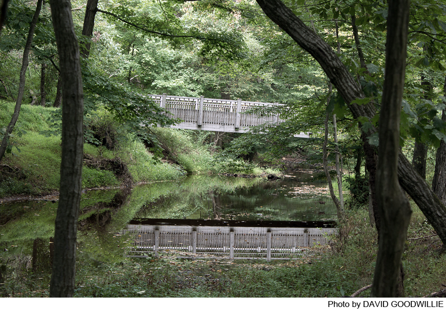
Begin your walk by leaving the parking area and crossing back over the middle school driveway to a small gravel road on the opposite side. Continue down the gravel path, past the wastewater treatment facility on your left to a bridge at the edge of the Back Brook. From this point, there are several options.
Schoolhouse Trail to Burnt Hill Road:
Turn right on the paved path and travel 0.2 miles to Burnt Hill Road.
Forest behind Orchard Hill Elementary School:
Take the bridge across the Back Brook and follow the paved path up the hill. At the top of the hill, follow a gravel road past a wastewater treatment facility on your right. The gravel road will change to a paved driveway with the school on your left and the forest on your right. Just before the one room schoolhouse, a small path turns right into the forest. The trails in the forest are not marked or well maintained. Look for a handsome stand of hickory trees in this section. There is a small loop to your right as well as the remnants of an old farm road that ends at a gate on Burnt Hill Road.
Schoolhouse Trail to Property Boundary:
Turn left and follow the crushed stone trail along the banks of the Back Brook. The trail passes through stands of Eastern red cedar on the left and the floodplain on the right. At 0.2 miles, the trail comes to an intersection and leaves several options. Turning left, follow the paved path up to the Montgomery Middle school parking lot and return 0.25 miles back to the parking area via the Middle School driveway. Turning right, cross over the Back Brook and follow the path up to the athletic fields. Continue along the edge of the athletic fields to an old gravel road that ends at Opossum Road at 0.4 miles. Proceeding straight, the trail continues to follow the brook on the right, with the middle school on the left. After crossing through a low, wet area, the trail hugs another dense stand of Eastern red cedar on the left before ending at a fenced pasture at 0.3 miles.
Trail Links:
At the western end of the Schoolhouse Trail, plans are to resume the trail on the other side of Burnt Hill Road and continue towards the Sourland Mountains. At the eastern end of the trail, plans call for the trail to continue paralleling the Back Brook, pass under Route 206 via a pedestrian tunnel and connect with the Montgomery Park trail system. All plans are subject to change. For more information go to Montgomery Township.
For more information on Sourland Mountain and preservation efforts go to Sourlands Planning Council.
For more information on regional projects to preserve Sourland Mountain go to D&R Greenway Land Trust.
Copyright © 2003 – 2013 New Jersey Trails Association. All rights reserved.
MenuBar
-
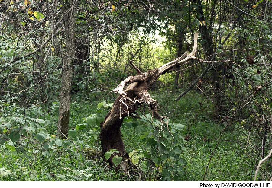
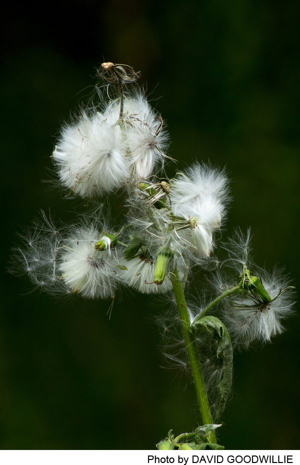
Despite the fact that the trail travels through a fairly thin piece of wooded stream corridor, it is alive with plant and animal life. Bird species are abundant including wild turkey, Eastern phoebe, red-bellied woodpecker and an occasional red-tailed hawk in the upland forest sections. Northern oriole, Carolina wren, belted kingfisher, green and great blue herons and a wide variety of warblers can be found along the stream corridor. The dense stands of Eastern red cedar provide cover for deer, red fox and great horned owl. The cedar stands are also great places to search for wintering birds like long-eared and saw whet owls. Gently turning over logs in the spring will reveal quite a few red-backed salamanders along with wood roaches, centipedes, millipedes and springtails. Be sure to put the log back when you are finished!
Wildflowers include spring beauties, mayapple and cut-leaved toothwort in the forest in spring. Along the stream banks watch for skunk cabbage, golden ragwort and cardinal flower. In early spring, look for the unusual rusty growth of the cedar-apple rust on the Eastern red cedars. This fungus requires two hosts to complete the life cycle – a cedar as well as an apple tree (crabapples will do just fine). On wet days in the spring, these rusts sprout large, orange tentacles that will release spores to the wind when they dry up.
Do you have information about this trail?
Click Here to contribute.
-
The one room schoolhouse behind Orchard Hill Elementary is known as the Bedensville School. Built in 1853, it operated as a school until 1868 with subsequent intermittent use as a Sunday school and for other school related functions. Its original location was at the intersection of Route 206, River Road., Bridgepoint Road and Orchard Hill Road. It was built on land donated by the Vorhees family who owned the adjacent farm. If you are traveling on Route 206 you will see a carriage barn remaining at this intersection. The school would have been located to the left of the traffic light at this point. The school was closed, as many schools were, after the Civil War when state funding began to replace private funding. To qualify for state assistance, a minimum number of students were required at each school (approximately 50 students). If the number of full-time enrolled students dropped below the minimum, state assistance was not available. The tuition to attend such a school varied from $1.00 to $1.50 for a 3-month term. School was open all year with the exception of Christian holidays. Boys rarely attended between planting season and fall harvest since the area was primarily Dutch farmers who needed their sons’ help on their farms.
The building is currently used as a living museum for children. It was moved to the present location and restored during the 1977 bicentennial celebration. Volunteers from the Van Harlingen Historical Society run seasonal programs for school groups where they dress in period clothing and run a “class” as if it were 1861. The building is open to the public for special events. For more information, please visit Van Harlingen Historical Society.
Do you have information about this trail?
Click Here to contribute.
-
Photos

Videos
