Mercer
Hopewell
Hopewell Sourlands Trail
Hopewell, NJ
Last Updated: 07/16/2025
Overview of Selected Trail
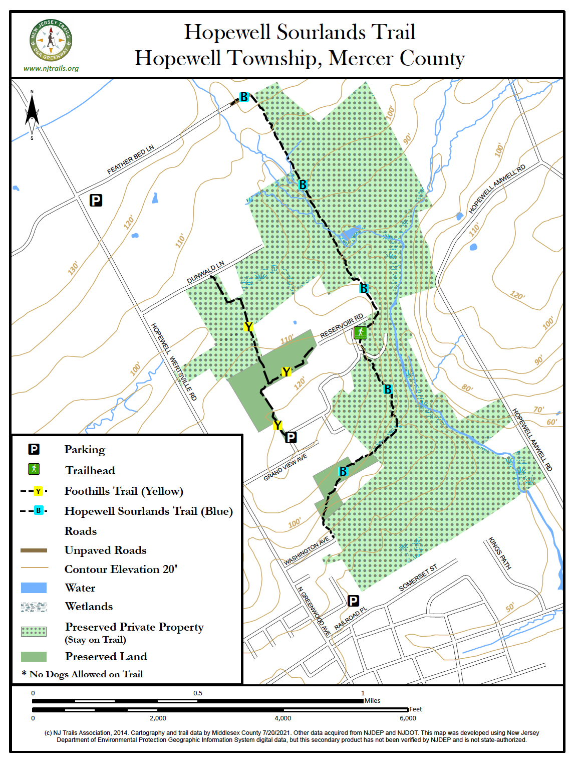
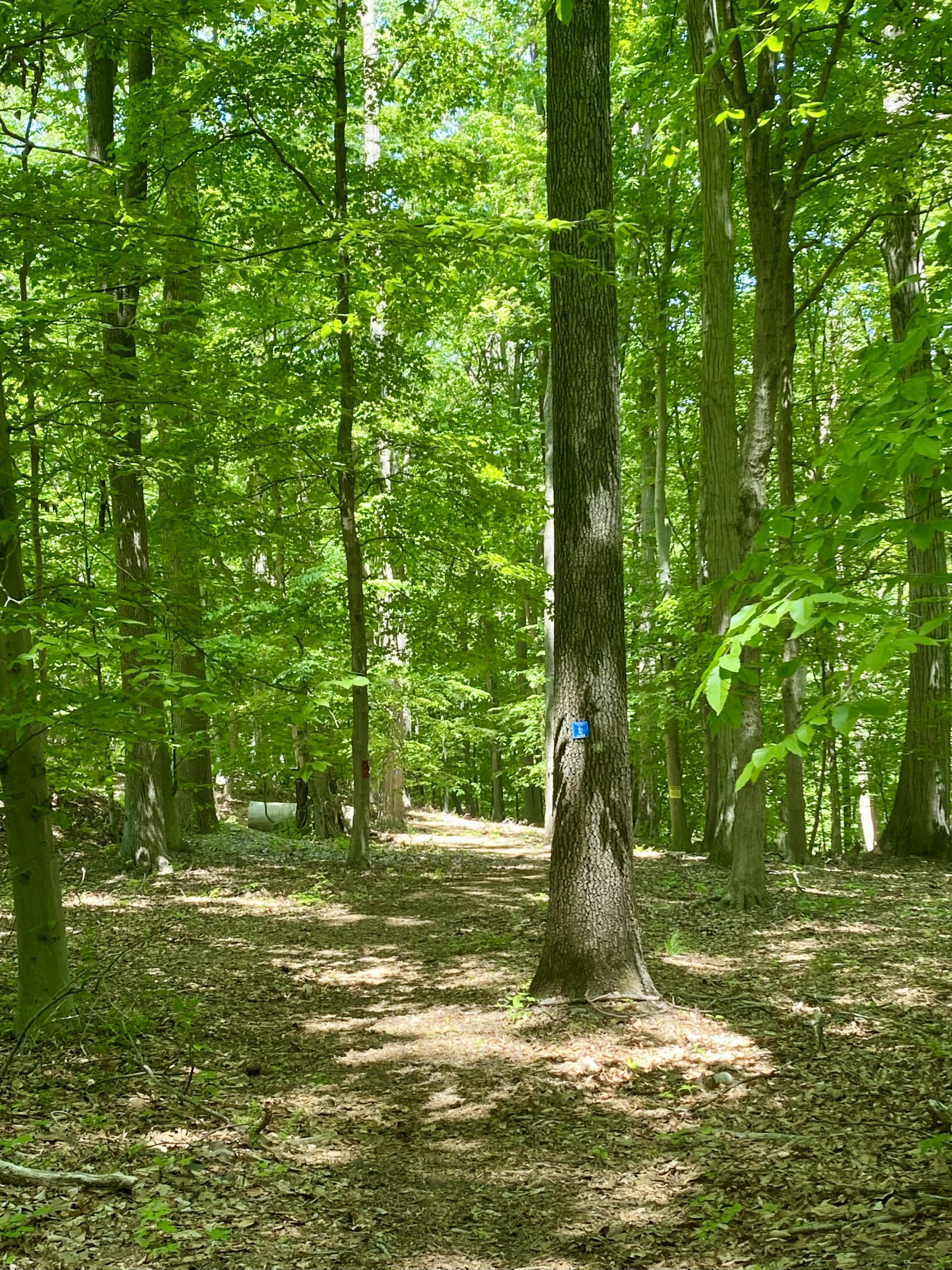
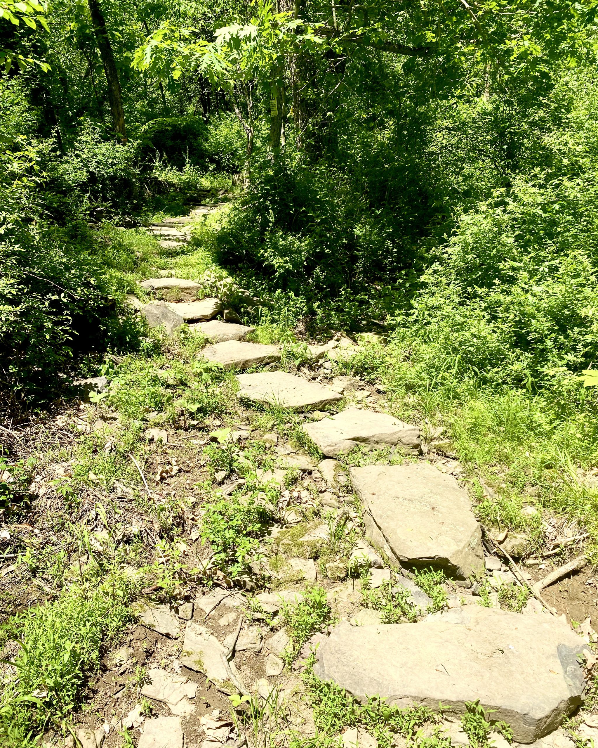
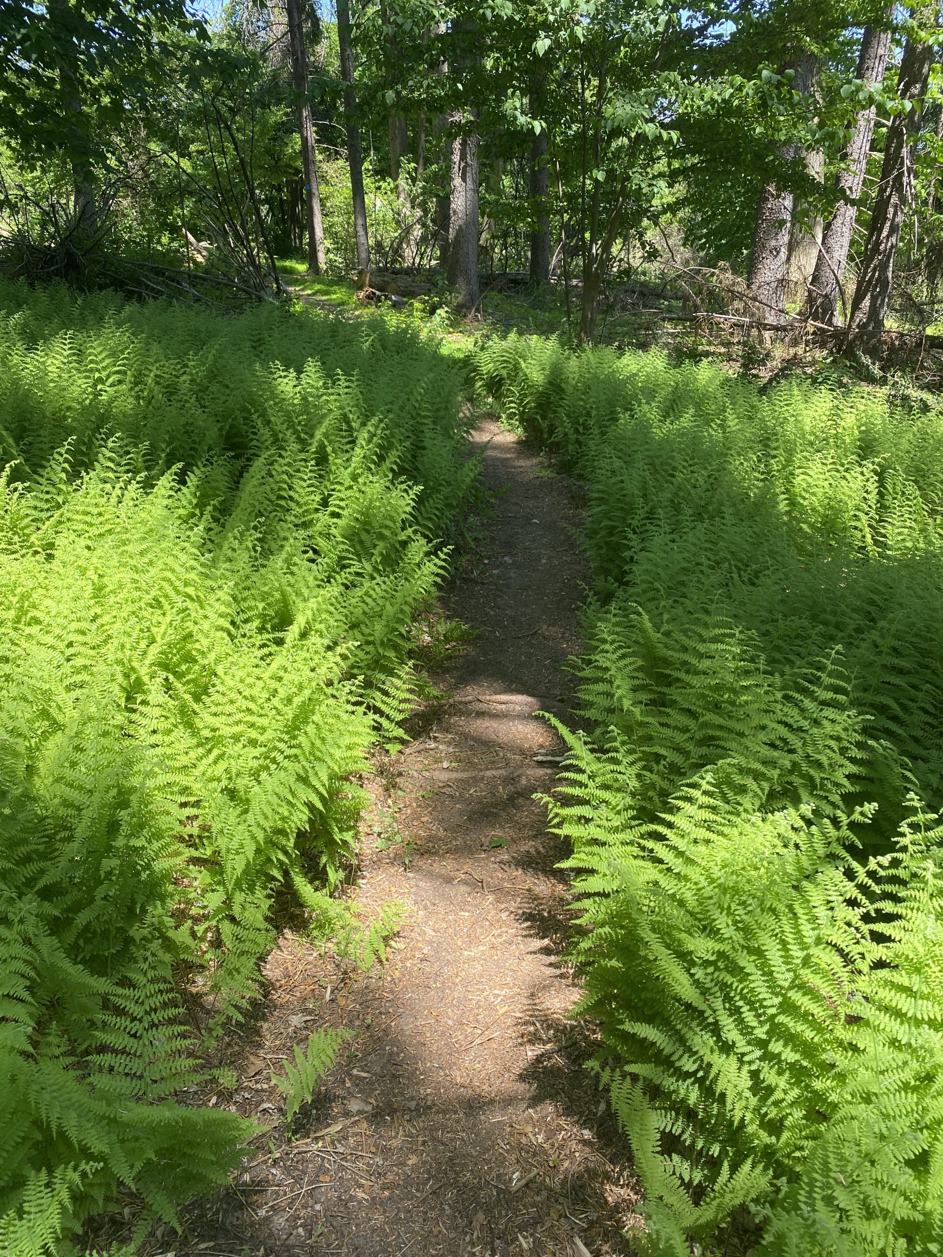
The 1.7-mile Hopewell Sourlands Trail runs from the edge of Hopewell Borough to the eastern end of Featherbed Lane in the Sourlands. It runs through second-growth forest, paralleling a small Bedens Brook tributary with pleasing waterfalls, skirting sheep meadow and farm fields, and winds through a peaceful spruce forest showing the lasting signs of past hurricanes—but also offering wide views of the Hopewell Valley.
Note:
No dogs allowed on this trail because it passes by an active sheep farm.
-
-
Distance:
The trail from Washington Avenue to Featherbed Lane is 1.7 miles, for a round-trip of 3.4 miles. From the eastern end of Featherbed Lane to the parking lot at the corner of Hopewell-Wertsville Road and Featherbed Lane is another half-mile. A one-way mostly downhill walk of 2.2 miles can be done, with a car left on Greenwood Avenue in Hopewell Borough, beginning at that parking lot.
Time:
At a pleasant moderate pace, the entire trail can be walked in perhaps 45 minutes each way, including time for enjoying scenic spots.
Markings:
The trail route is marked with blue markers on trees, with the logos of D&R Greenway Land Trust and Friends of Hopewell Valley Open Trust, which collaborated on the development of this trail.
Trail Usage:
Hikers only. Please note that hikers should not bring dogs with them on this trail, not even on leash. Because the trail passes close to an unfenced sheep meadow, the farm owner there explicitly prohibits dogs on the trail. For that reason, the entire trail is off limits to dogs. Hikers may encounter one or more of the various property owners with their dogs. They are allowed to take their dogs on their own land. Although this may be frustrating for dog owners, please understand that this kind of compromise is an essential ingredient in creating public trails on private land.
Elevation:
The walking route begins at the eastern end of Washington Avenue in Hopewell Borough, at an elevation of 240 feet above sea level. The trail rises, sometimes steeply, to an elevation of 350 feet at the kiosk near Reservoir Road, and then very gradually to 405 feet at Featherbed Lane.
Difficulty:
Easy to moderately strenuous on a few steep slopes. Walking from Washington Avenue to Featherbed Lane is generally uphill, the other direction downhill.
Parking:
Walkers beginning in Hopewell Borough should park at the Hopewell Railroad Station and then walk up Greenwood Avenue to Washington Avenue, then along Washington Avenue to the end where the trail begins. Please do not park on Washington Avenue. Cars on Washington Avenue block the movement of farm equipment used by the farmer who has graciously allowed the trail to cross his land. Residents of Washington Avenue may occasionally park on the street, but they are easily contacted by the farmer to move their cars. Not so for trail users.
Trail users beginning at the north end of the trail should park at the D&R Greenway Land Trust parking lot on the corner of Featherbed Lane and Hopewell-Wertsville Road. Walk down Featherbed Lane to the end and continue on the grassy lane about 150 yards to the trail, which turns off to the right. Please do not park at the end of Featherbed Lane; you would risk blocking the movement of delivery trucks and other vehicles.
Tips:
Keep in mind that most of this trail is on private property. Respect the property owners who have made this trail possible by staying on the marked trail
Deer Management: Hunting occurs on some of the lands crossed by this trail. In deer hunting season, the trail or parts of the trail may be closed at certain times. Hunting schedules and trail closure days are being worked out, and exact information will be posted on this website when they are known. Signs will also be posted at trail entrances indicating trail closures. On some sections of trail, where hunting is less intensive, the trail may remain open during hunting season. Walkers are advised in such periods to wear an article of bright orange clothing.
Amenities:
A kiosk with trail information is located at the midpoint of the trail near Reservoir Road. The directional signs on Washington Avenue guiding you to the trail may display a QR code that links you to this trail guide and its map.
Directions:
From the traffic light in the center of Hopewell Borough at the intersection of Broad Street and Greenwood Avenue, go north on Greenwood Avenue.
- For public parking at the railroad station, go just .15 mile and turn right on Railroad Place. Park there and walk up Greenwood Avenue to Washington Avenue. Turn right and walk past the Highland Cemetery to the end of the street, where a driveway going uphill to the left is the beginning of the trail.
- For parking at the upper end of the trail, go up Greenwood Avenue (which becomes Hopewell-Wertsville Road) a total of 1.7 miles and turn right on Featherbed Lane. The entrance to the D&R Greenway Land Trust parking is immediately on the right. Walk from there to the end of Featherbed Lane and continue about 150 yards on the grassy lane to the trail.
-
The Hopewell Sourlands Trail is a rare example in New Jersey of a walking route created by stringing together a series of public access easements on private land. The trail winds along this 15-25 foot wide corridor that the public is welcome to walk—but the public is also asked to remain on the marked trail and avoid straying onto the neighboring private property. The trail corridor easements cross property owned by six different property owners as well as a small land trust preserve. The overall trail was developed through a close collaboration between D&R Greenway Land Trust and Friends of Hopewell Valley Open Space.
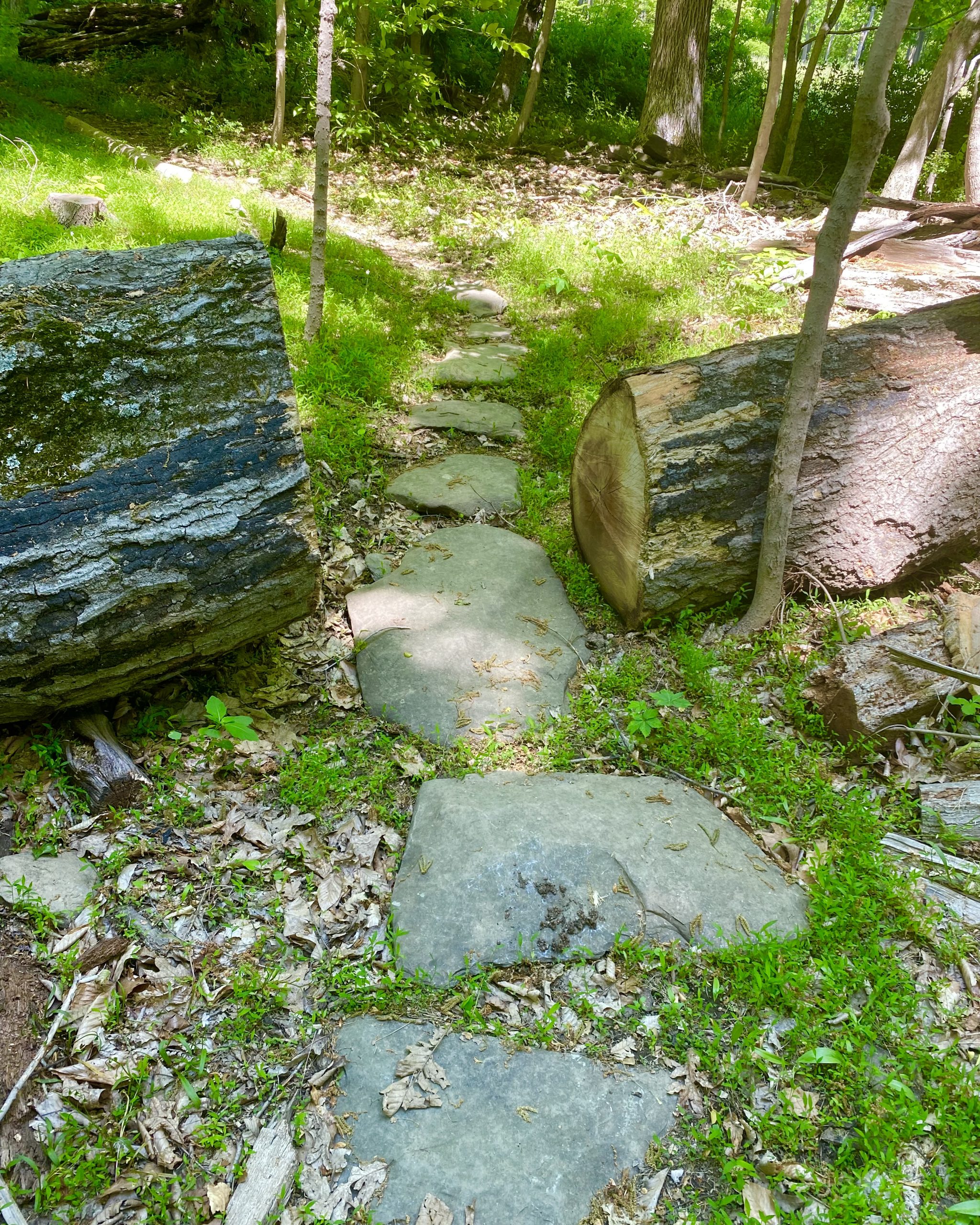
The trail begins at the eastern end of Washington Avenue on the northern boundary of Hopewell Borough. Walkers first make their way up a rough driveway (which is driven by two residents, so be careful). The right to walk on this driveway was granted by its owner, the neighboring Highland Cemetery Association. At the sharp bend in the driveway, the trail route climbs a small wooden stairway up a steep bank into the spruce forest—a preserve owned by the Friends of Hopewell Valley Open Space.
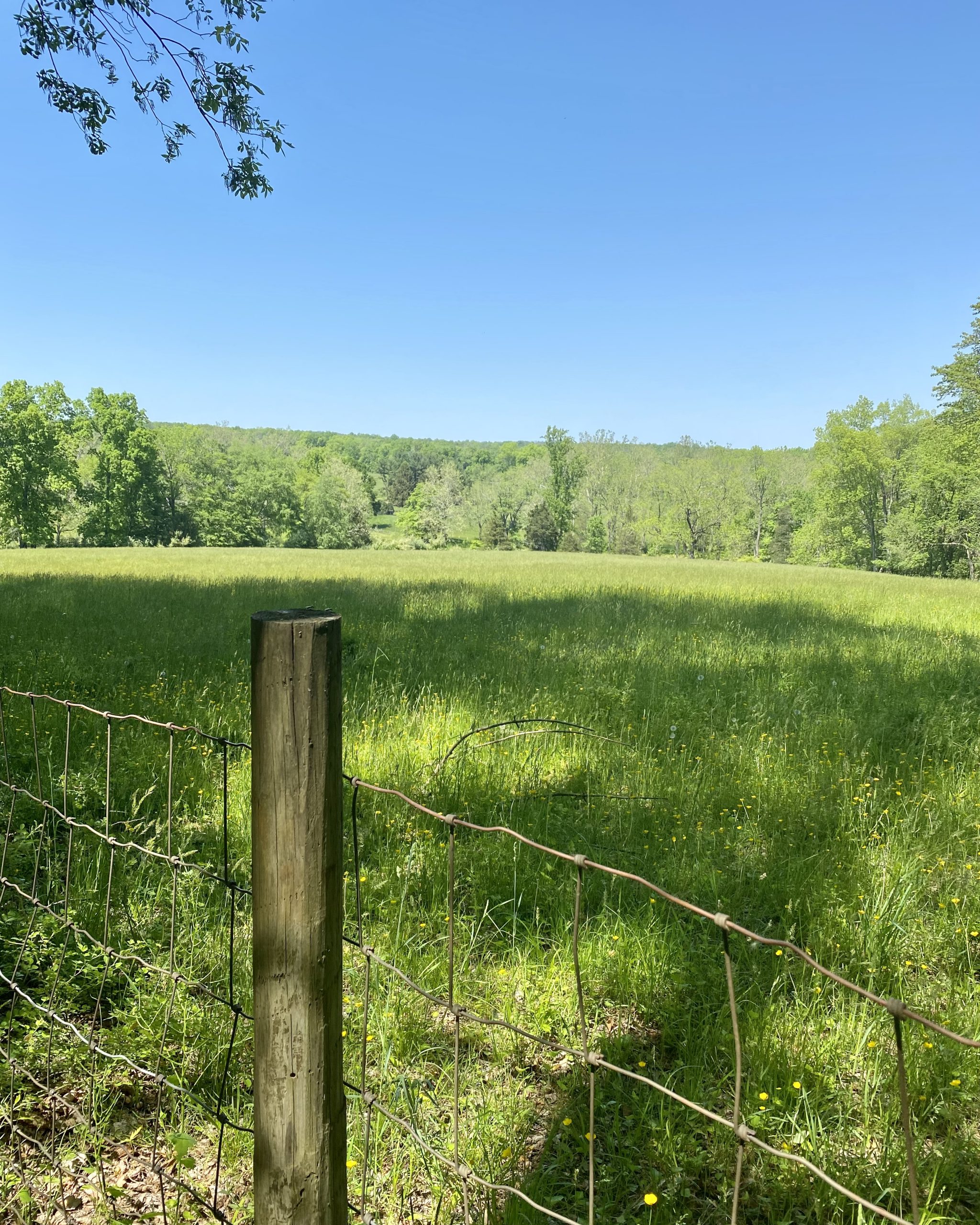
The trail winds its way through the spruce woods and comes out to the edge of a farm field, directly across from the end of a hedgerow. The route continues down along the hedgerow to its end, and then skirts the edge of another field heading north. Please do not wander around the fields; they are private. The walk through the spruce woods and along the hedgerow gives broad views of the Hopewell Valley and the Mt. Rose Ridge to the east.
The trail climbs a steep slope with a switchback turn and heads north through the edge of the woods past another field. It reaches and crosses a private driveway, and then parallels Reservoir Road for a few hundred yards, coming to a kiosk near that road.
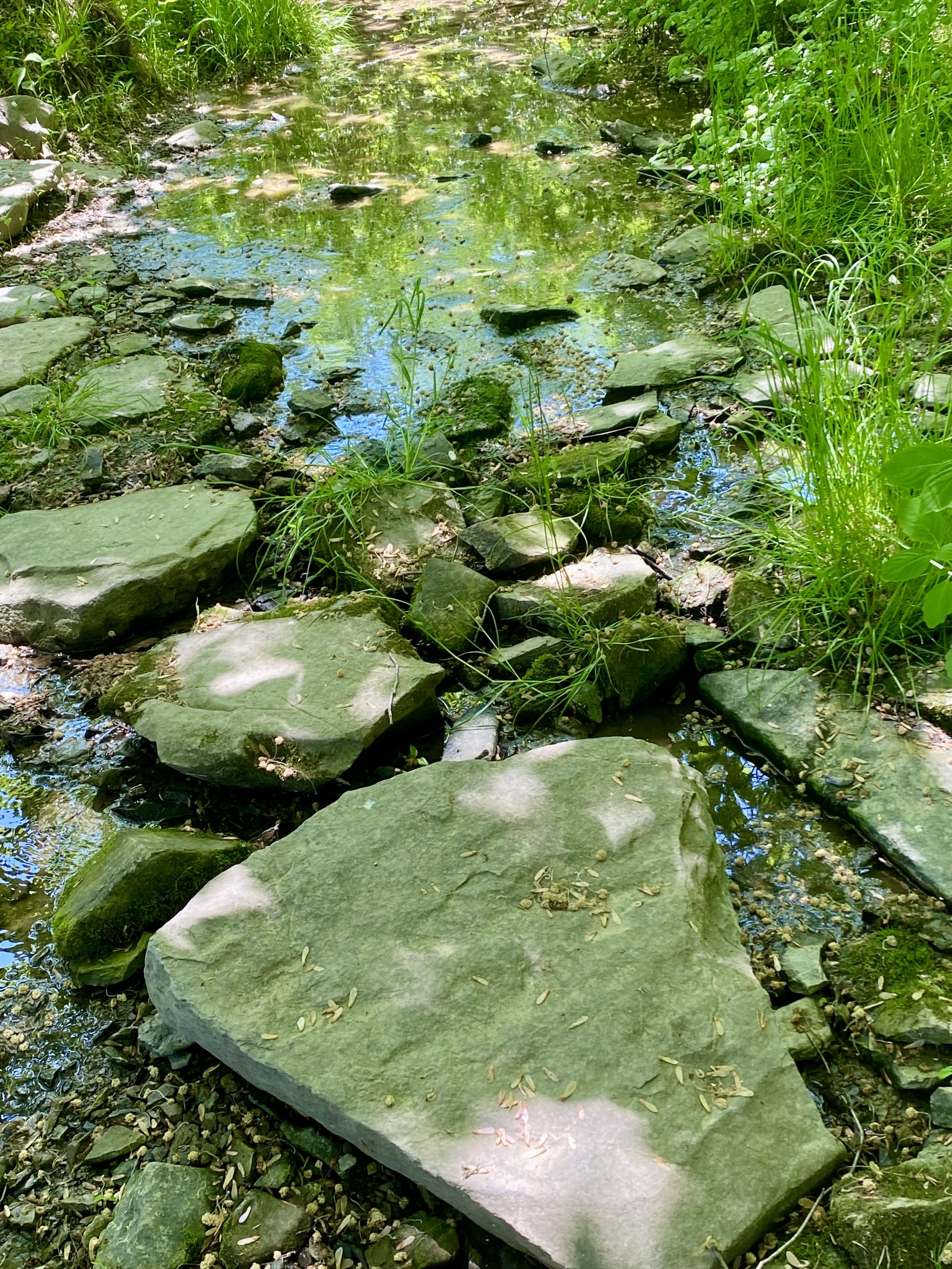
From here, the trail continues north, passing an active sheep meadow and then skirting a hay field before descending to and crossing two small brooks. From there, the trail continues through second-growth forest, with nice sights and sounds of a brook that in spring entertains with its small waterfalls and their pleasing music.
The trail winds up on the woodland portion of Featherbed Lane. Turn left and continue a short distance along this grassy lane to the eastern end of the paved Featherbed Lane. It is about a half-mile walk up this quiet paved lane to the parking lot at the corner of Hopewell-Wertsville Road.
-
The Hopewell Sourlands Trail passes through a variety of habitats as it climbs from Hopewell Borough to Featherbed Lane, from hayfields to mature forest. Beside the Highland Cemetery at its lower end, the trail traverses a patch of conifer trees, planted long ago, that was heavily damaged by Superstorm Sandy. The trail then runs along a hedgerow separating hay fields before entering mature forest typical of the Sourlands and continues in such forest and along the edges of hay fields and sheep meadow until it reaches Featherbed Lane.
The Sourlands is a distinct, mostly wooded, sparsely populated area. As can be seen from the 1930 New Jersey aerial survey, it was a patchwork of hard-scrabble farms and wooded areas too rocky or wet for productive farming, criss-crossed by stone walls marking field or property boundaries. Remains of the walls can be seen from the trail.
Mature forests here are composed largely of American Beech, Northern Red Oak, White Oak, Black Oak, and hickory species including Shagbark and Mockernut Hickories. An occasional American Basswood can be observed in moist areas. There are tulip trees at the higher elevations and beech and ironwood in the wet areas. Eastern Red Cedar are common, particularly in former fields reverting to woodland. Dead or dying ash trees (emerald ash borer victims) are noticeable throughout the Sourlands. Overabundant deer significantly limit forest understory species by their browsing, but one can find shrubs like Maple-leaved Viburnum, Blackhaw Viburnum, and Spicebush along with sprouting Beech trees. Forest wildflowers include White Wood Aster, Wreath Goldenrod, Stoneroot, Bloodroot, and Black Cohosh. The trail passes over or along several small, intermittent streams and tributaries which have concentrations of ephemeral plants and flowers before trees leaf out in spring. Along the upper end of the trail near Featherbed Lane, ramps (wild leeks) abound in spring.
Wildlife includes mammals such as Red fox, Coyote, and Opossum. Mink can be occasionally observed in nearby streams. Eastern Box Turtle habitat occurs along the entire trail length and salamanders inhabit mature forests (Spotted Salamander, Red-backed Salamander). Two-lined Salamanders inhabit the nearby Bedens Brook.
Forests along the trail are important nesting and stopover habitat for migratory birds, including wood warblers such as Black-throated Green Warbler, Black-and-White Warbler and many more. Commonly nesting species include Wood Thrush and Veery. American Kestrels can be seen over larger open hay fields, along with other more common raptors such as Red-tailed Hawks and Sharp-shinned Hawks. Woodpeckers seem more common now that the dying ash trees are providing extra food. If you look and listen carefully you might spot downies, hairies, pileated, red-bellies, and sapsuckers.
Do you have information about this trail?
Click Here to contribute.
-
The lands crossed by the Hopewell Sourlands Trail have been witness to the broad sweep of local history, and the regional history it was part of. (The main source for these comments, and an excellent source for more details, is Hopewell: A Historical Geography, Richard W. Hunter and Richard L. Porter, 1990, Township of Hopewell, Historic Sites Committee.)
Before Europeans arrived in the area around Hopewell, the Lenape people made it home. When Europeans arrived, the Lenape were still inhabiting two known villages in this area, known as Wissamonson and Minnepenasson, just a few miles apart. The Hopewell Sourlands Trail crosses the area where artifacts have been found suggesting the location of Minnepenasson. The village was “located on the slope of the Pheasant Hill, close to the boundary line now followed by Province Line Road. It commanded a fine view of the Beden Brook valley to the south.” Beden Brook is fed by the unnamed tributaries that descend from the Sourlands, adding to the trail experience of hikers on the Hopewell Sourlands Trail. Artifacts have periodically been brought to the surface by plowing in this area and there are also reports of burial artifacts being found.
This south-facing slope of the Sourlands was settled by Europeans in the first half of the 18th century. The area was attractive for settlers because it met two important criteria for good homestead sites: good drainage, and good sources of drinking water. Well-drained soils ensured that farmhouse basements, root cellars, spring houses, and barn basements would not be flooded. The “spring-line” along the slope can be discerned in the line of early farm sites along the slope, where good water supply was assured.
The area was settled as part of the process of gradual fragmentation of land holdings. The process began with the original 30,000-acre tract held by Daniel Coxe and then, beginning in 1692, by the West Jersey Society, a company of English land speculators. They began selling land, mostly to English settlers who came from older settlement areas on Long Island and in East Jersey. Many prominent Hopewell family names—Blackwell, Burroughs, Drake, Golden, Hart hunt, Moore, Phillips, Smith, Stout, Titus and others — were part of this wave of settlers starting in the early 18th century. Colonel Joseph Stout, born in 1690, inherited from his father the large farm parcel that encompassed the present route of the Hopewell Sourlands Trail. Colonel Stout served in the French and Indian Wars, and his farmhouse was known sometimes as the Joseph Stout House and sometimes as the Hunt House because it was occupied during the Revolution by John P. Hunt. Colonel Stout’s house served General Washington as the site of a major council of war in June 1778 before the Battle of Monmouth. The Stout lands were divided and gave rise to descendants’ farmsteads in the area between Hopewell-Wertsville Road and Province Line Road, some still in use today. Farmhouses reflected the English, Dutch, German, and Scotch-Irish origins of the local population, often mixing their architectural and construction hallmarks.
Do you have information about this trail?
Click Here to contribute.
-
Photos
Videos
