Burlington
Bordentown Township
Abbott Marshlands: Bordentown Bluffs
Bordentown Township , NJ


Last Updated: 01/17/2019
Overview of Selected Trail
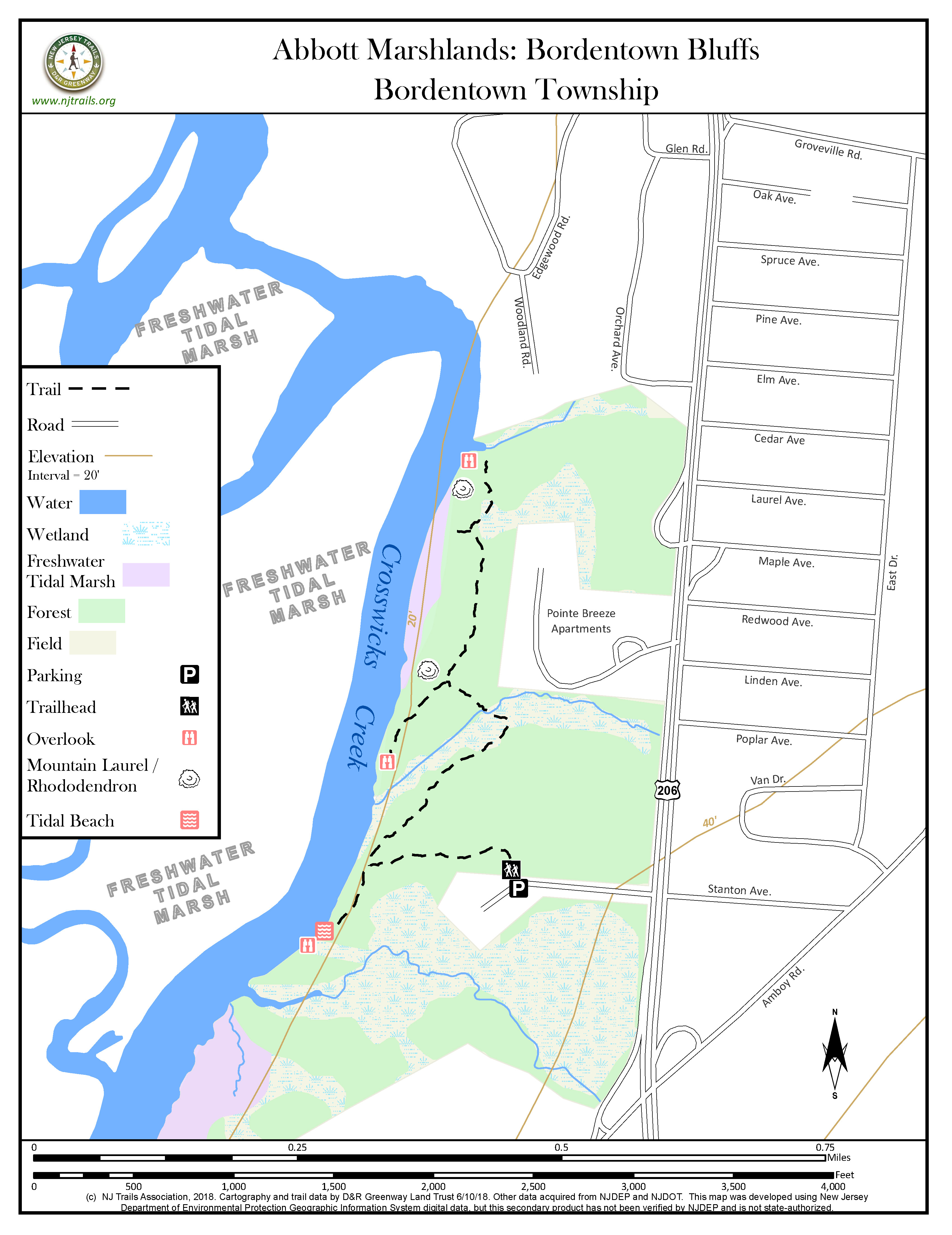
This section of the Abbott Marshlands is part of Delaware and Raritan Canal State Park and was preserved in 1996. The trail runs along the top of a bluff overlooking the marsh and Crosswicks Creek, through the marsh’s least disturbed woods boasting chestnut oaks, thickets of mountain laurel and great rhododendron, and a few remnant American chestnut sprouts.
.
-
-
Distance:
1.6 miles round trip
Time:
Approximately 30-60 minutes
Markings:
Blue markers with arrows for the trail from Stanton Ave.
Trail Usage:
Walking/hiking, Dogs permitted on leash. Motorized vehicles not allowed.
Elevation:
Flat on top of the bluff. The trail drops 50 feet into a ravine and climbs 50 feet steeply up the other side.
Difficulty:
Easy
Parking:
Parking on the Stanton Avenue West, with room for 10-15 cars.
Tips:
Wear sturdy shoes and bring along drinking water for your walk. Light colored clothing is better for spotting ticks on clothing. For more information about the Abbott Marshlands, as well as maps, scheduled field trips, guides, etc. visit: www.abbottmarshlands.org.
Amenities:
None
Directions:
Take Interstate 295 to Interstate 195, to Exit 1A for 206 South (toward Bordentown). Follow Rt. 206 south for 1.5 miles. Turn right onto Stanton Avenue–the first right after Pointe Breeze Apartments. The Stanton Avenue sign may be missing; look for a small Abbott Marshlands sign. Drive to the end of the road to park.
-
From the end of Stanton Avenue, follow the trail toward the bluff and Crosswicks Creek. The main trail turns right (north) at the t-intersection, crosses a ravine and runs through a Mountain Laurel thicket (unique in this part of New Jersey). Along the way are side trails to spectacular views of Crosswicks Creek and the marshlands beyond. This trail is NOT A LOOP. The trail ends at a steep ravine with at a small tidal stream at the bottom. Return the way you came, back to Stanton Avenue.
There are two spurs from the main trail. At the t-intersection nearest Stanton Avenue, turn left. This will take you to an open sandy area and a Crosswicks Creek ‘beach’. The beach will be accessible only at low tide because Crosswicks Creek is tidal. Take care near the water as currents can be fast and dangerous. Do not allow children to play in the water.
A second spur is located at the top of the hill after the ravine. At the hilltop, turn left to walk through rhododendron and mountain laurel. This will take you to the top of the bluff, sixty feet above Crosswicks Creek; there is tidal freshwater marsh beyond.
For more information about the Abbott Marshlands, as well as maps, scheduled field trips, guides, etc. visit the Abbott Marshlands website at www.abbottmarshlands.org
-
The oak woods on the top of the bluff are dominated by chestnut, white and black oaks, and numerous tulip poplars and black gums. On the bluff itself, in the older part of the woods, are thickets of mountain laurel and great rhododendron. There are a few remnant eastern hemlocks that have survived the invasive wooly adelgid infestation. The deer herd in this area is very small. Spring birds are plentiful and include scarlet tanagers, brown thrashers, titmice and chickadees. At the overlooks, watch for bald eagles, marsh hawks, red-tailed hawks and wetland birds. Listen for king-fishers.
(Inventory lists can be found at www.abbottmarshlands.org, under Ecology).
Do you have information about this trail?
Click Here to contribute.
-
There is evidence that the Native American Paleo-Indians occupied this area beginning 13,000 years ago. Traces of a large village on this site include fire-fractured rocks, pottery, tools and ornaments. European colonists first settled the area in 1648. Later the Bordentown Bluffs became part of the “Point Breeze” estate of Joseph Bonaparte, brother of Napoleon, who lived here from 1817 until 1834, when he returned to Europe. The land, preserved in 1996 by D&R Greenway Land Trust, is now part of the D&R Canal State Park.This is part of the area designated in 1976 as the Abbott Farm National Historic Landmark by the US Department of Interior. Any digging is illegal and destroys the historical record.
Do you have information about this trail?
Click Here to contribute.
-
Photos


Videos
