Mercer
Hopewell Township
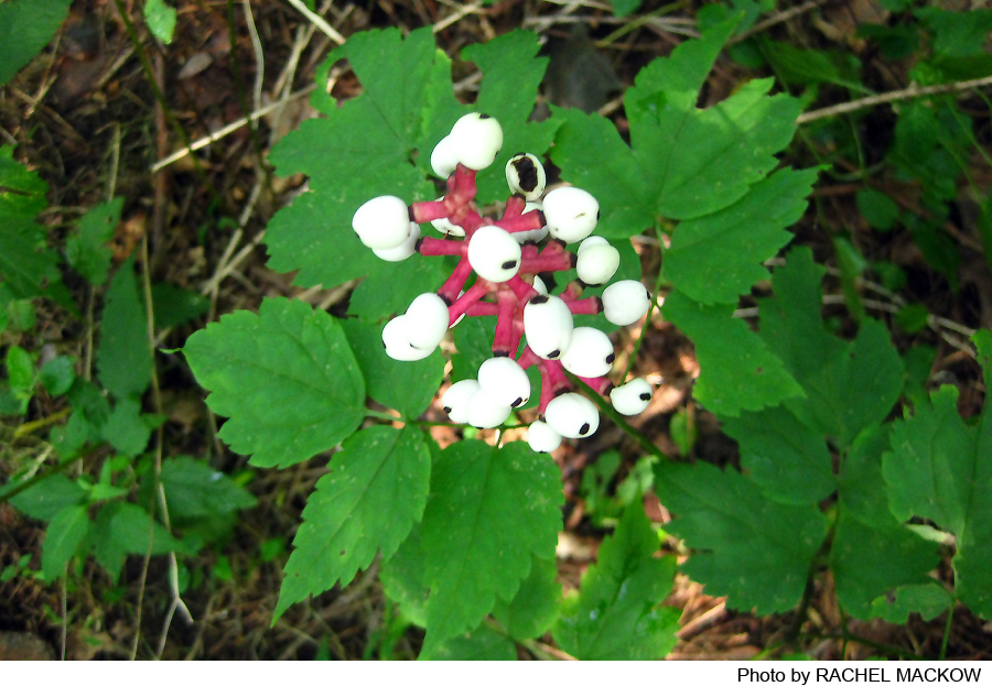
Woodsville Preserve
Hopewell Township, NJ 08525


Last Updated: 01/19/2025
Overview of Selected Trail
This trail is a long narrow loop through open woods and one field. It borders on a pretty part of Woodsville Brook and winds through a mature groove of beech trees. Along the way there are signs of previous habitation and use of the land as a farm with several outbuildings.
-
-
Distance:
1.6 miles
Time:
1.5 hours
Markings:
Painted white diamonds on trees
Trail Usage:
Walking/Hiking, Dogs permitted on leash
Elevation:
Gradual fifty foot change in elevation
Difficulty:
Easy. Downhill to the end of the loop, uphill on the way back.
Parking:
There is parking for 3 cars.
Tips:
This trail can be wet in the spring.
Amenities:
Directions:
From Route 31, 2 miles north of Pennington, turn west onto Marshalls Corner-Woodsville Road. In .9 miles turn left onto Harbourton Woodsville Road. In .8 miles turn right into an old driveway/road at #43. Park in front of the chain.
-
The first section of the trail follows an old road as it passes the former site of a house and outbuildings on the western side of the trail. There is Vinca (myrtle) growing around the larger trees that line the driveway. The woods are very open with red maple, white ash, some large black cherry trees, sassafras, tulip poplar and hickory. There are scattered stands of dying red cedar indicating that this was once an open field. Listen for towhee and thrush song in high summer. Japanese stilt grass covers the ground throughout this part of the woods. Look for standing dead trees (den trees) with signs of woodpecker holes that have been enlarged by the inhabitants (flying squirrels, grey squirrels)
As the trail levels off and crosses a culvert, look for a change in the make up of the woods on the west side of the trail. Suddenly there is a large stand of hornbeam, hickory and ash with no undergrowth on the ground. The trail continues through a stand of American beech. Leaving the road, the trail swings to the west at the end of the meadow. The path follows a delightful meander of Woodsville Brook, skirts a slough filled with skunk cabbage and begins to climb back toward the south through more American beech.
-
See trail description.
Do you have information about this trail?
Click Here to contribute.
-
This was a farm with a greenhouse, many out buildings and horses.
Do you have information about this trail?
Click Here to contribute.
-
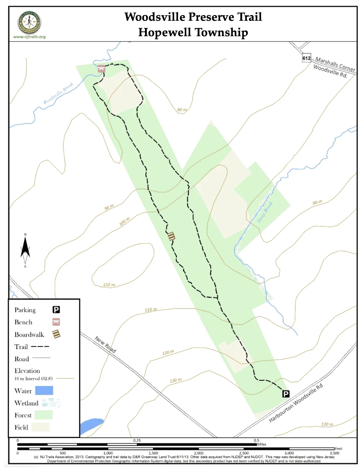
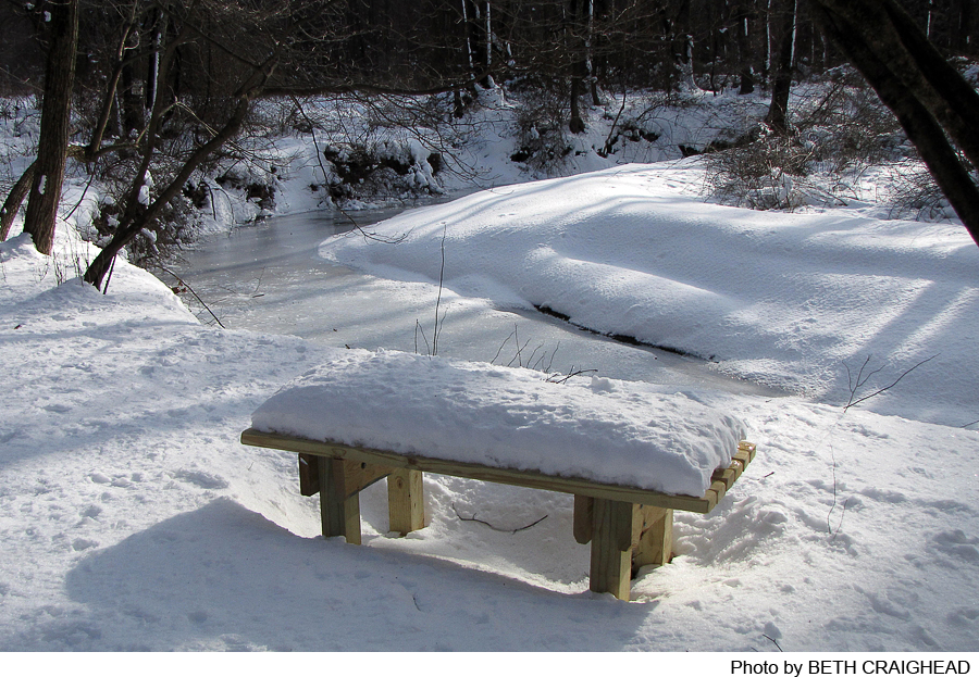
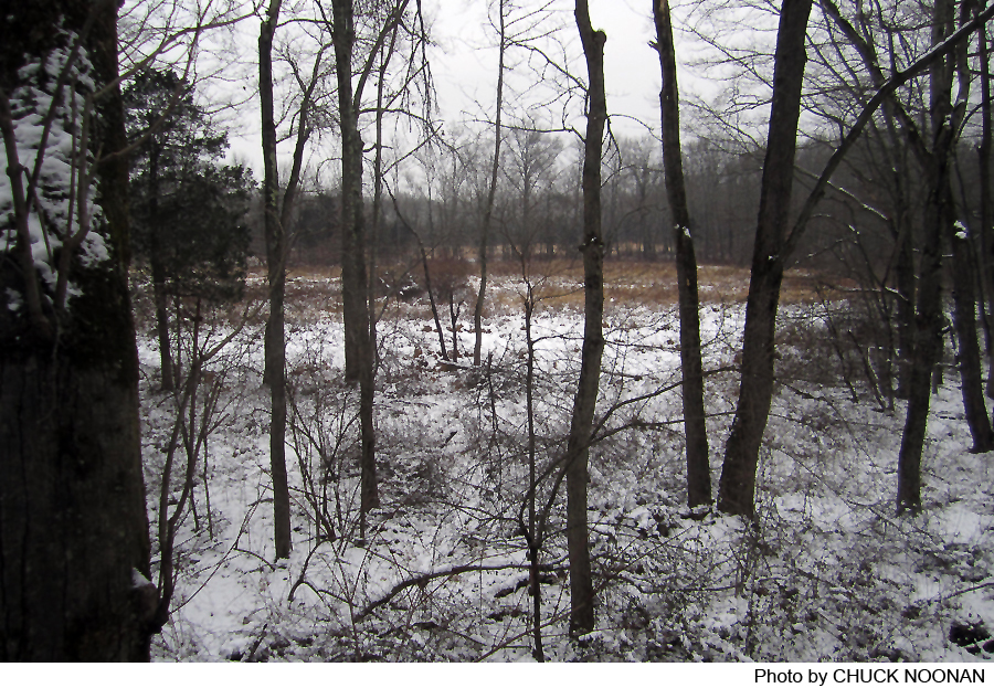
Photos
Videos
