Hunterdon
Stockton
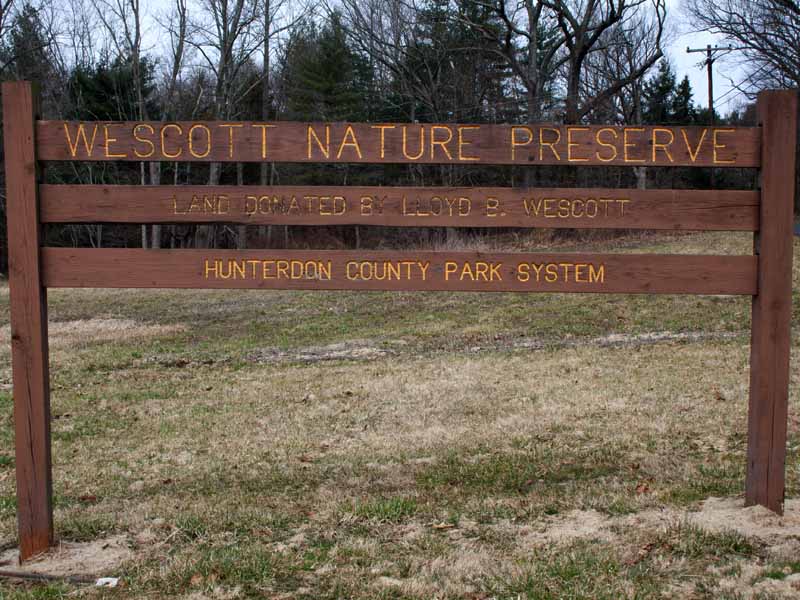
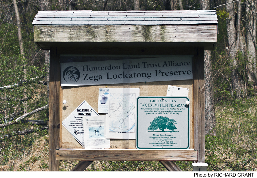
Wescott and Zega Lockatong Preserves
Stockton, NJ 08559


Last Updated: 09/19/2013
Overview of Selected Trail
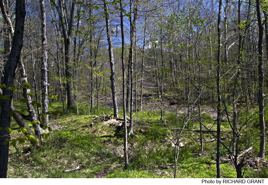
WESCOTT: This short gem of a loop trail winds through meadow, a hardwood forest and a beautiful stand of Hemlock, with vistas overlooking Lockatong Creek. The trail is used for hiking, mountain biking, horseback riding and cross-country skiing.
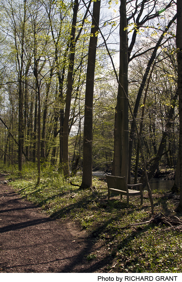
MIMI’S TRAIL: This lovely trail descends through hardwood forest to follow Lockatong creek. It ends at a bench overlooking a small waterfall. The trail connects at the bench to the Ralph Peters Trail.
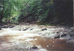
RALPH PETERS TRAIL: This trail traverses several farm fields before entering the mixed hardwood-coniferous forest and descending to Lockatong Creek through a beautiful stand of Hemlocks. It follows the creek to the bench on Mimi’s Trail (the beginning of Mimi’s trail on the Wescott Zega Preserve. The creek has several small waterfalls and rapids as it flows past steep cliffs).
-
-
Distance:
Wescott: 3/4 of one mile
Mimi’s Trail: 3/4 of one mile
Ralph Peter’s Trail: 1.7 miles to Mimi’s Trail
Time:
Wescott and Mimi’s Trail each take approximately 20-45 minutes.
Ralph Peters Trail: 40-60 minutes.
Markings:
Wescott: Orange, square, plastic patches on posts and trees
Mimi’s Trail: Red diamond plastic patches on posts and trees
Ralph Peters Trail: Red diamond plastic patches on posts and trees
Trail Usage:
Walking/Hiking, Dogs permitted on leash
Elevation:
Wescott and Mimi’s Trail: 40 feet (not steep anywhere)
Ralph Peters Trail: 280 feet overall, 180 feet elevation in steepest area
Difficulty:
Easy walking throughout on both Wescott Nature Preserve and Mimi’s trail
Ralph Peters Trail: Easy and level walking at the beginning and end of the trail. There is a steep descent to the creek.
Parking:
WESCOTT and MIMI’s TRAIL: The parking lot will hold at least 13 cars
RALPH PETERS TRAIL: The parking lot will hold 6-8 cars.
Tips:
Caution:
In order to control the population of deer on park property, hunting is permitted on the preserve. Visitors during hunting season are strongly encouraged to wear blaze orange or confine visits to Sundays. Hunting season is mid-November through mid-February.
Ralph Peters Trail: the descent to the creek can be slippery after rains.
Amenities:
The park is open from sunrise to sunset
Directions:
CAUTION: The bridge on Raven Rock Rosemont Road is out (as of 2013). The directions below take one around the bridge.
WESCOTT NATURE PRESERVE: From Flemington Area:
Travel west on Route 12 to the circle and take Route 523 south. At the junction with Route 604 in the center of Sergeantsville, turn right onto Route 604 and proceed to Rosemont. At Rosemont turn left onto Route 519. Route 519 makes an “S” bend while leaving Rosemont. Near the end of the “S” Bend, turn right onto Raven Rock-Rosemont Road. Proceed on Raven Rock-Rosemont Road approximately 0.7 mile until you come to the preserve located on the right.
WESCOTT NATURE PRESERVE From the Lambertville Area:
Travel Route 29 North to the junction with Route 519 just above Stockton. Proceed on Route 519 until it takes a sharp bend to go into Rosemont. At this bend, Raven Rock-Rosemont Road bears to the left. Make the left and proceed 0.7 mile to the preserve which is located on the right.
MIMI’S TRAIL From Flemington Area:
Travel west on Route 12 to the circle and take Route 523 south. At the junction with Route 604 in the center of Sergeantsville, turn right onto Route 604 and proceed to Rosemont. At Rosemont turn left onto Route 519. Stay on Route 519 to Route 29. Turn right (north) on Route 29. Travel north for 2.2 miles to a right turn onto Federal Twist Road. In .7 miles turn right onto Rosemont Raven Rock Road. The preserve is on the left in .4 miles just before the missing bridge.
MIMI’S TRAIL From the Lambertville Area:
Travel Route 29 north to Federal Twist Road on the right. Take Federal Twist Road for .7 miles. Turn right onto Rosemont Raven Rock Road. The preserve is on the left in .4 miles just before the missing bridge.
MIMI’S TRAIL From Frenchtown:
Take route 29 south, past Raven Rock/Bull’s Island. Turn left at Federal Twist Road. In .7 miles turn right onto Rosemont Raven Rock Road. The preserve is on the left in .4 miles just before the one lane steel bridge.
RALPH PETERS TRAIL From Flemington Area:
Travel west on Route 12 to the circle and take Route 523 south. At the junction with Route 604 in the center of Sergeantsville, turn right onto Route 604 and proceed to Rosemont. At Rosemont turn left onto Route 519. Stay on Route 519 to Route 29. Turn right (north) on Route 29. Travel north for 2.2 miles to a right turn onto Federal Twist Road. In .1.5 miles turn right onto Strimples Mill Road. The parking lot is on the right in .3 miles immediately after the curve in the road.
RALPH PETERS TRAIL: From the Lambertville Area:
Travel Route 29 north Federal Twist Road. Turn right onto Federal Twist Road. Turn right on Federal Twist Road. In 1.5 miles turn right onto Strimples Mill Road. The parking lot is on the right in .3 miles immediately after the curve in the road.
RALPH PETERS TRAIL From Frenchtown:
Take Route 29 south, past Raven Rock/Bull’s Island. Turn left at Federal Twist Road. In 1.5 miles turn right onto Strimples Mill Road. The parking lot is on the right in .3 miles immediately after the curve in the road.
-
Wescott Nature Preserve is an easy.75 mile loop that winds through a meadow of tall grasses and wildflowers and deciduous forest to the top of a 20 foot cliff overlooking Lockatong Creek. The path meanders along the top of the cliff through a stand of old hemlock trees before turning and climbing back to the parking lot.
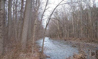
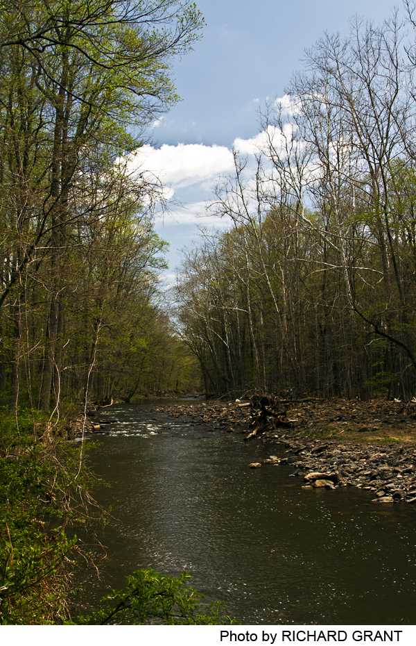
Mimi’s trail -.75 miles from the parking lot to the connection with RalphPetersTrail. Red markers on the trees change to orange markers for Ralph Peters trail. From the Zega Lockatong Preserve parking lot head up hill away from the creek. Stay straight on the mowed path to the edge of the woods. From this point the trail descends to the creek through an Oak Hickory forest. Lockatong Creek is a native trout stream with deep pools, riffles and rapids. The trail ends at the Mimi Upmeyer memorial bench by the small waterfall on the Lockatong Creek. Looking across the creek you are looking at the trail on the Westcott Preserve (on top of the cliff).
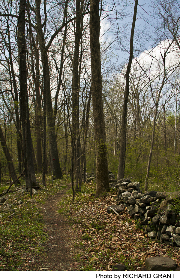
RALPH PETERS TRAIL: 1.7 miles from the parking lot to Mimi’s Trail, orange markers. From the parking lot, the RalphPetersTrail winds through several farm fields and meadows all bordered by hedgerows and old rock walls. The trail skirts a small pond and gently descends through a delightful open woods of red and white oak with deep moss and dappled shade. Shortly after entering the deeper woods the trail forks at yet another stone wall. The left fork leads down to an overlook of a small steep gorge that has been cut into the landscape by an intermittent stream. After a heavy rainfall this will appear as a 12 foot cascade of water. In dry times the huge shelves of rock are observable.
Returning to the fork, follow the trail to the right along the ridge, through more stone walls, through a beautiful stand of Hemlocks and down a steep slope to the stream bed. This slope can be very slippery when wet! The trail goes into the edge of the stream bed. Turn right and head downstream for about 50 feet where the trail climbs the bank and continues on flat floodplain land. When the water is high, this section is impossible to use without getting wet. The trail winds through the flood plain forest and a large stand of cedars to end at the Mimi Upmeyer Bench. This is the beginning of Mimi’s trail. Continuing to follow Mimi’s trail will bring the hiker out to the Zega Preserve parking lot on Raven rock Rosemont Road.
Consult the Hunterdon County website for further parks information: Hunterdon County Parks.
For more information about land preservation efforts within Hunterdon County, please go to: Hunterdon Land Trust Alliance.
-
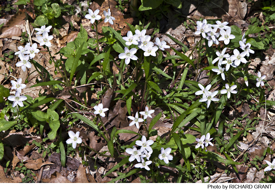
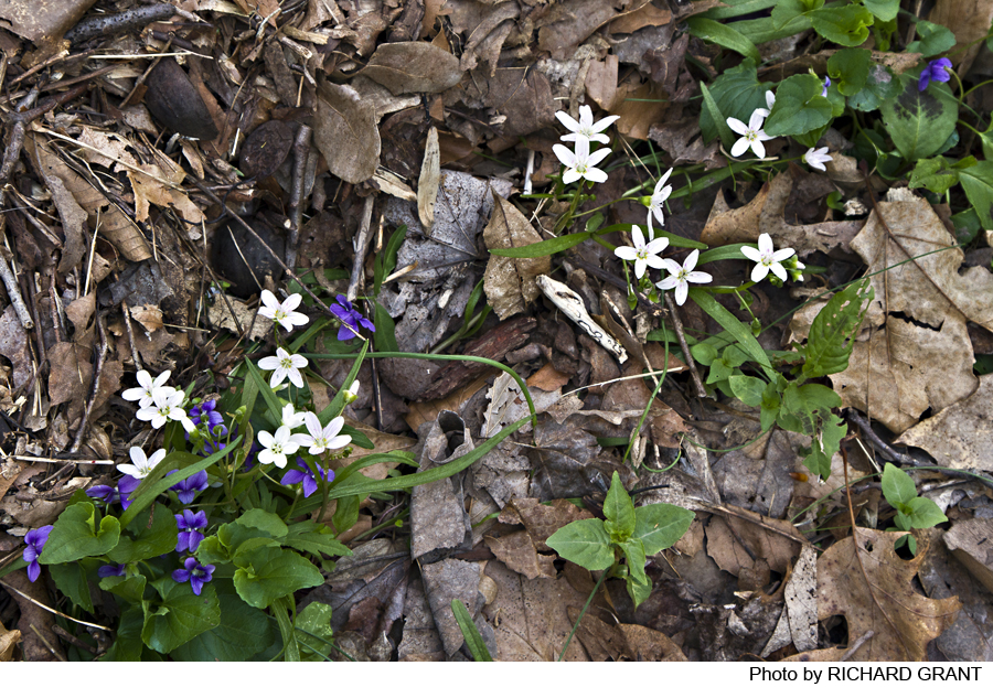
WESCOTT NATURE PRESERVE: This 80 acre preserve encompasses three delightful diverse habitats of meadow, stream and coniferous and deciduous woods. In the meadow, look for grasslands species such as Eastern Bluebirds and American Kestrels. Listen for the summer songs of cicadas, katydids and crickets in the tall grasses.
The Lockatong Creek is a native trout stream and a resource for wildlife such as raccoons and deer. Fishing is permitted in the Lockatong. Access to the creek is from the loop trail. As you follow the trail you will go through one of the few stands of mature Hemlock Trees in the county. Research is being done in the reserve on protecting the Hemlocks from the Woolly Adelgid, an invading insect from Asia.
RALPH PETERS TRAIL: This beautiful preserve is a wonderful place to look for birds and the remnants of wild Hunterdon County. While strolling through the fields and meadows at the beginning of the trail, look for signs of wild animals- deer, fox, raccoon, skunk-that use the trail as a highway. This is also an excellent area to watch for hawks and vultures. The hedgerows are home to many species of birds including the bluebird. At the little pond look for red-winged blackbirds and wetland plants such as sedges and reeds. In the early summer, bull frogs can be heard calling from this pond. On entering the young woods of red oak and white oak, look for ground hog holes by the rock walls. The older woods change to hickory, beech and maple as the trail follows the ridge and slowly descends toward the creek. Ground cover here includes trillium and Christmas fern. Listen for thrush and cuckoos. Both the yellow and black-billed cuckoos have been spotted here. Look for a large two -trunked chestnut oak and a muscular grape vine where the trail goes through one of the rock walls. At the steepest part, the trail slips through a grove of hemlock and large tulip trees.
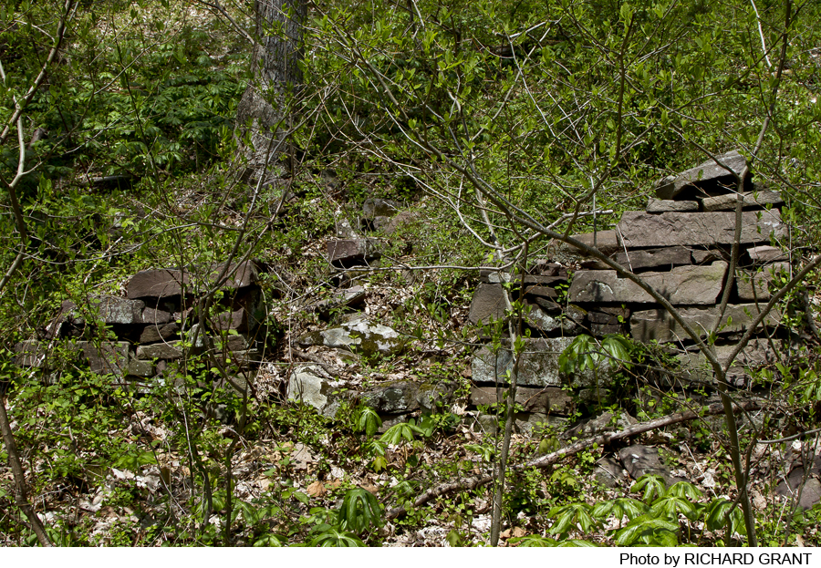
The part of the trail that follows the creek downstream winds through a young floodplain forest and through an old grove of dying cedars. As it approaches the overlook of the creek by the bench, some old foundations of buildings can be seen beside the trail.
Do you have information about this trail?
Click Here to contribute.
-
WESCOTT NATURE PRESERVE: The Lenni Lenape Indians had settlements in this area and used the hard rock Argillite to shape other rocks into tools and weapons. Outcroppings of Argillite can be seen in the streambed where water runs over the bedrock and forms rapids. In 1966, Mr. and Mrs. Lloyd Wescott donated the reserve to Hunterdon County. The reserve is maintained by the Hunterdon County Parks and Recreation Department.
MIMI’S TRAIL is contained within the 70 acre property (the Zega Lockatong Preserve) and is owned and maintained by the Hunterdon Land Trust Alliance. Mimi’s trail is dedicated to the memory of Mimi Conklin Upmeyer who was the Hunterdon Land Trust’s first administrator. She served for many years on various planning boards and commissions in Delaware Township. Mimi and her husband Neil Upmeyer were lifelong conservationists.
RALPH PETERS TRAIL is jointly owned and maintained by The Hunterdon Land Trust Alliance and Hunterdon County. The total acreage is 102 acres. The Ralph Peters Trail is on the land that was part of the Peters farm. Where the trail runs along side Lockatong creek it is part of the Hunterdon County Wescott Preserve. This land was once home to the Lenni Lenape Indians. They used the Argillite to shape other rocks into tools and weapons. Outcroppings of Argillite can be seen in the streambed where water runs over the bedrock and forms rapids. In 1966, Mr. and Mrs. Lloyd Wescott donated the reserve to Hunterdon County. The Ralph Peters Trail connects to and becomes Mimi’s Trail as one proceeds downstream. Mimi’s Trail is on the Zega-Lockatong Preserve (Hunterdon Land Trust Alliance).
Do you have information about this trail?
Click Here to contribute.
-
Photos
Videos
