Hunterdon
Glen Gardner
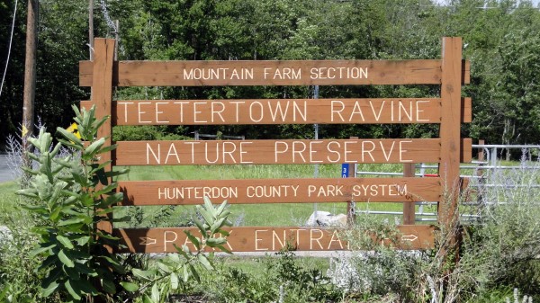
Teetertown Ravine Nature Preserve
Glen Gardner, NJ 08826


Last Updated: 11/21/2014
Overview of Selected Trail
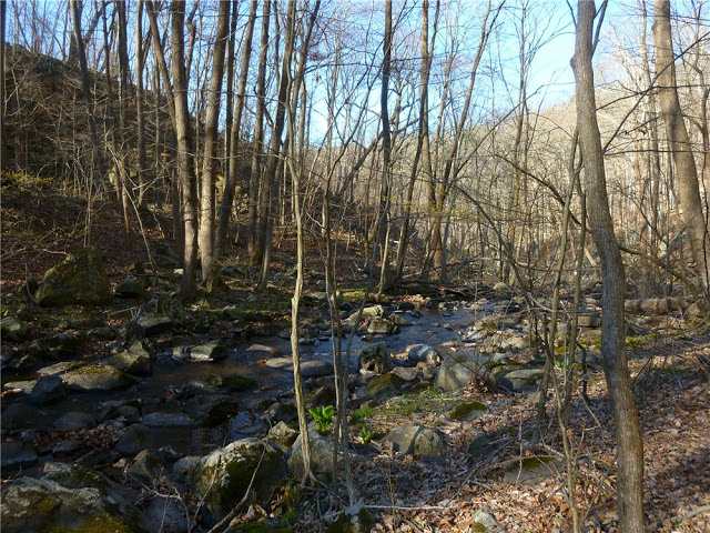
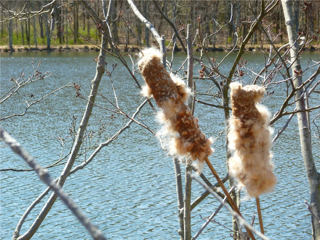
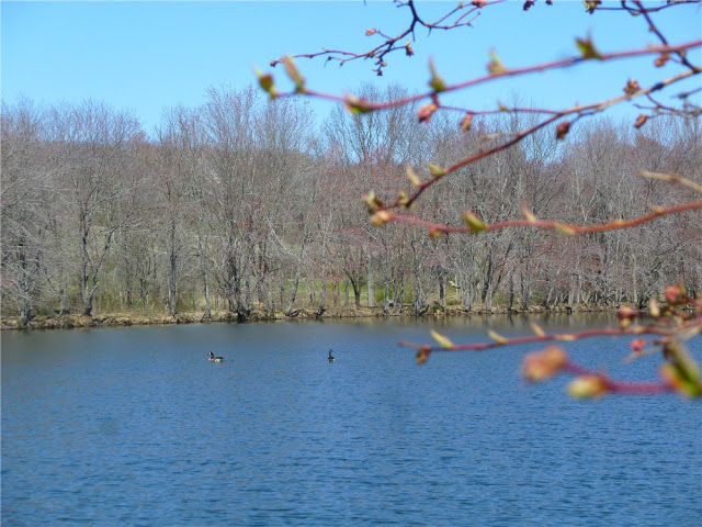
The Teetertown Ravine Nature Preserve’s 147 acres were acquired to protect one of the most significant natural areas in Hunterdon County. This park offers the solitude of a densely wooded area, including a variety of hardwoods, shrubs, and animal life, and the contrast of a spectacular rushing stream winding its way through the Ravine’s dramatic rock outcroppings. In 1999, the adjoining property, which is now called Mountain Farm Section, was purchased, raising the total acreage to 302. The additional property adds large fields and two ponds to the diversity of the park. Rare birds, such as Bobolinks, have been seen here, and volunteers maintain a Bluebird trail.
For more information on Hunterdon County Parks, please see Hunterdon County.
-
-
Distance:
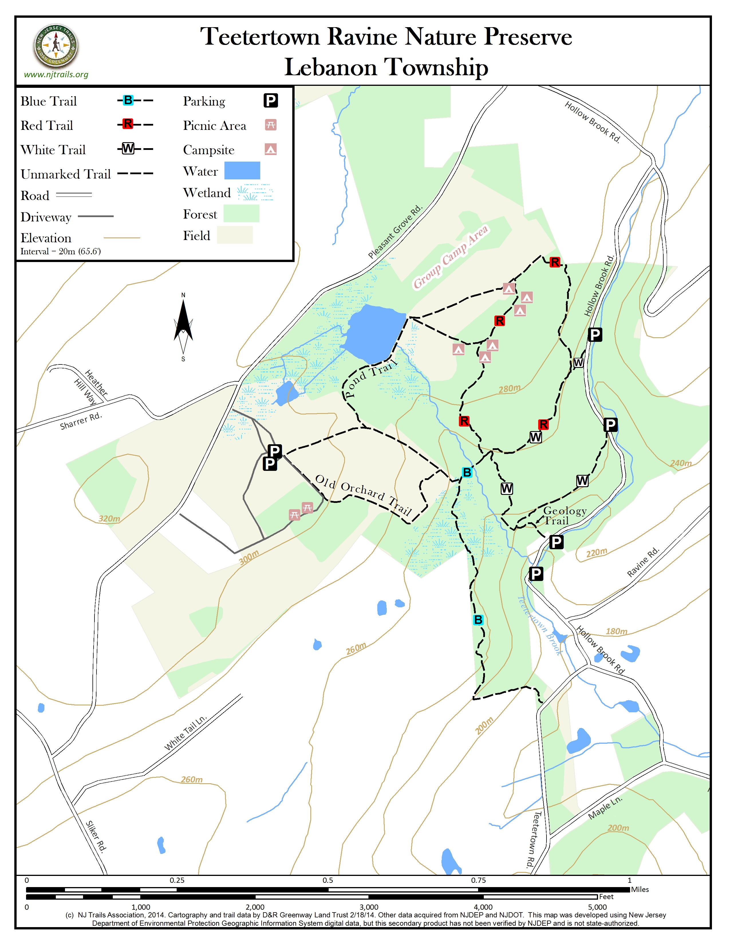
Blue Trail 0.6 mile, White Trail 0.7 mile, Red Trail 1.0 mile, Geology Trail 0.1 mile, Pond Trail 0.4 mile, Old Orchard Trail 0.6 mile
Time:
30 minutes to 3 hours depending on pace
Markings:
The color of the trail coincides with color markings on trees along the trail, i.e. – the yellow trail is marked with yellow markers. The Orchard and Pond Trails are unmarked, but their routes are mowed through the fields.
Trail Usage:
Walking/Hiking, Horseback riding, Mountain biking
Elevation:
Elevation along the Blue trail ranges from 600 feet to 740 feet. Elevation along the Geology Trail ranges from 680 feet to 760 feet.
Difficulty:
Moderate
Parking:
Parking is available at the Mountain Farm Section off Pleasant Grove Road, and just .4 mile further north on Pleasant Grove Road there is additional parking in the Teetertown Ravine section. All the trails are accessible from both parking areas. Still a bit further along Pleasant Grove Road there is more parking near the woodland tent sites. Limited parking is available along Hollow Brook Road.
Tips:
The trails at the preserve are open to for the following uses: Hiking, biking, horseback riding, and cross-country skiing. The trails down into the ravine are rocky and in places very steep, so cross-country skiing is not advisable there.
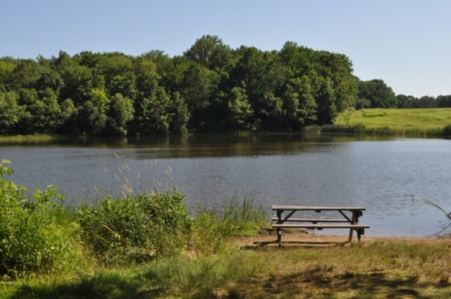
Picnic areas are available to the public.
The ponds at the Mountain Farm Section are excellent for bass and bluegill fishing, catch and release only.
Native trout fishing is permitted in Hollow Brook with appropriate license.
Hunting is allowed by Parks Department permit only. Please wear blaze orange during hunting season, or confine your visits to Sundays.
Wilderness and group campsites are available, by reservation only.
Please note that several of the trails are multi-use. Bicyclists should yield to hikers and horses, while hikers should yield to horses.
Amenities:
A visitor center is located near the main parking area and can provide information and assistance to the public. Hours for the center are Saturday and Sunday 10 AM to 2 PM. A summer nature program for children is based at the Mountain Farm Section. Picnic areas are available.
Directions:
From the junction of Route 78 and Route 31 in Clinton:
To Mountain Farm Section Parking Area- Proceed north on Route 31 for 1.7 miles to Route 513 north. Turn right and follow Route 513 through High Bridge toward Califon for about 6.5 miles. Just past the A&P, turn left onto Sliker Road. After about 1.5 miles on Sliker Road, turn right onto Pleasant Grove Road and travel another 0.6 mile. The driveway for Mountain Farm will be on the right hand side.
To Teetertown Ravine Parking Area- Follow directions above, EXCEPT after about 1.3 miles on Sliker Road, turn right onto Teetertown Road. Follow the left fork of the road about 1 mile to the stop sign at Hollow Brook Road. Turn left and proceed 0.1 mile up the ravine. There are vehicle pull-offs near the trailheads.
Orchard Avenue: Take Interstate 295 to Interstate 195, to Exit 1A for 206 S. Follow 206 South for 1.1 miles to Glen Ave. Turn right onto Glen Ave, then first left onto Orchard Ave. Park at the dead end. Please do not block driveways or mailboxes. You will be entering the trail from the north end.
Stanton Avenue: Take Interstate 295 to Interstate 195, to Exit 1A for 206 S. Follow 206 south for 1.5 miles. Stanton Avenue is on the right between Park Street and Amboy Road. The sign is smaller than normal. Turn right on Stanton, drive down to the end of the road to park.
-
TEETERTOWN RAVINE SECTION TRAILS
White Trail:
The White Trail consists of two old logging trails. The two ends of the trail are clearly marked with park signs at pullouts along Hollow Brook Road. Beginning at the southern end of the White Trail, follow the old logging trail up the ravine. At a small intersection, the Geology Trail heads down steeply back to Hollow Brook Road, with dramatic views of the rock formations lining the side of the ravine. Passing by that intersection, the White Trail winds up through the forest and connects with the Red Trail at 0.4 miles. Turn right and follow the combined Red/White Trail. At 0.65 miles, the Red Trail continues to the left and the White Trail continues down the hill back to Hollow Brook Road. Turn right and follow the road 0.15 miles back to the pullout.
Red Trail:
This trail winds through the upper portion of the preserve. Beginning at the northernmost parking pullout along Hollow Brook Road, follow the White Trail up the ravine. At 0.05 miles, the Red Trail turns right, leaving the combined Red/White Trail which continues straight. Turning right, follow the Red Trail through the forest to a field. The route then follows the edge of the woods to the left, and then re-enters them, passing several of the wilderness campsites. The trail continues through the forest and joins the Blue Trail at 0.85 miles. Turning left, the Red Trail joins the White Trail. Continue on the combined Red/White Trail back to Hollow Brook Road at 1.0 miles.
Blue Trail: (Biking and Horseback riding prohibited)
The Blue Trail can be accessed from the junction with the Red Trail, Old Orchard Trail, or the parking pullouts along Hollow Brook Road. Beginning from the Red Trail, this trail crosses a stream, passes the connection with the Old Orchard Trail at 0.05 miles and proceeds inside a small ravine. As it exits over a rock wall, it will pass through a section of the preserve that contains much of the plant life common to swampy areas. The trail follows along the top of the ravine with a splendid view of the valley. At 0.5 miles, the trail turns left and descends 140’ along an old rock wall down to the road. Please use caution, as the hill is very steep. Follow the road to the left and take the first left onto Hollow Brook Road and the ravine. There are several opportunities for a round trip as the road reaches the junction with the Geology Trail at 0.35 miles, the White Trail at 0.7 miles and the Red and White Trail at 0.85 miles.
MOUNTAIN FARM SECTION TRAILS
These trails, which cross fields and run along their edges, are unmarked. Use the map in the park brochure, or the map from this website, to orient yourself and get started.
Pond Trail:
This trail connects the Teetertown Ravine trails to the fields and ponds of Mountain Farm. The Pond Trail begins from the parking area at the Mountain Farm section. Keeping the Visitor Center on your left, follow the road east. At 0.1 miles, the Old Orchard Trail turns right. Stay on the road, which will change to crushed gravel when you reach the pond at 0.2 miles. Follow the crushed gravel path along the east side of the pond. At 0.3 miles, you will reach a trail junction. The mowed trails to the right and diagonally through the field will both connect with the Red Trail at 0.4 miles. The trail to the left into the woods, and the mowed route straight ahead both lead to the Group Camping Area.
Old Orchard Trail:
The Old Orchard Trail begins from the parking area at the Mountain Farm section. Keeping the Visitor Center on your left, follow the road east. At 0.1 miles, the Old Orchard Trail turns right into the field. At 0.3 miles, the Old Orchard Trail turns right and continues along the edge of the field. Connect to the Blue Trail by continuing straight.
As the trail winds around what was once a peach orchard, notice the pile of rocks cleared from the field by farmers. Mullein, Staghorn Sumac, and Multiflora Rose are a few of the plants that have started to take over the field. The thickets along the fence are excellent places for birds to feed and find shelter. The trail continues along the edge of the field turning right again at 0.4 miles, passing the picnic area and reaching the road at 0.5 miles. Turn right on the road and finish at the parking area at 0.6 miles.
-
The forested ravine offers a wide array of plants and animals to enjoy. A recent spring trip yielded several species of flowers including may apples, rue anemone, jack-in-the pulpit and wild geranium as well as lady and Christmas ferns. The understory is speckled with viburnum, witch hazel and spicebush in the wet areas. Look for the cone shaped “witches hat” galls on the leaves of the witch hazel. Tulip poplar, sugar maple, black and red oak dominate the canopy and provide great shelter for a variety of birds including ovenbird, Eastern wood pee-wee, black and white warblers, black throated green warblers and pileated woodpeckers.
The fields offer a wonderful splash of color during the summer that include yarrow, Queen Anne’s lace, Deptford pink, blue-eyed grasses and sundrops. Eastern bluebirds, tree swallows and yellow warblers search the fields for insects as black swallowtail butterflies and a variety of skippers dance from flower to flower.
Do you have information about this trail?
Click Here to contribute.
-
The nature preserve was named after John Teeter who purchased a pre-Revolutionary War gristmill in 1814. From the mill, Mr. Teeter was able to produce flour and grist. After extensively altering the mill in 1820, he turned over operations to his son-in-law, Samuel Dorland. One of his relatives, Elsie Teeter, lived on a nearby farm with her husband, James Lance. The farm remained in the possession of the Lance family until 1926. In 1953, the Watchtower and Bible Tract Society of New York, Inc. (Jehovah’s Witnesses) took ownership of the site as a communal farm, calling it “Mountain Farm.” However, due to economics, the farm was considered surplus and was sold to the County in 1999.
In 1896, Lawrence Hager Trimmer (1847- 1909), founder and director of the High Bridge National Bank, established the Middle Valley Trap Rock and Mine Company with Teetertown Ravine serving as the location for quarry operations. Crushing 400 tons of rock daily, with the help of a 150 horsepower engine, the plant finally ceased production in 1923. Memorabilia pertaining to this operation, the communal farm, and the Lance family, can be viewed in the park’s visitor center.
Do you have information about this trail?
Click Here to contribute.
-
Photos
Videos
