Somerset
Montgomery
Stonebridge Trails
Montgomery, NJ 08558


Last Updated: 07/15/2014
Overview of Selected Trail
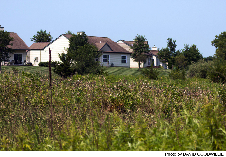
The lands along Montgomery Road in Montgomery Township, consisting of approximately 219 acres, on which the Stonebridge Adult Community is located, were preserved in September 1997 by D&R Greenway Land Trust and the State of New Jersey Green Acres Program. D&R Greenway Land Trust then conveyed it to Montgomery Township and the State of New Jersey. Trails run around the north, east and west sides of Stonebridge Retirement Community and the 1860 House (Montgomery Cultural Center), both on land previously owned by Ingersoll-Rand Corporation.
-
-
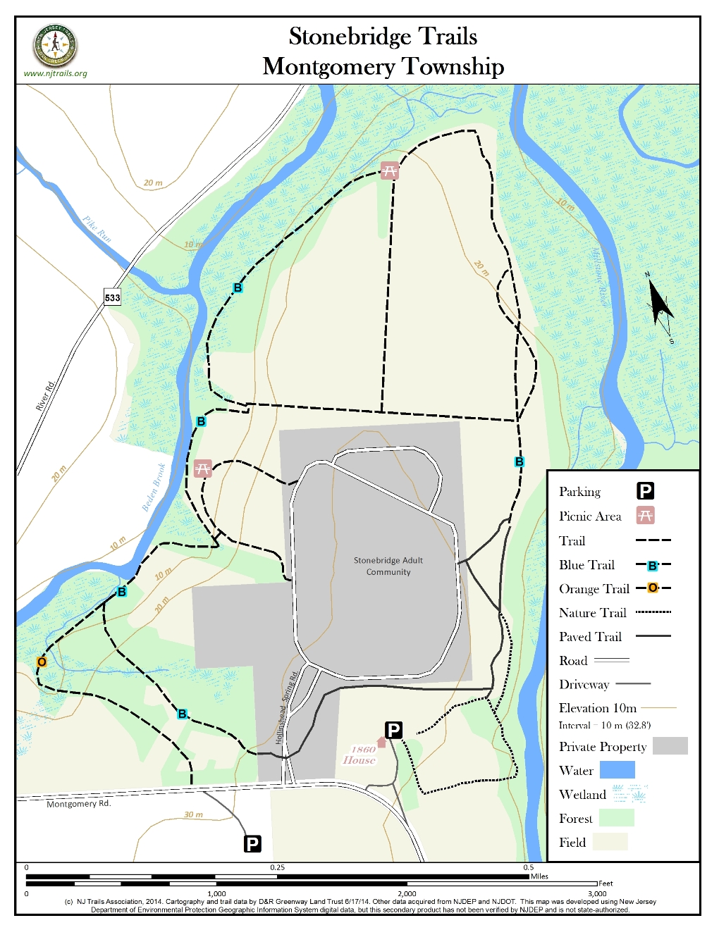
Distance:
4.5 miles total – Blue Trail: 1.6; Orange Trail: 0.4; 1860 House Trails: 0.4; Unmarked: 2.2
Time:
2-3 hours to hike all trails – 1-1 1/2 hours for Blue Trail; 15-20 minutes for the 1860 House loop
Markings:
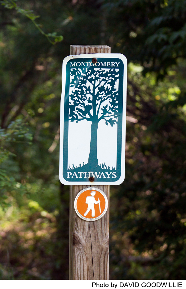
Blue and orange metal trail markers, painted green blazes in white circles, a few blue Montgomery trail posts at intersections(see Trail Description).
Trail Usage:
Walking/Hiking, Accessible by wheelchair and baby stroller, Dogs permitted on leash
Elevation:
Moderate climb/descent on 1860 House loop; otherwise flat terrain
Difficulty:
Easy. Moderate climb/descent on 1860 House loop.
Parking:
There are two parking areas for these trails: 1) almost directly across from the entrance of Stonebridge on Montgomery Road, pull in small access road and park next to field. 2) From Route 206, Travel east on Montgomery Road, past Stonebridge entrance on your left. Enter horseshoe driveway on left and drive behind historic 1860 house. Park in this lot and walk to adjoining trails.
Tips:
There are sweeping views of fields and the Millstone River Valley. Watch for bluebirds using the bird houses in the fields on the northwestern side of Stonebridge.
1.5 miles of wooded hiking trails; 1.5 miles of mowed paths around corn fields; 1.8 miles of sidewalks and paved trails are wheel chair/stroller accessible.
Amenities:
The trails utilize sidewalks in some areas enabling use by families with strollers or those dependent on wheelchairs.
The trails are conveniently located just outside Rocky Hill with small shops for coffee, or Montgomery Shopping Center with restaurants and stores.
Directions:
Stonebridge and 1860 House are both on Montgomery Road between Route 206 and the borough of Rocky Hill, at the southern end of Somerset County. From the north, go south on Route 206. Just beyond the large intersection with Orchard, River and Bridgepoint Roads, turn left on Montgomery Road(a mile north of Route 518) for 1/3 mile.
From the east, go west on Route 518 through Rocky Hill (where the road becomes Washington Street and speed limits are strictly enforced) and turn right on Montgomery Road for about a mile.
From the west, go east on Route 518, turn left on Route 206 (Wawa and Shell Gas Station on corners)for 3/4 mile, then right on Montgomery Road for 1/3 mile. *At this time, there is no designated parking at Stonebridge for people walking on trails. Just before you reach the entrance on your left, turn right into small access road and park next to field. You can then easily walk across the road to access the trails. To get to the western side trails, walk to the stop sign, go left on Hollinshead Spring Road (you will see the tennis court). For access to the eastern side trails, go right on Hollinshead Spring Road for 300 yards and look for trails.
Second parking area: For the 1860 House Trail, enter the horseshoe driveway just to the east of the Stonebridge entrance, and park in the lot behind the house.
-
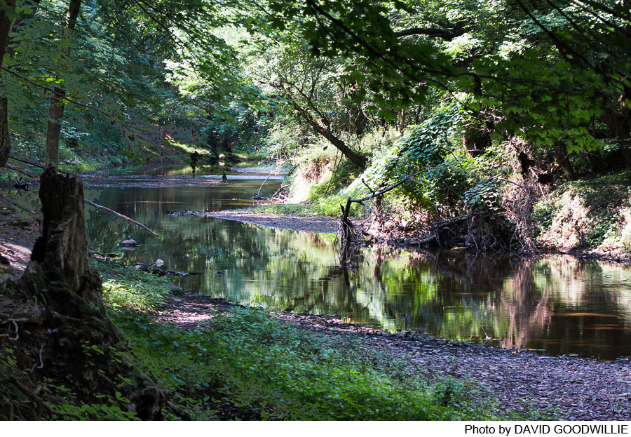
The Blue Trail follows a high bank of Beden(s) Brook for half a mile, with outstanding views, while the rest of it runs between woods and corn fields to the 1860 House. To complete a loop, it is necessary to follow a paved trail across the south side of the property. The 1860 House loop runs through fields and then descends and re-ascends a high bank along the Millstone River, also with great views.
The primary trail in the area is the Blue Trail, which can be accessed from either parking area. This writeup describes a clockwise loop, starting at the lot next to the tennis court. From the lot, cross the road at the nearby crosswalk and continue on the paved trail through the field for 500 ft. At this point, a narrow trail goes left, then forks after a short distance. Take the right fork, which is marked for the first 0.2 mile with green painted blazes in a white circle(courtesy of the local Girl Scout troop). The balance of the loop is marked with blue metal markers. The trail enters the woods and runs along the edge of a high embankment, affording great views of Beden(s) Brook below. It passes a small memorial with a bench (there are several along the loop) and comes to a small gully with a large, downed tree, around which it takes a long detour (the trail will eventually go straight ahead after the tree is cleared). At the far end of the detour, an unmarked, mowed path runs east across the edge of a corn field to connect with the eastern half of the Blue Trail.
Beyond this point, the loop continues through the woods for another 0.4 mile, gradually moving away from the stream as the high bank gives way to flood plain, and leaves the woods at a marker post where another mowed path runs north from the first one. The loop continues to the left between the woods and the corn field, turning south after a short distance (this section can be quite wet during the rainy season). It splits briefly in an area where there are several deer exclosures and a number of small trees have been planted in a reforestation effort. The two forks meet again shortly (a future trail will leave the left fork and enter the woods along a high bank overlooking the Millstone River, paralleling the mowed trail for some 800 feet before rejoining it; it will return to the bank further on, and eventually connect with the 1860 House Trail). The Blue Trail continues, arriving at a paved section (see below) which continues for about 0.2 mile. To stay on the loop, follow the paved trail to the right as it passes in front of the main building and then crosses the entrance road. Beyond the road it enters the woods, still paved for the first 300 feet or so, then becomes a narrow trail again. As it arrives at the bank above Beden(s) Brook, theOrange Trail comes in from the left. The Blue Trail goes right and then swings east around a dry canyon, at the end of which it meets the trail coming in from the parking lot. Go right on this trail, then right again on the paved trail to return to your car.
The Orange Trail is only 0.4 mile in length. After following the brook for a short distance it turns to the left, crosses a small stream and then a swampy area, and runs through open fields and pine and cedar woods to Montgomery Rd., about 500 feet west of the Stonebridge entrance. Across the road is a large field, partially planted with corn, which can also be accessed by the public.
To reach the 1860 House Trail from the Blue Trail, continue straight ahead at the end of the pavement and look for a blue marker on a low-hanging branch. Pass to the right of this marker and along the edge of a small field, then go left on a mowed path that intersects the 1860 House loop, which is only about 0.4 mile long. To the right is the house; go left through the field to the woods, where the path becomes a trail that descends about 50 feet down the steep bank, then re-climbs it and re-crosses the field before reaching the driveway or turning to the right to complete the loop.
There is 3/4 mile of paved trails and at least another 3/4 mile of sidewalks that are easily accessible to wheelchairs and strollers. From the parking area next to the tennis court, cross the road and take the same paved path as if taking the Blue Trail. Remain on the path as it swings through the fields for 0.2 mile before returning to the road, at which point sidewalks go in three directions. Continuing on the left or center sidewalk will bring you to another intersection, and eventually to the east side parking lot, where a crosswalk leads to the paved part of the Blue Trail. Turning right here and right again where the paving ends will bring you by a series of sidewalks back to the starting point after a loop of about 0.8 mile.
-
The preserved lands along Montgomery Road in Montgomery Township, Somerset County lie along the confluence of two major waterways: the Millstone River and the Beden(s) Brook. The floodplains, natural springs, hardwood forests, hedgerows and farmland provide habitat for hawks, red fox, owls, raccoons, pheasants, box turtles, white-tailed deer and wild turkey. The land is directly adjacent to the D&R Canal State Park and complements the otherwise linear park. Wetlands areas exist on the property and provide a great diversity of habitat, proximity to water, with long forest edges that are beneficial for wildlife.
Do you have information about this trail?
Click Here to contribute.
-
The lands along Montgomery Road in Montgomery Township, consisting of approximately 219 acres, on which the Stonebridge Adult Community is located, were preserved in September 1997 by D&R Greenway Land Trust (formerly known as Delaware & Raritan Greenway) and the State of New Jersey Green Acres Program. The Delaware & Raritan Greenway then conveyed it to Montgomery Township and the State of New Jersey. The land was previously owned by Ingersoll-Rand Company, a manufacturer of construction equipment, pumps, bearings and tools. After a corporate decentralization in the mid-1980’s, the research and development work was divided among separate divisions and the 71,000 square foot Montgomery lab closed. In 1995 the building and its water tower were razed. With the prospect of a business park and traffic congestion looming, Montgomery Township re-zoned from commercial to residential to prevent a large-scale development. Ingersoll-Rand sued due to claims of lost value. A grass-roots group called Citizens for Open Space Preservation (COSP) and community leaders rallied to oppose the proposed development of 213 homes. The group called attention to the natural resources, principally for wildlife and bird habitat and the waterways: Bedens Brook, Pikes Run stream, Millstone River, and the Delaware & Raritan Canal. They succeeded in getting the Ingersoll-Rand Corporation to talk with the Township about the potential for creating more open space on the property. A settlement was reached in June 1993 for more low impact alternatives. Ingersoll-Rand also deeded 22 acres to the town for park land, including 19 acres on the south side of Montgomery Road, part of which was once a playground, and a three acre site of the 1860 house for use as a Montgomery Cultural Center. There was also a buffer along the Millstone River to the east for use as a nature trail. Many organizations wrote letters of support for the land to be preserved. Some of the organizations that supported the preservation included: Stony Brook Millstone Watershed Association, Middlesex Somerset Mercer Regional Planning Council (MSM), D&R Greenway, and the Delaware and Raritan Canal Commission.
Adjacent to the Stonebridge Retirement Community is the historic 1860 House, formerly the Montgomery Cultural Center (under re-organization with the hope it will be revived in the future). In the early 1900’s, Edward A. Smalley owned this home and some of the surrounding land and operated a dairy farm. Mr. Smalley used his carriages to transport older children back and forth to school in Princeton. He also regularly met trains and transported out-of-town baseball teams back and forth to games.
The former Ingersoll-Rand lands connect the Millstone River Valley, River and Canal Roads and a rich historic past. River Road to the north, is a designated scenic roadway and part of a state and federal historic district. Along River Road is Dead Tree Road which links to the historic Mill Pond and Montgomery Park.
The land is also adjacent to the borough of Rocky Hill and approximately 35 additional acres of preserved parkland.
Do you have information about this trail?
Click Here to contribute.
-
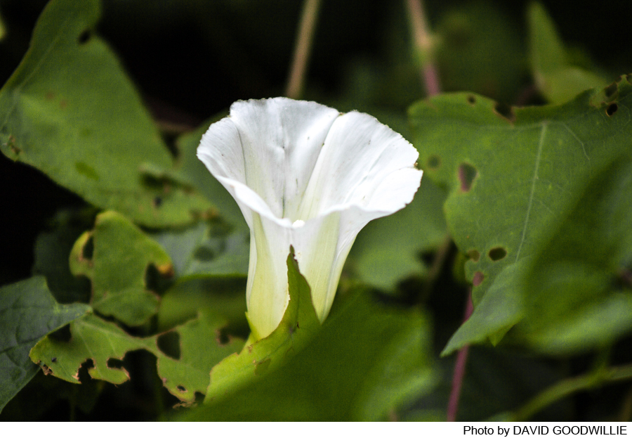
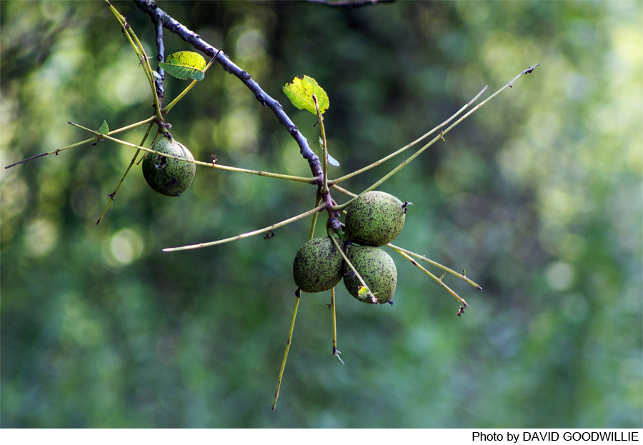
Photos

Videos
