Somerset
Hillsborough Township
Sourland Mountain Preserve – Somerset
Hillsborough Township, NJ 08844


Last Updated: 06/25/2013
Overview of Selected Trail
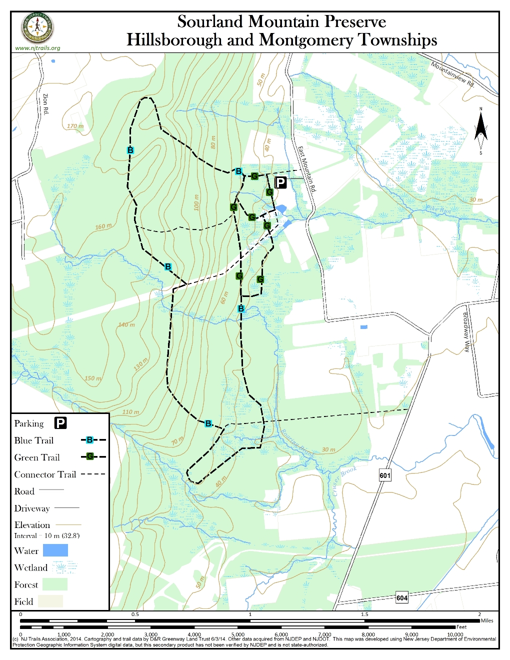
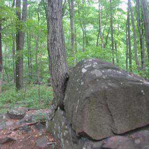
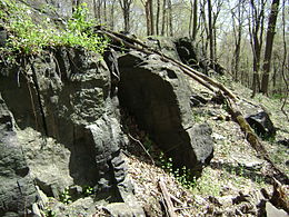
Sourland Mountain Preserve in Somerset County is 3,025 acres of woodlands, boulder fields, unique wetlands, and steep hillsides. The Preserve is owned by Somerset County and administered by the Somerset County Park Commission. The Preserve is remarkably close to the Route 206 corridor, but is rich in natural resources. Passive recreational opportunities include hiking, mountain biking, bird watching, orienteering, bird watching, and bouldering. The trails described here are located on the northern most border of Montgomery Township in Hillsborough Township. Sourland Mountain Preserve is part of the Sourland Mountains, a 90 square mile area extending over five townships (Montgomery, Hillsborough, Hopewell, West Amwell and East Amwell) and three counties (Mercer, Somerset and Hunterdon) in central New Jersey. The Sourlands consist of the main Sourland Ridge with an elevation ranging from 300 – 600 feet and several geologically similar adjoining areas, including Baldpate Mountain, Mount Rose and Pheasant Hill.
-
-
Distance:
Maple Flats trail is 1.4 miles
Ridge Trail is 5 miles
Pond View trail is 1 mile
Time:
Maple Flats trail takes about 45 minutes depending on pace. Ridge Trail requires about 2 hours if you descend hill at Trail Post #5; 3 to 3 1/2 hours if you follow south to include all trail posts consecutively #1 – #13; depends on pace.
Markings:
Maple Flats trail is posted clearly with white geometric signs with a black tree symbol. The posts are placed about five feet high on the trees.
Ridge Trail begins with both triangle and square tree symbols as you continue on they become triangle tree symbols.
Trail Usage:
Walking/Hiking, Dogs permitted on leash, Mountain biking
Elevation:
Maple Flats trail is 100-200 feet elevation; Ridge Trail is a steeper climb that varies from 100 to 500 feet at its highest elevation; Pond View trail is a mostly flat trail at the base of the Sourland Mountains.
Difficulty:
Maple Flats is an easy to lightly moderate hike with inclines.
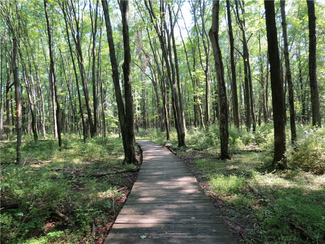
The Ridge trail is a challenging one set among great boulder fields with many inclines and declines. Thirty nine separate wooden walkways help with the demands of the varied terrain.
Parking:
A parking lot at the trailhead allows space for 30+ cars.
Tips:
Trails can be muddy in late winter and during the spring thaw. Wear boots or sturdy over the ankle boots. Stop at kiosk to see large trail map display. Pick up trail map in case there are new trails or changes to existing ones. Allow 35 minutes as a basis for hiking one mile. Your time will vary on whether you are traveling in a group, with children, and physical condition. Allow plenty of time to return to parking lot during winter months when days are shorter.
Amenities:
There is portajohn at the trailhead. There is also a kiosk with park maps and other hiking information.
There is a pretty pond with grass surrounding it for a picnic or relaxation.
Directions:
From the north:
Take Route 206 south through Hillsborough. The next town you pass through is Belle Mead. After you pass the Belle Mead post office and a car dealership, bear right at the fork just before a railroad bridge. This is Route 601 South. The road winds around to the right and straightens out. You will then see Carrier Clinic on the right. Look for East Mountain Road on your right. Turn right on East Mountain Road and follow where you will exit Montgomery Township and enter Hillsborough Township. Approximately one mile from the turn off at East Mountain Road you will see the entrance to Sourland Mountain Preserve on your left.
From Central New Jersey (Route 295/95):
Take the exit for Route 206 North Lawrenceville. Pass the Lawrenceville School on your right.Travel Route 206 north toward Princeton. After you pass the Governor’s Mansion you will see a traffic light and a left turn for Elm Road. Turn left here and follow this road. It will become the Great Road as you travel uphill toward the village of Blawenburg. Cross Route 518 and travel north past Montgomery High School and the Skillman Post Office. From the Skillman Post Office it is about 3 miles until you will see East Mountain Road on your left. Bear left at East Mountain Road (Carrier Clinic will then be on your right) and travel approximately one mile to the entrance of Sourlands Preserve on your left.
-
Maple Flats Trail
Start off from the parking lot and enter the woods at the main entrance. There are two trail posts marking the trail. There are a series of trail posts with numbers and geometric shapes.
When you reach trail post #1 go to the left and the trail will be marked with a triangle and a square. If you proceed straight up the hill the trail will be marked with a square which is called the Ridge Trail, but this is a separate walk.
Turn left at trail post #1 and cross a wooden bridge. It is a gradual uphill through this section and drier than the trails off to the south. At trail #2 you will turn right and walk up through large oak trres. You will cross a boardwalk with a fallen tree on either side. The trail becomes rocky and steeper at this point.
Cross another boardwalk and look for trail post#3. Turn left and continue on the trail here you will see a large boulder on your right. Emerge from the woods and you will be on the right of way of the pipeline. The left fork is the Triangle/Square Trail. Follow this and cross two more boardwalks. These wooden structures are particularly nice in the late winter and spring when the trails are very muddy. The trail meanders through two more boardwalks and comes out of the woods at trail post #11. You may turn right and walk down the hill on the right of way for the pipeline which takes you back to the base of the pond and the parking lot beyond. If you wish to complete the Maple Flats trail reenter the woods on the opposite side of the pipeline right of way and follow to tail post #12. Turn right and follow down hill to Trail Post #13 and then to the parking lot.
Ridge Trail
Enter at the main trail head and enter the woods. Trails markers consist of geometric shapes posted to trees and wooden posts in the ground: square, triangle and circle. You will see tulip, oak, and black walnut trees along the way. Walk across wooden walkway to reach trail post#1 and turn left. Cross wooden bridge and follow to trail post #2(the large #2 is missing from the second trail posts but it is easily recognizable). At the beginning you will see both triangle and square tree symbols. Take the right fork and the trail climbs uphill. You will start to see Gray or Black birch trees and Basswood. Basswood was used by Native Americans during the winter and the “Hunger Moon.” In February they would eat the buds from this tree. A third walkway leads to trail post# 3 where you make a slight right onto an uphill route. There are no tree symbols between posts 3 and 4.
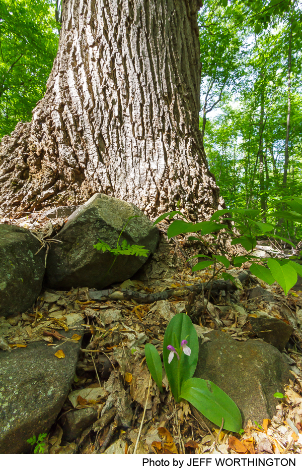
In the summer months you will a variety of ferns along the way. There is also spicebush along the trail. Spicebush shows as yellow leaves in fall and has yellow flowers in the spring. Near trail post #4 the forest opens up and you will notice smaller trees such as Shagbark hickory (note the characteristic bark that appears to look like curled pencil shavings on the tree trunk) and Red Maple.
After you pass trail post #4 trail descends again as you approach trail post#5. At trail post #5 a fifth wooden walkway leads to a downhill creek; if you bear left you get a panorama of the Sourlands. Then you can bear right to continue onto Trail post #6. The distance to post #6 is considerable.
At this point you may descend the Texas Eastern pipeline right of way and go down hill to reach the pond and the parking lot, or continue up the hill a short distance (turn right) and follow into the woods on the Ridge Trail marked with a Square to trail post#6. There are two more boardwalks through this area. Once you reach Trail Post#6 there is a very steep section of trail with a handrail. You will then begin your descent to trail post#7. Turn right at Trail post#7 and travel to Trail Post #8 near a brook. The trail meanders again and there is another boardwalk that takes you to trail post#9. Continue straight and follow square trail markers to #10. You turn right downhill to #11 and again emerge from the woods at the pipeline right of way. Return into woods on the opposite side to find trail post #12 and trail post #13 which brings you back to the bottom of the hill and near the parking lot. The tree markers were posted with a square above a triangle on the final lap of the hike.
-
There is an abundance of wildlife and birdlife in the Sourland Mountain Preserve. One can see bluebird houses at the park. The “knocking” and calling of woodpeckers will also be heard when in the forest.
Trees include Tulip poplar, oak, black walnut, shagbark hickory and red maple.
Do you have information about this trail?
Click Here to contribute.
-
Sourland Mountain history and ownership dates back as far as 1664 when the British drove away the Dutch from their lands on the eastern seaboard. King Charles II gave his younger brother, James, Duke of York (who would become James II) the territories between the Connecticut and Delaware Rivers. James then proceeded to give the land between the Hudson and the Delaware to two close friends: John, Lord Berkeley and Sir George Carteret. John, Lord Berkeley received lands looking toward the Delaware River, then called the province of West Jersey; while Sir George Carteret received the lands that looked to New York, then called province of East Jersey.
A boundary line was agreed to in 1676 and eventually finalized in 1687 using surveys of George Keith. Despite the unification of West and East Jersey and the American Revolution, the boundary lines, called the “Keith Line” still remain fairly intact. According to T.J. Luce, in the book, New Jersey’s Sourland Mountain, “…that part of Sourland Mountain belonging to Somerset, the northern part was in Hillsborough Township, created in 1771 from the county’s western precinct (i.e. west of the Millstone River) and named in honor of Lord Hillsborough, the first Secretary of State for the colonies, a post created in 1768. Hillsborough tried to enforce the Townshend Acts, which among other things laid duties on items such as tea, paper and glass. When in his so-called Massachusetts Circular Letter John Adams urged the colonists to repudiate the Acts, Hillsborough instructed the royal governors to treat the letter “with the contempt it deserves.” Lord Hillsborough resigned his post in the year following the naming of the township in his honor.”
The southern half of Sourland Mountain in Somerset County was in Montgomery Township. This township was created in 1798 from the same western precinct and the name came from General Richard Montgomery who died in the Battle of Quebec in 1775. His name was given to other Montgomeries around the United States, including Montgomery, Alabama.
The history of the name Sourland has caused a great deal of debate over the years. The most widely held explanation refers to the nature of the soil. This has referred to the poor quality of the land in the Sourlands, to the sour smell the woods seem to emit after a rain, or to the acidic nature of soil generally in this part of New Jersey. The word “Sourland” could be derived from “sorrel-land” which describes the sorrel (reddish-brown) colored soils encountered by the pioneering German farmers. Another usage of sorrel signifies plants and trees called sorrel, whose sap or juice has a sour taste.
Dutch farmers who settled in the region appreciated their land so it is uncertain whether they really did refer to it as “sour.” There is data that shows that Dutch farmers around the village of Harlingen (in Montgomery Township) may have indeed believed the land lacked nutrients and therefore made it sour. There is doubt whether these Dutch farmers added lime to the soils, but there is evidence in favor of wood ashes or potash being applied to the soil to make it sweeter.
Do you have information about this trail?
Click Here to contribute.
-
Photos


Videos
