Hunterdon
Hopewell
Sourland Mountain Preserve – Hunterdon
Hopewell, NJ 08525


Last Updated: 07/02/2018
Overview of Selected Trail
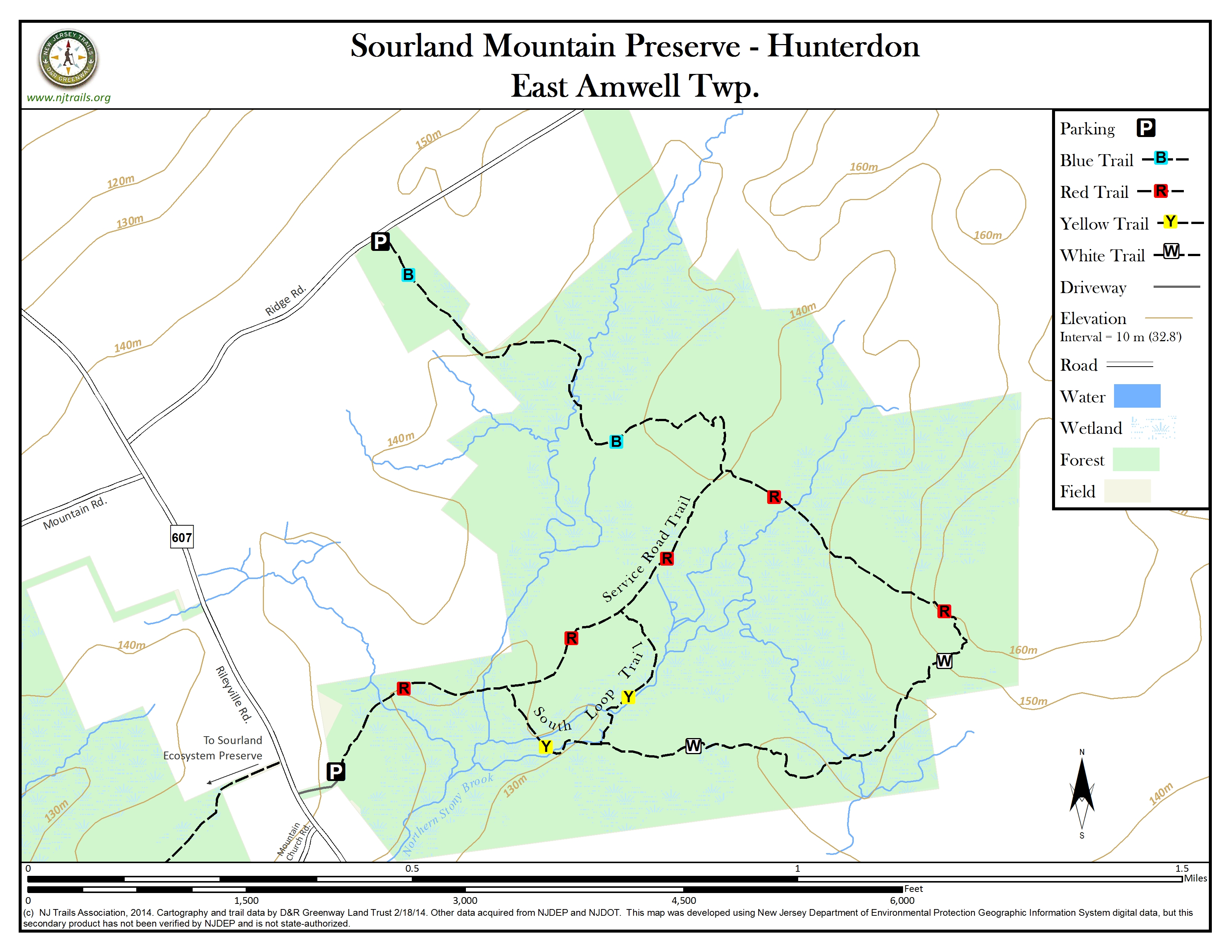
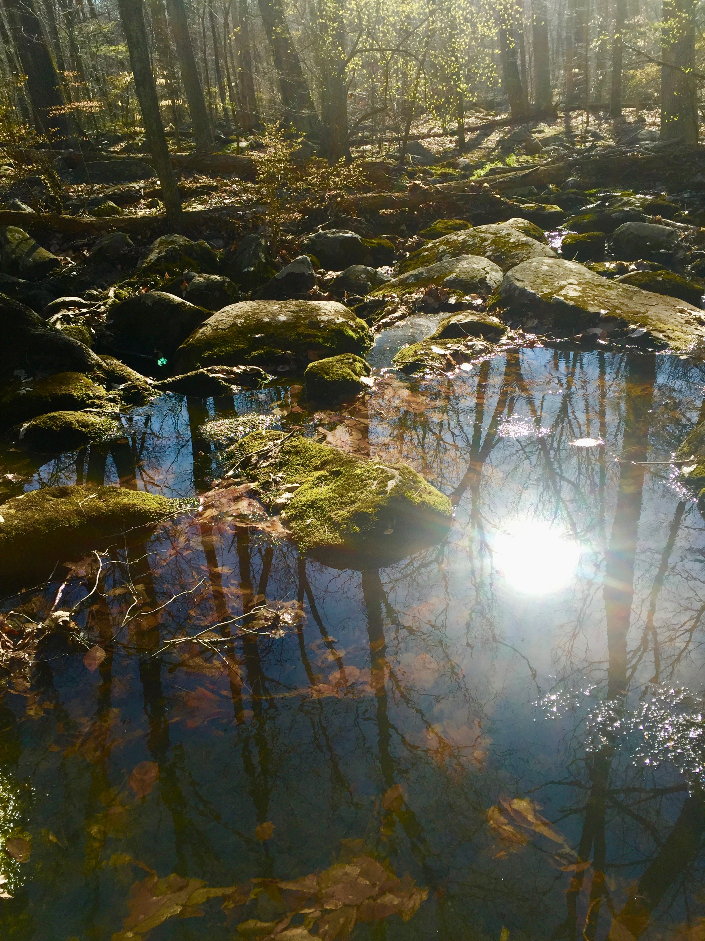
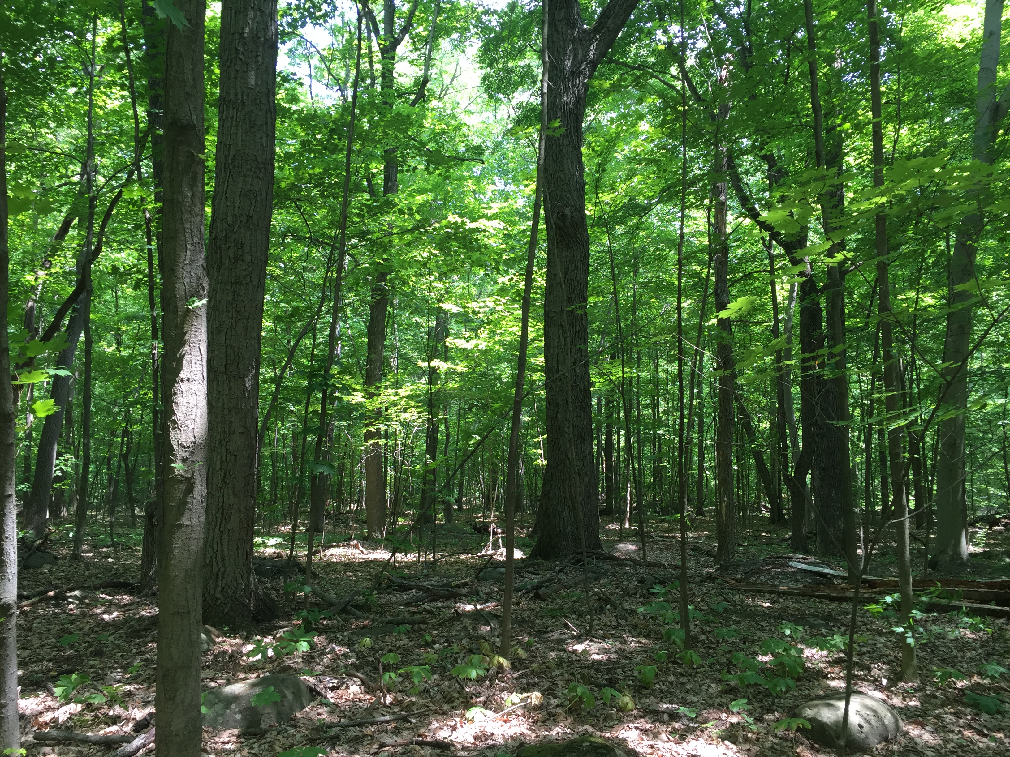
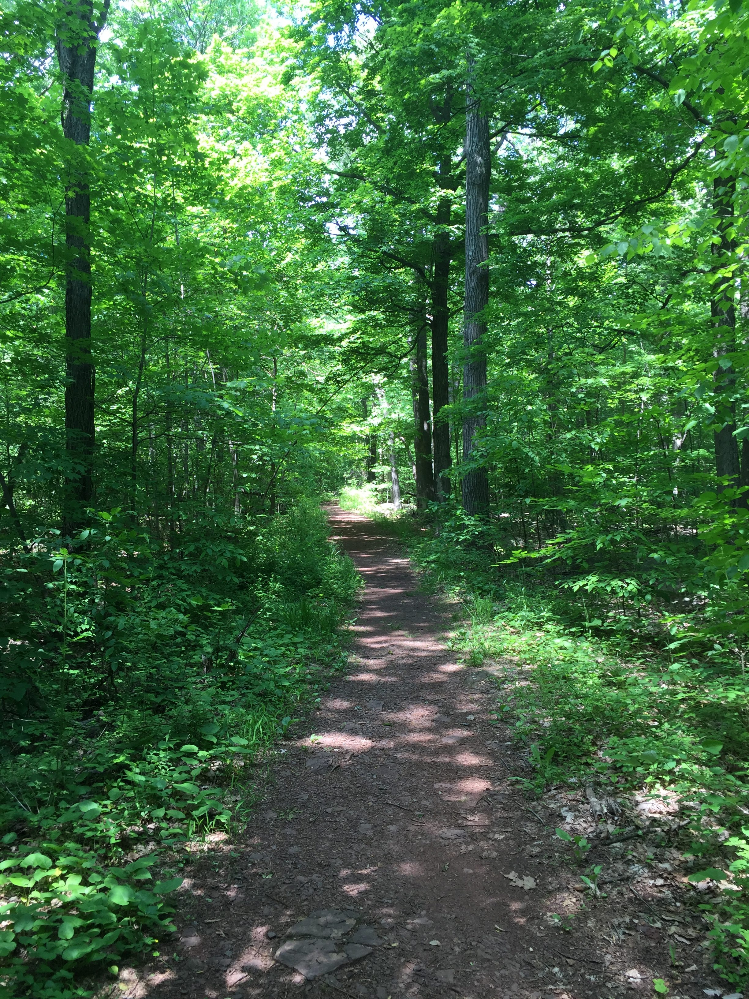
Four trails wind through the environmentally sensitive Sourland Mountain forest and dense boulder fields of diabase rock. Trails parallel and cross many small streams and vernal pools.
-
-
Distance:
Total of 3.53 miles of trails.
Time:
45 minutes to several hours depending on the trails hiked.
Markings:
Yellow, white, and blue diamonds are tacked to trees along these three trails, and these same colors are used as painted blazes. These trails are reached by the unmarked, but easily followed service road trail.
Trail Usage:
Walking, Hiking, Dogs permitted on leash.
Elevation:
Very gradual increase in elevation with a steeper climb at the end of the service road and midway through the blue trail. Overall it is a change of 80 feet.
Difficulty:
Easy-to-moderate – After long periods of rain, trails can be very muddy. Sturdy trail boots are recommended.
Parking:
A small gravel parking lot off the main entrance at Rileyville Rd. can accommodate seven cars. A large sign for Sourland Mountain Preserve is at the entrance to the driveway.
A smaller dirt parking lot off the Blue Trail trailhead at Ridge Rd. can accommodate three cars. This lot is about ½ mile from Rileyville Rd. and is marked by “Public Nature Preserve” signage.
Tips:
Trails are open for use from dawn to dusk. No Parking after sunset. No rock climbing or horseback riding. Deer hunting by permit only in the northern part of the reservation from December to February. During hunting season visitors are asked to wear blaze orange or confine their visits to Sundays when hunting is prohibited.This is a fragile environment which is very sensitive to disturbance. Stay on the trails. Wear water resistant hiking boots during wet periods
Amenities:
None.
Directions:
From Trenton: Take Route 31 North. Turn right onto Route 654 to Hopewell. In Hopewell turn left at the second light onto Greenwood Avenue, which becomes Rileyville Rd. The Preserve is 2.8 miles up on the right. You will pass Hillbilly Hall Restaurant, a local landmark. The Sourland Mountain Preserve is 0.5 miles after that restaurant, on the right. The entrance to the parking lot is by a mailbox for 235 Rileyville Rd.
From the Flemington Area: Take Route 202/31 South from the Flemington Circle for five miles to the jughandle for Wertsville Road. Exit on Wertsville Road (Route 602) and use the traffic light to crossover Route 202/31. Continue on Wertsville Road for about 3.3 miles to Rileyville Rd (Route 607). Turn right onto Rileyville Rd and go about 1.7 miles. The park entrance is on the left and is marked by a Green Acres sign as well as a County Park sign. Two other driveways share the entrance. Continue up the center driveway to the small parking area. Do not block the gated access road.
From Princeton: From Nassau Street, follow Route 206 South to Elm Road. Turn right onto Elm Road. At the first traffic light, turn left onto Rosedale Rd. and follow to the end. Turn right onto Carter Rd. (CR 569). When you pass through the traffic light at Cherry Valley Road, the name will change to Hopewell-Princeton Road. Continue through this traffic light to the end of the road at Broad Street in Hopewell Borough. Turn left onto Broad Street. At the next traffic light turn right onto Greenwood Avenue. Stay on this road for 2.8 miles. You will pass Hillbilly Hall Restaurant, a local landmark. The Sourland Mountain Preserve is 0.5 miles after the restaurant on the right. The entrance to the parking lot is by a mailbox for 235 Rileyville Road.
-
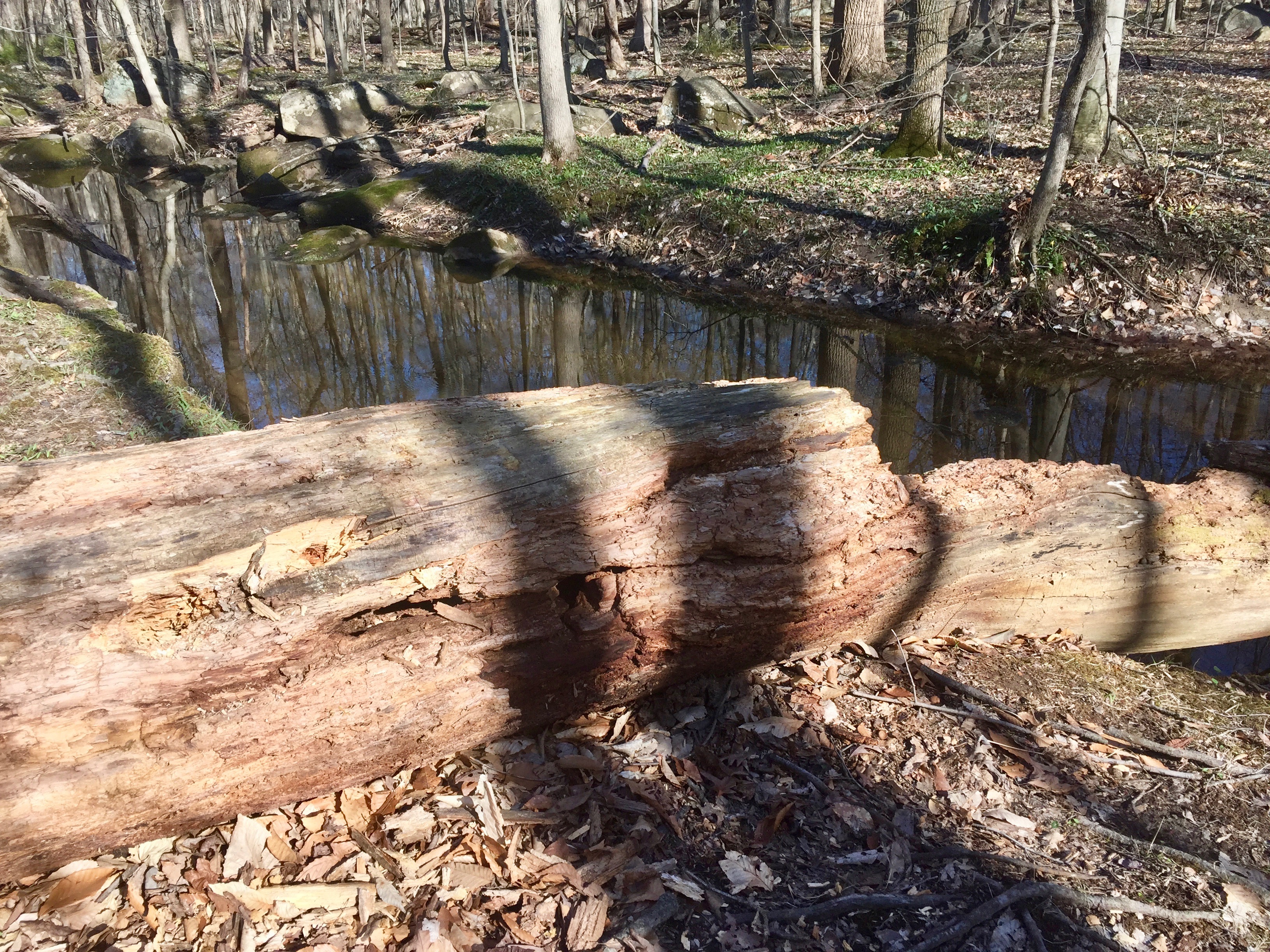
Main Trail: The main service road trail (unmarked) is a wide flat gravel and dirt service road with a short uphill slop at the end. The trail winds through a beautiful deciduous forest, strewn with large boulders. Along this trail is a floodplain with a rich diversity of aquatic life.
Yellow Trail: This trail branches off the Main Trail to the right (south), about a quarter mile from the parking area, and returns to the Main Trail about a quarter-mile further on. It can be very wet and twice crosses a stream where hikers must rock hop. In spring many wildflowers can be found along this trail.
White Trail: This trail connects the end of the Main Trail with the Yellow Trail. It can also be accessed from the midway point of the Yellow Trail and continues onto the end of the Main Trail. It also traverses rocky areas and can be very wet in spring or after rains.
Blue Trail: This trail branches to the left (north) from midway up the Main Trail, and connects to the small parking area on Ridge Rd. This trail climbs up through a large boulder area and then back down, crossing a creek. The crossing may be impassible during the wet spring season. This trail, as it approaches Ridge Road, is on private land on which a trail easement has been granted to D&R Greenway Land Trust. . Please follow and stay on the established trail.
-
The swampy woods and thin soil in this area support red maple, ironwood (horn beam) and tulip poplar. In the better drained areas, one will find hickory, white ash and American beech. White oak and chestnut oak are also found . The younger woods show the competition for light in the tall straight trunks. Small sedge bogs can be found along the trails and skunk cabbage is in evidence by some of the small stream headwaters. The undergrowth includes trillium, ferns, and spicebush.
The Sourland Mountain is one of the most environmentally sensitive, fragile areas in the state. Please stay on the trail as you enjoy the walk.
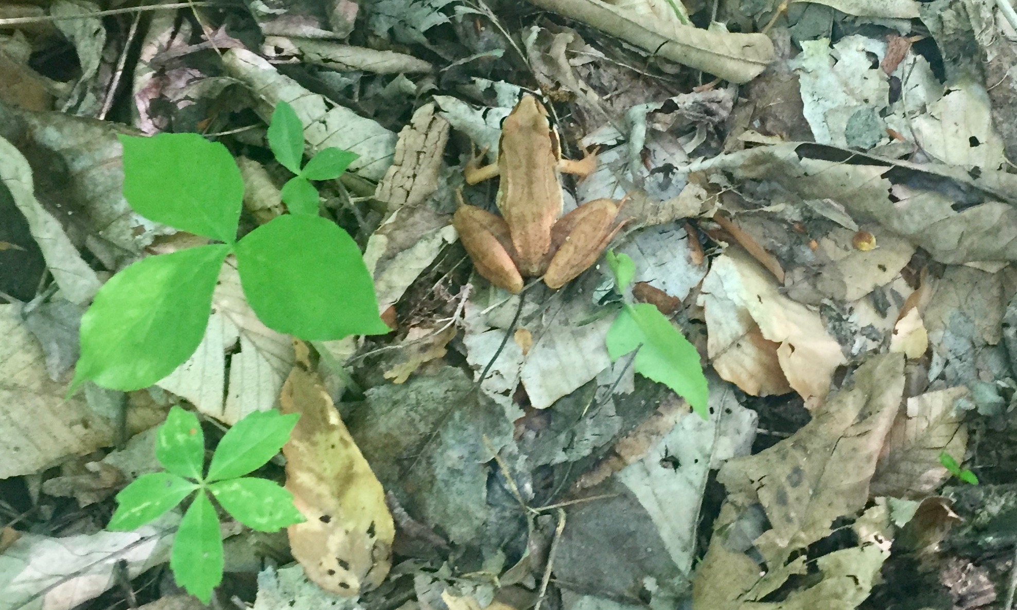
The Preserve’s rocky terrain and low permeability result in numerous vernal pools that are home to an abundance of amphibians including many species of toads, frogs, and salamanders.
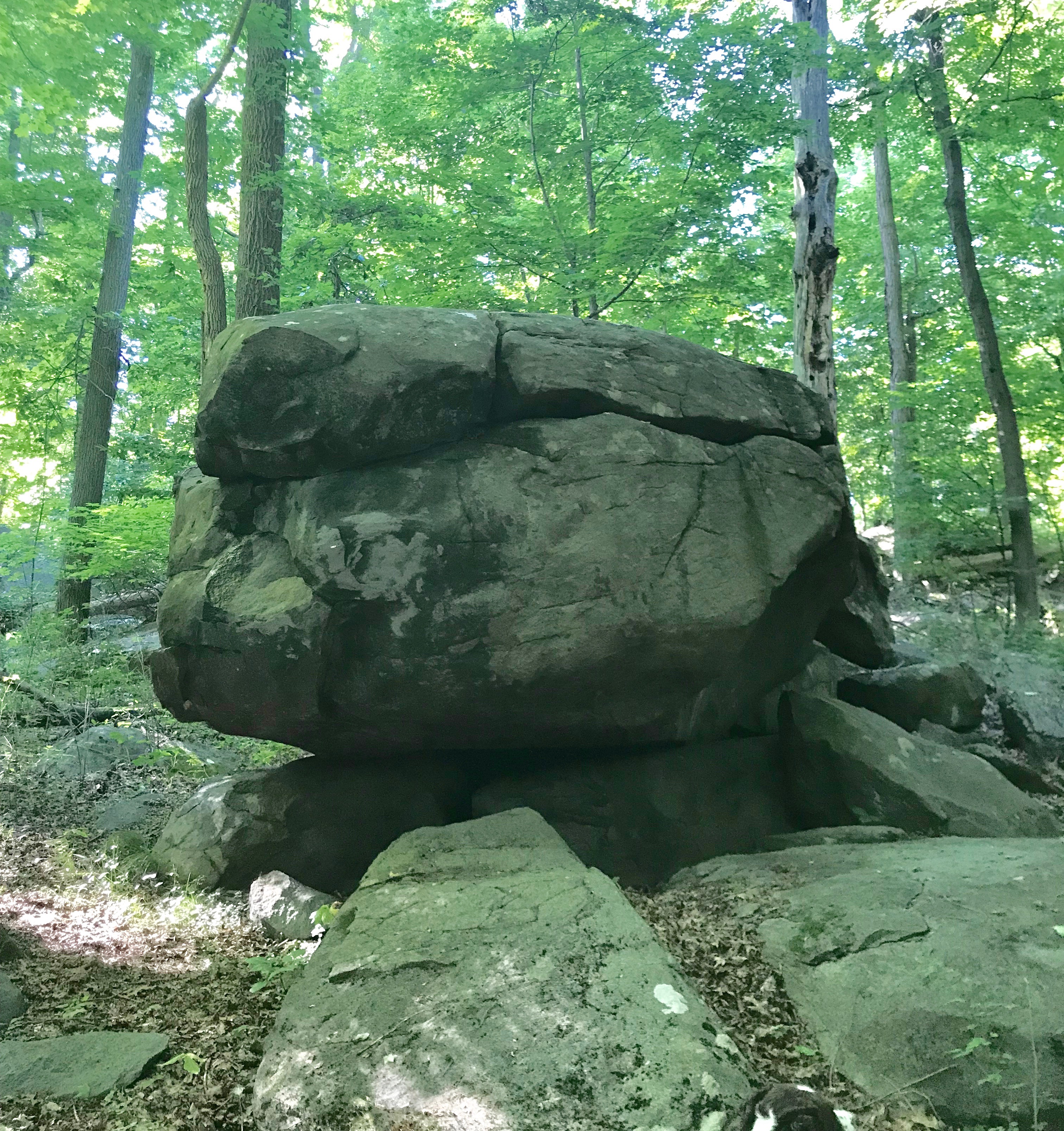
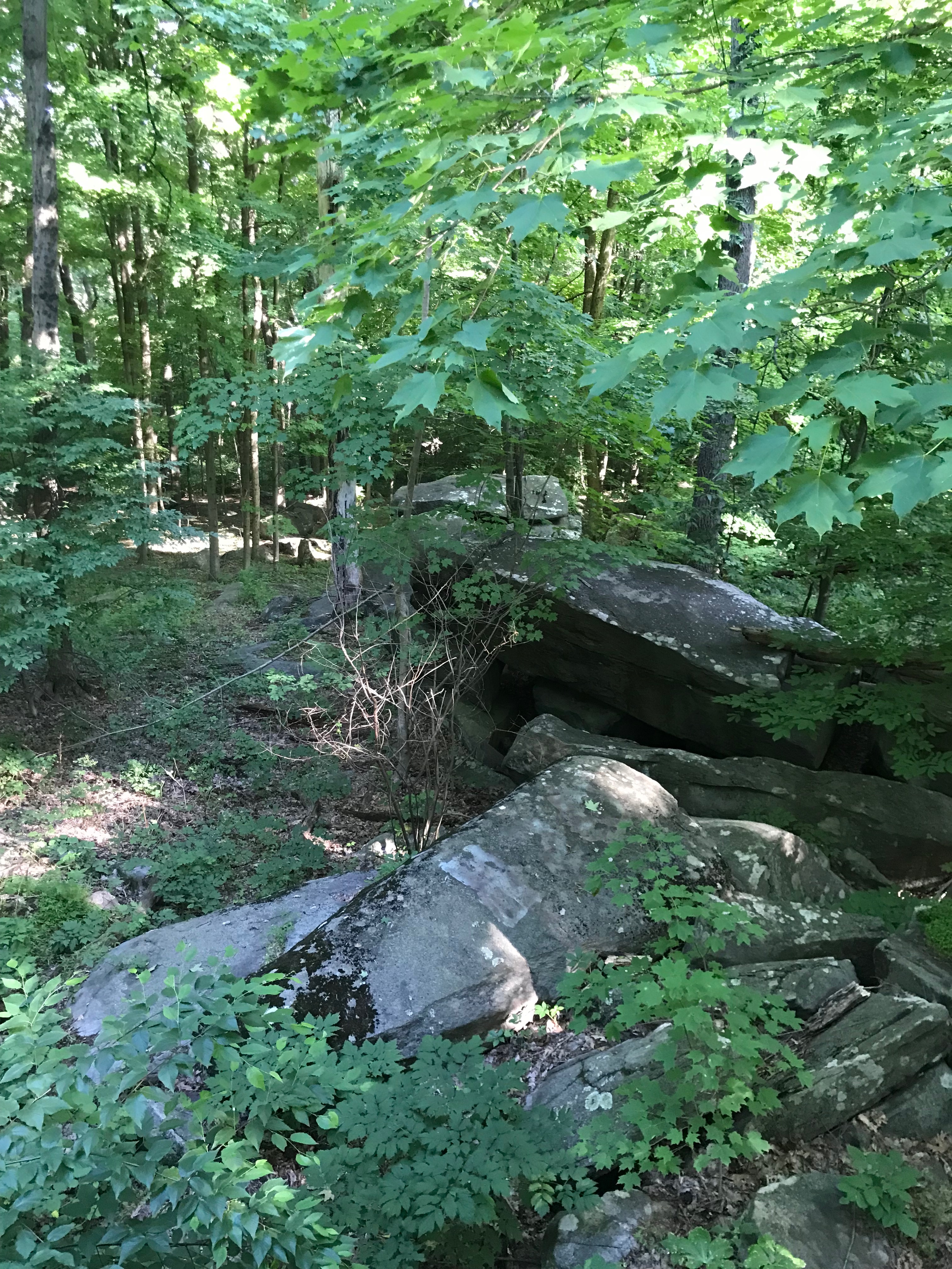
The forest floor is blanketed with boulders large and small. This diabase rock has weathered out of the bedrock of the mountain and exhibits spheroidal weathering giving the rounded shape to many of the boulders.
Do you have information about this trail?
Click Here to contribute.
-
Formed almost 200 million years ago, the rocks of the Sourlands, called diabase “trap rock,” were used to produce railroad ballast, concrete aggregate, and Belgian blocks for roadbeds. Evidence from quarrying can still be found along the fissures of some boulders.
The Sourland Mountains are steeped in mysticism and history. Some say compasses do not work in these hills; others say the mountains are haunted. John Hart, a signer of the Declaration of Independence, hid in these hills during the Revolution. The Charles Lindbergh Estate, the site of the famous baby kidnapping, is near the Preserve.
This Preserve is maintained by the Hunterdon County Parks Department. Area non-profit organizations are also working to preserve contiguous land in the Sourlands.
Do you have information about this trail?
Click Here to contribute.
-
Photos

Videos
