Middlesex
South Brunswick Township
Scotts Corner Conservation Area
South Brunswick Township, NJ 08512


Last Updated: 05/14/2022
Overview of Selected Trail
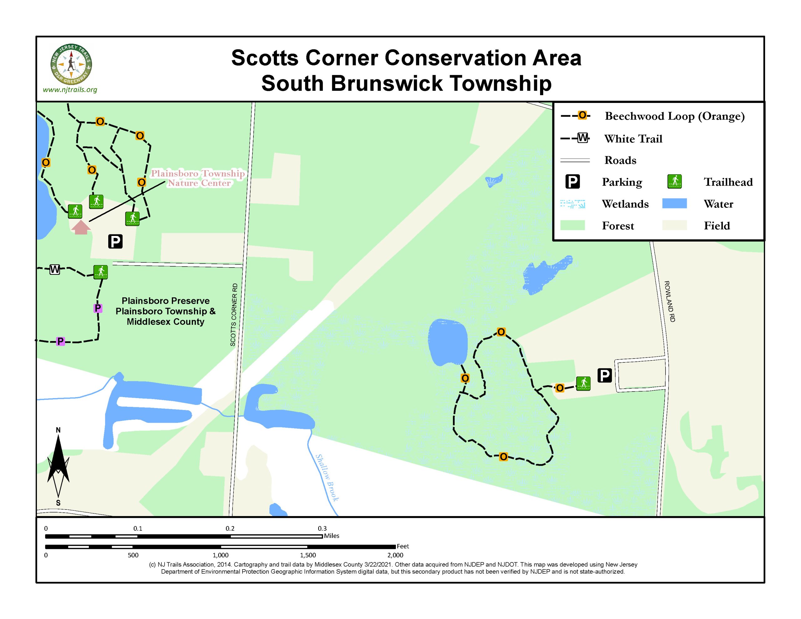
The Scotts Corner Conservation Area is a small portion of a larger tract of preserved land in South Brunswick and Plainsboro Township. Currently there is a 1/2-mile loop trail for hikers to enjoy and in the future, hiking trails will link to the adjacent Plainsboro Preserve. It is owned and maintained by the Middlesex County Office of Parks and Recreation.
-
-
Distance:
A half-mile loop.
Time:
Twenty minutes at a leisurely pace.
Markings:
Trail is marked with orange blazes.
Trail Usage:
Hiking and dogs lon leash.
Elevation:
A very flat hike, with one elevated section with wooden staircase.
Difficulty:
Easy
Parking:
Gravel parking area on Rowland Road.
Tips:
Note: This Park is secluded, the chances of seeing other hikers is low.
The trails are open from sunrise to sunset. All dogs must be on leashes. Please feel free to pick up any litter you find.
Trail is not suitable for bicycles or horses.
Trails are mostly dry after a day of rain. Some areas would be undesirable to walk during rain, because of slippery rocks and bog-walks.
For assistance, call Park Ranger Unit at 732-745-3800.
Amenities:
Kiosk is located at the trailhead. Maps are available in the map box at the kiosk.
Restrooms are available across Rowland Road at Rowland Park. More information on hours for Rowland Park is available from the Township of South Brunswick.
Directions:
From New Brunswick:
Take the exit for Rt. 130 South off Rt.1. Follow to Friendship Rd and turn right. At the end of Friendship Road turn left onto Broadway Road and take the first right onto Rowland Road. Parking area is ¼ mile down on the right.
From New Jersey Turnpike:
Take Exit 8A. Follow signs for Rt. 32 West. Continue across Rt. 130 onto Friendship Road. At the end of Friendship Road turn left onto Broadway Road and take the first right onto Rowland Road. Parking area is ¼ mile down on the right.
-
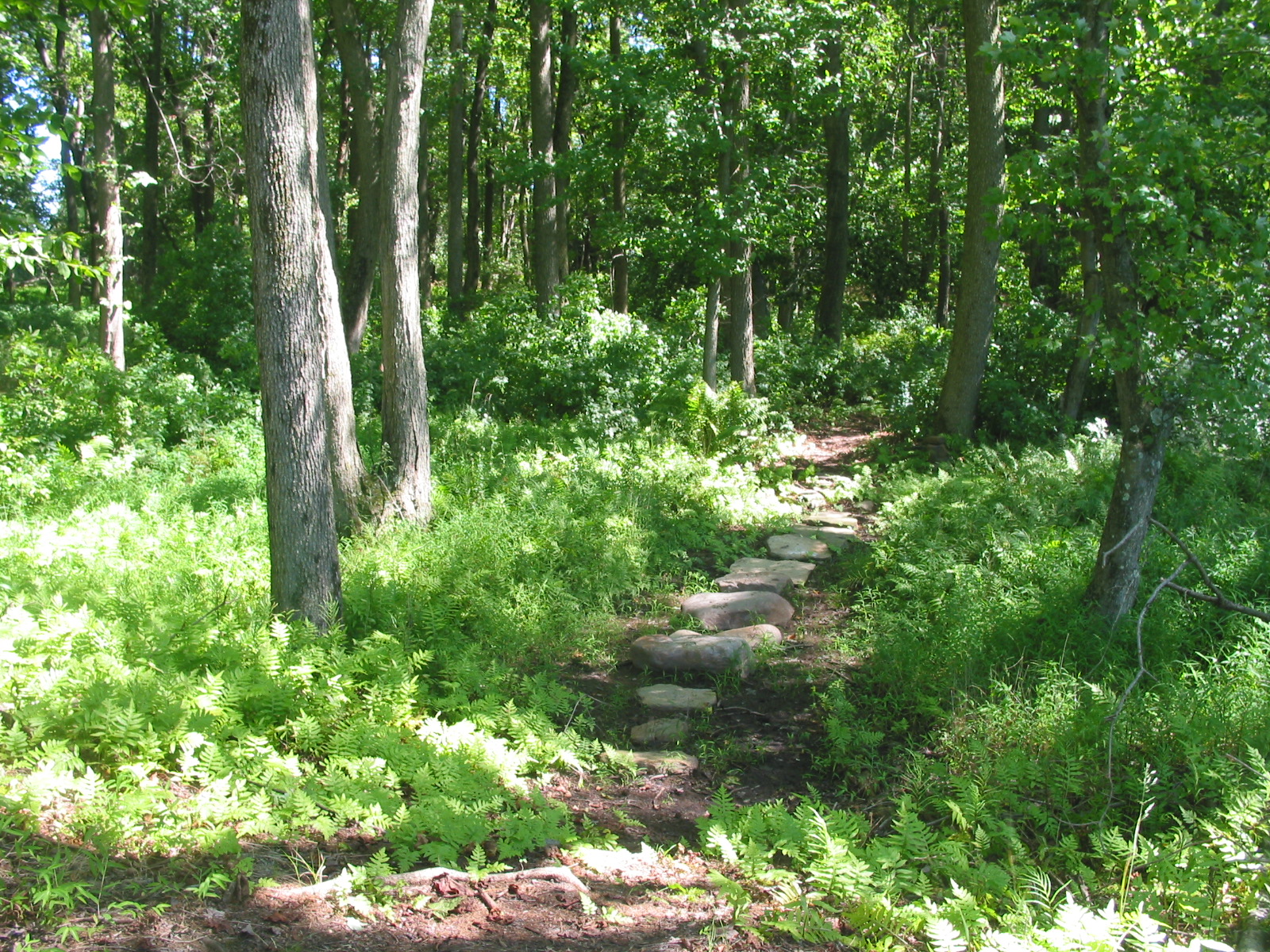
All trails are at least 4 feet wide with an 8-foot clearance and marked with blazes.
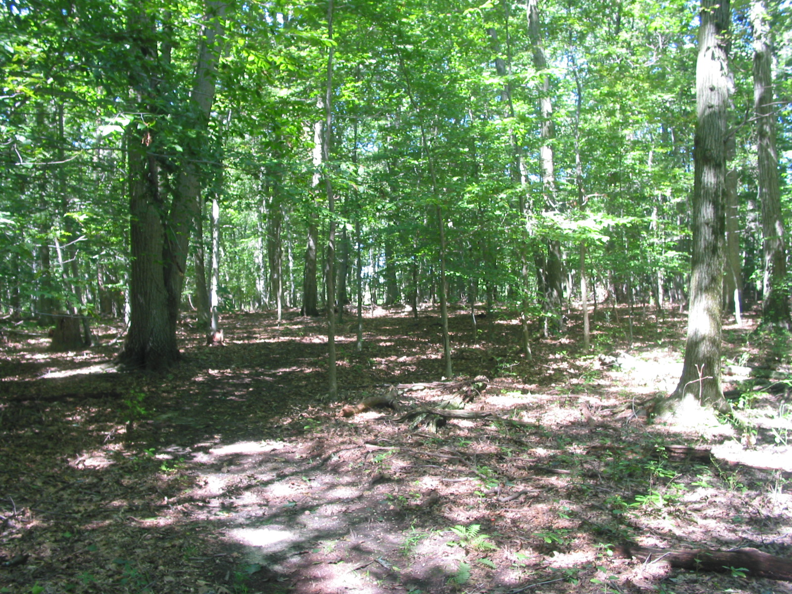
Beechwood Loop (Orange): The trail begins from the far end of the parking area between the split-rail fence. Passing the kiosk on your left, the trail quickly arrives at a “T”. Turning right, the trail meanders through the forest across several bog walks and some stepping stones. At 0.2 miles, the trail ascends a set of stairs to the top of an embankment with a look-out over a small pond. Continue carefully across this embankment and cross a seasonally wet area on elevated bog walks. At 0.22 miles, trail to the right leads to a small bird blind looking out over the pond and wetland. Turning left, the trail continues through the forest and returns to the “T” at 0.45 miles. Turn right back to the parking area.
-
Here you will find more than 150 acres of wet meadows, shrublands, and forest dominated by beech and maple trees. These habitats offer outstanding protection for a diversity of wildlife, including songbirds, small mammals, and a wealth of insects. Approach the pond quietly to observe waterfowl such as wood ducks and migrating or great blue herons hunting for a meal. In spring, look for migrating songbirds in the forest, watch for spring ephemerals like spring beauty and trout lily on the forest floor and listen for calling amphibians in the wetlands. Late summer and early autumn provide wonderful color as ferns and trees turn a golden hue.
Do you have information about this trail?
Click Here to contribute.
-
Preservation in this area began in 2001 when the County acquired 80 acres of property on the corner of Rowland and Broadway Roads, which would eventually become Rowland Park. In 2003 Middlesex County started acquiring the former farmland in this area from the Boyko Family. Over the next 10 years, the County would continue to acquire additional lots from the family with the final acquisition of 35 acres of property along Friendship Road that had been the proposed pathway for (the now defunct) NJ Route 92. NJ Route 92 was a proposed extension of the New Jersey Turnpike that would have connected Exit 8A with Route 27 in the center of Historic Kingston, cutting across pristine woodlands and bucolic farmland landscapes. The Scotts Corner Conservation is adjacent to the Plainsboro Preserve, connecting to an additional 1000 acres of preserved open space.
Do you have information about this trail?
Click Here to contribute.
-
Photos
Videos
