Hunterdon
West Amwell Township
Pryde’s Point-Alexauken Creek
West Amwell Township, NJ 08530


Last Updated: 04/29/2021
Overview of Selected Trail
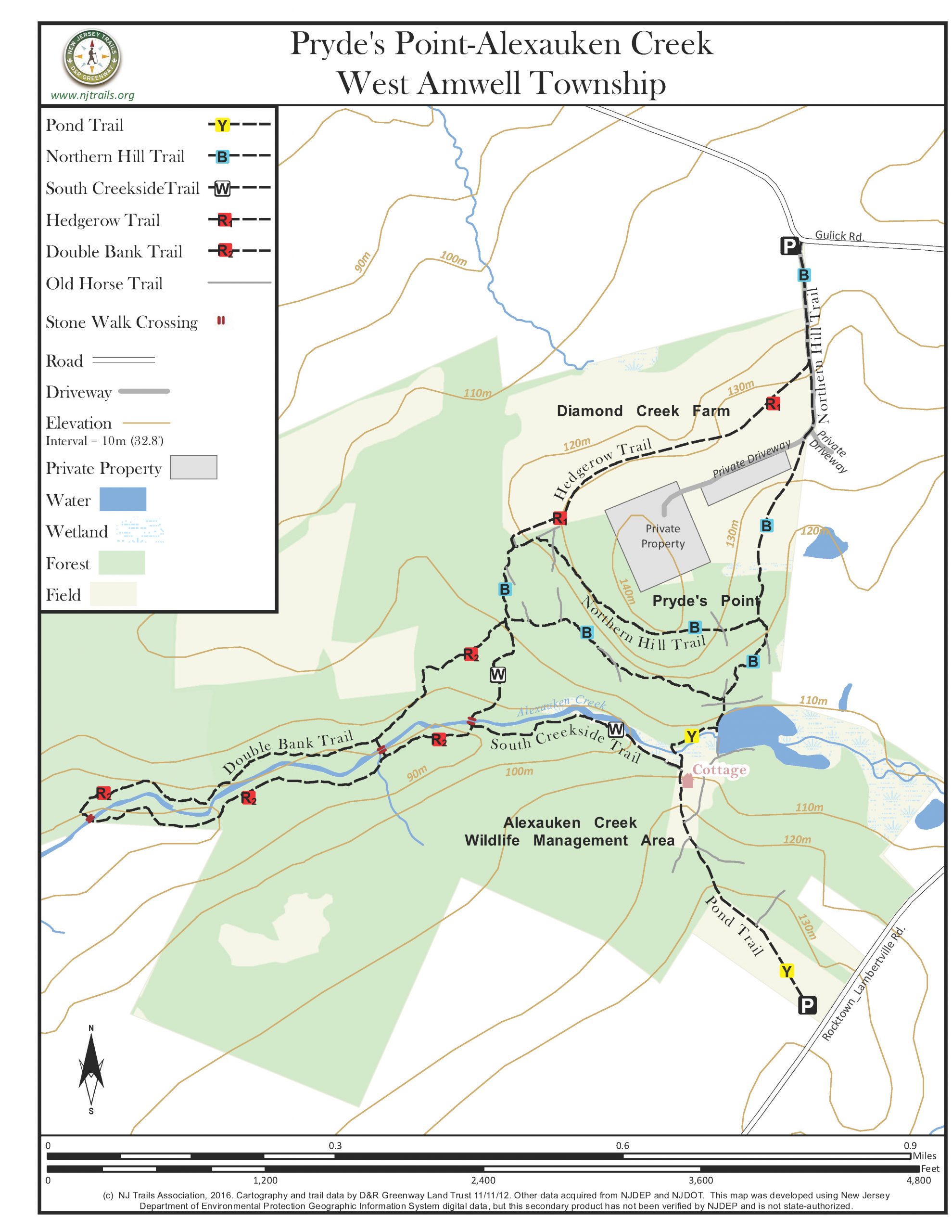
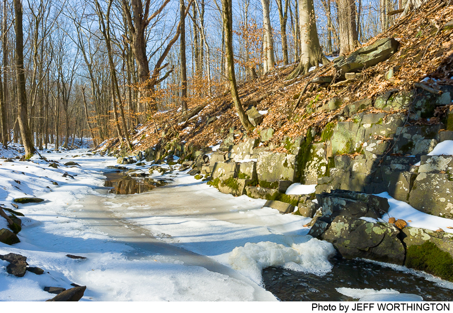
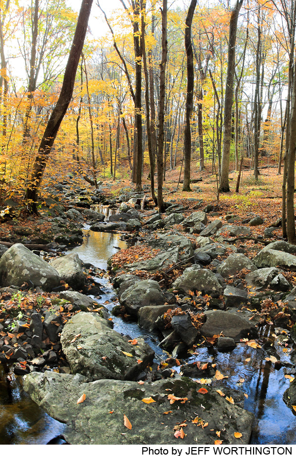
This large expanse of forest on both sides of the Alexauken Creek includes “Pryde’s Point”—private land with trails open to the public—and the State of New Jersey’s Alexauken Creek Wildlife Management area. The combined preserve can be entered from the north off Gulick Road, and from the south off Rocktown-Lambertville Road. A network of trails on the north side provides several routes down to the Alexauken Creek, and one trail from the south descends to the creek as well. From both directions, walkers can go several miles down along the creek, returning on the other side—with the sound of small falls over rock ledges to entertain them along the way. Stepping stone crossings at several places allow walkers to construct loop hikes of varying length.
-

-
Distance:
The overall network has about 3.4 miles of trail. A walk from Rocktown-Lambertville Road down to and across the creek, then as far as possible downstream and back up to the starting point would be a walk of about 1.8 miles.
Time:
About 1.5 – 2.5 hours for a long, leisurely walk.
Markings:
Trails are marked with plastic blazes of different designs in four colors:Red for the Hedgerow Trail providing access to the preserve from the driveway off Gulick Road in the north.
- Red for the Hedgerow Trail providing access to the preserve from the driveway off Gulick Road in the north
- Orange for the Pond Trail leading from the parking lot on Rocktown-Lambertville Road down past the old cottage, across the creek, and upstream to the pond dam and the intersection with the Northern Hill Trail
- Blue for the Northern Hill Trail, which forms a loop on two levels of the hillside, with a spur leading out to the north to Gulick Road
- Red for the Double Bank Trail, which takes off from the Northern Hill (blue) and South Creekside Trails (white) and forms a long loop downstream
Trail Usage:
Walking/Hiking, Dogs permitted on leash. No bikes, motorized vehicles, or horses are allowed.
Elevation:
Gentle ups and downs. The top of the dirt lane coming in from Gulick Road is at 445 feet, and the creek near the pond is at about 337 feet. Walking these trails involves short modestly steep stretches, but overall the grades are gentle.
Difficulty:
Moderate grades. The creek crossings are on large flat stones, so you have to be comfortable on such footing.
Parking:
The most ample parking is the large lot of the Alexauken Creek Wildlife Management Area on Rocktown-Lambertville Road about a mile west of Route 31.
Just off Gulick Road is a crushed stone parking area for about six cars.
Tips:
After very heavy rains the stepping stones across Alexauken Creek may be submerged for a short time until the spate subsides. Do not attempt to cross the creek if you do not see a clear line of stepping stones. On the south side of Alexauken Creek is an old dilapidated cottage (to be demolished some day when state resources are available). Do NOT approach or attempt to enter the cottage. It is historic, but in precarious shape.
During hunting seasons (between the bow, small-game, and deer shotgun seasons, extending from November through at least February), hunters will be active on this property on some days. You may see a “hunting in progress” sign on the kiosk map just off Gulick Road. When that sign is posted, the public is advised not to use the trails. Throughout the hunting seasons walkers are advised to wear orange or another bright color while in the woods, because some hunters may enter the property from the state Wildlife Management Area.
Hunters have reported that several bears inhabit the woods north of the Alexauken Creek in this area. Chances of encountering one are very slim, but if you do, remember: All hikers should stand together with their hands raised to make a “big presence.” Back away slowly, avoiding eye contact with the bear. Do not turn and run.
Amenities:
None.
Directions:
To the parking area off Rocktown-Lambertville Road: From the intersection of Route 518 and Route 31, go north on Route 31 for 2.5 miles, and make a diagonal left turn on Rocktown Hill Road. At .2 miles at a small intersection turn left (west) onto Rocktown-Lambertville Road. Continue .9 miles to the parking lot entrance on your right.
To the parking off Gulick Road: From the intersection of Route 518 and Route 31, go north on Route 31 for 2.5 miles, and make a diagonal left turn on Rocktown Hill Road. At .2 miles go straight through a small intersection in the tiny hamlet of Rocktown, and at .4 miles make a left on Gulick Road. Go west on Gulick Road .4 mile and turn left into a driveway where a mailbox is marked “23.” The parking area is immediately on the right.
-
Northern Hill Trail – Blue: From the Gulick Road parking, walk up the dirt driveway, which gives you two ways of entering the trail network. About a third of the way up the driveway, the red Hedgerow Trail (developed by Hunterdon Land Trust) heads to the right (see below). The second option is to continue along the blue markers straight up to the top of the driveway, and turning sharp right at the top of the hill. Immediately after turning right, this trail route, marked in blue, leaves the driveway heading down to the left on a mowed path across a meadow, marked by a few posts—but it is possible that lapses in mowing may leave this route unclear. If you walk down towards the woods, however, you should spot a blue marker on a tree where the trail enters the woods. (Note: The driveway and meadow are private property, and the entire loop trail follows an easement on private property; stay on the marked trails and respect the privacy of those who live nearby.)
The trail enters the woods and comes shortly to an intersection where the trail is marked blue both to the right and ahead. The Northern Hill Trail loop begins here and can be taken in either direction. If you go to the right the trail climbs gradually through woods, with early views back to the old pond below. At the far northwestern end of the loop, the red Hedgerow Trail joins from the right, coming from the open field, and the blue-marked trail turns south, soon meeting the red Double Bank and the white South Creekside Trails at a stony intersection. The Northern Hill Trail turns back southeast and descends into the creek valley before turning northeast and returning to the intersection where the loop began. From there you retrace your steps up across the meadow and down the driveway.
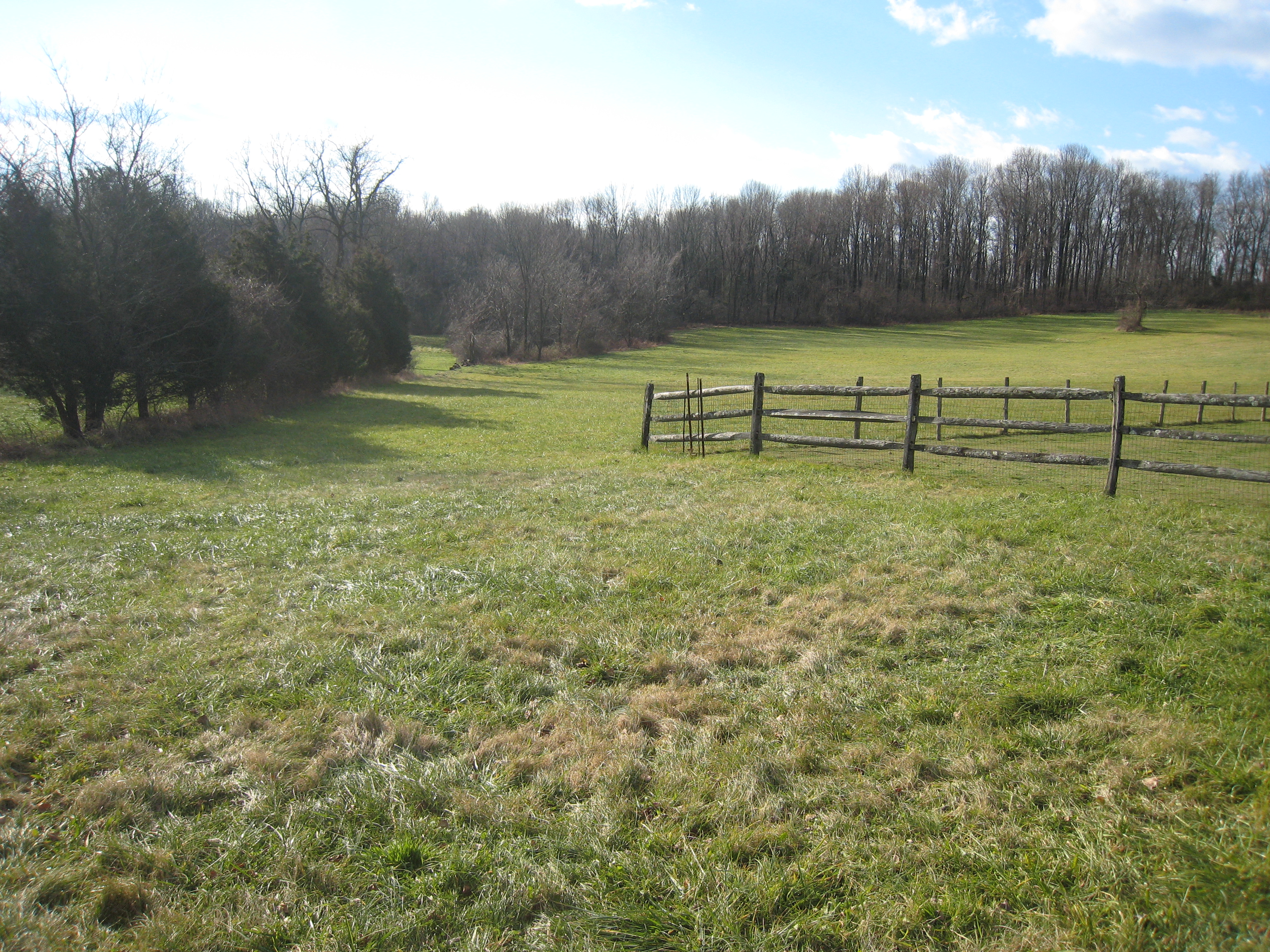
Hedgerow Trail – Red: Taking off from the dirt lane coming up from Gulick Road, this route follows the grassy boundary between two fields, and then drops down to the right side of a hedgerow of trees. At the end of the hedgerow the route bends down along the edge of the field to its lower corner, where a 40-foot path into the woods links it to the blue-marked northern Hill Trail.
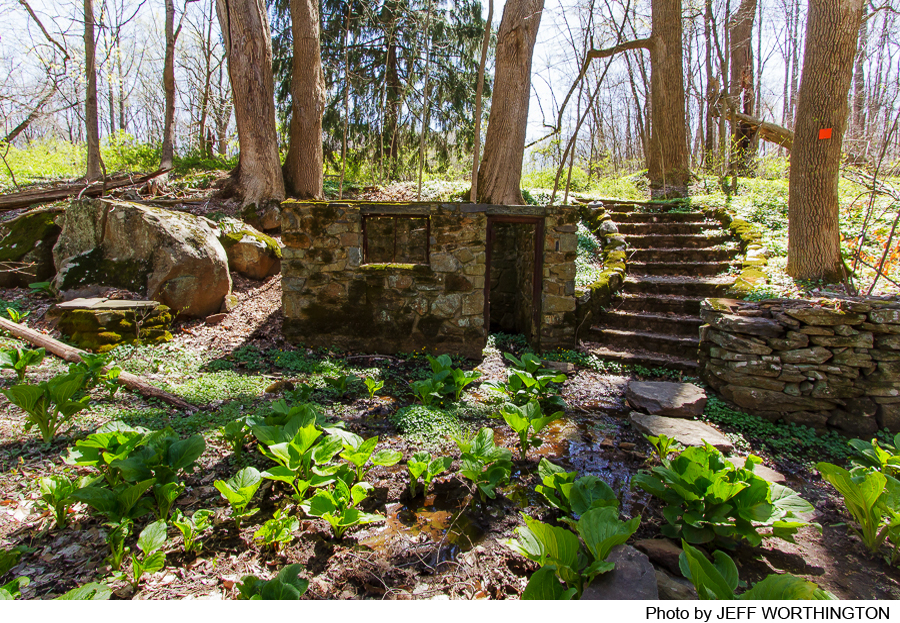
Pond Trail – Orange: This trail leaves the parking lot on Rocktown-Lambertville Road, first following a mowed path across the field, then a rocky lane through the woods downhill. It passes a derelict old Revolutionary era house (do not try to enter!). The white-blazed South Creekside Trail heads off to the left, and the Pond Trail goes straight, descending an historic stone stairway and passing the foundation and walls of an old spring house. It curves through some trees and crosses the creek bed on stepping stones, climbs some stone steps to the northern bank, and heads north to the pond and its crumbling dam. The trail turns left, reaches to northern bank of the pond, and continues just 50 yards or so to its intersection with the blue-marked Northern Hill Trail. That trail can be taken either left or right, and walkers can use it for a loop in either direction. Note: Cross an unmarked old horse trail near the pond before reaching the Northern Hill Trail, and look carefully for its blazes.
Note: Walkers using the Pond Trail to return to the parking lot on Rocktown-Lambertville Road should stay alert. As they climb up from the creek, a first branch of the trail appears to head slightly right (almost straight); do not take it. Continue another 20 yards to where another branch heads up through the woods to the right (almost straight). An orange marker is placed on a somewhat distant tree, but there are no trees right by the trail.
South Creekside Trail – White: At the westernmost point of the Northern Hill Trail, a trail marked in white descends a few steps and turns sharp left towards the Alexauken Creek. Stone steps on both sides, and large stone slabs, provide a convenient crossing–and a beautiful spot for a picnic or just contemplation. On the south side of the creek, the white trail goes back upstream, offering beautiful views down to the creek, and joins the Pond Trail just above the old stone stairway.
Double Bank Trail – Red: Starting where the Northern Hill and South Creekside Trails meet, this trail heads west through woods and across occasional dry drainages, reaching the high northern bank of the Alexauken Creek and soon thereafter a set of stone steps descending to the creek and a crossing. Walkers can use this “red link” to shorten their loop walk; heading back upstream on the south bank. Alternatively, they can continue downstream, sometimes right by the stream, at other climbing high above it, until another set of stones steps and stepping stones at the trail’s most westerly point take them across to the south bank. From there they can head back up stream, joining the white South Creekside Trail and continuing on to the cottage on the Pond Trail.
-
A thorough survey of the Alexauken Creek Wildlife Management Area completed in 2003 by the Washington Crossing Audubon Society documented the rich life in the creek valley. Over 100 species of birds were identified, including great blue and green herons, wood duck, sharp-shinned and Cooper’s hawks, American kestrel, great horned owl, pileated woodpecker, and belted kingfisher. Five different frog and six salamander species were found, and five different turtles. Several snake species were identified, and walkers may see, particularly around the dam, the non-venomous Northern black racer–which can be up to six feet long. Beavers enjoy the pond, and foxes, raccoons, and rabbits inhabit the area, and tracks suggested that coyotes prowl as well. Hunters note that several bears inhabit the woods in this area.
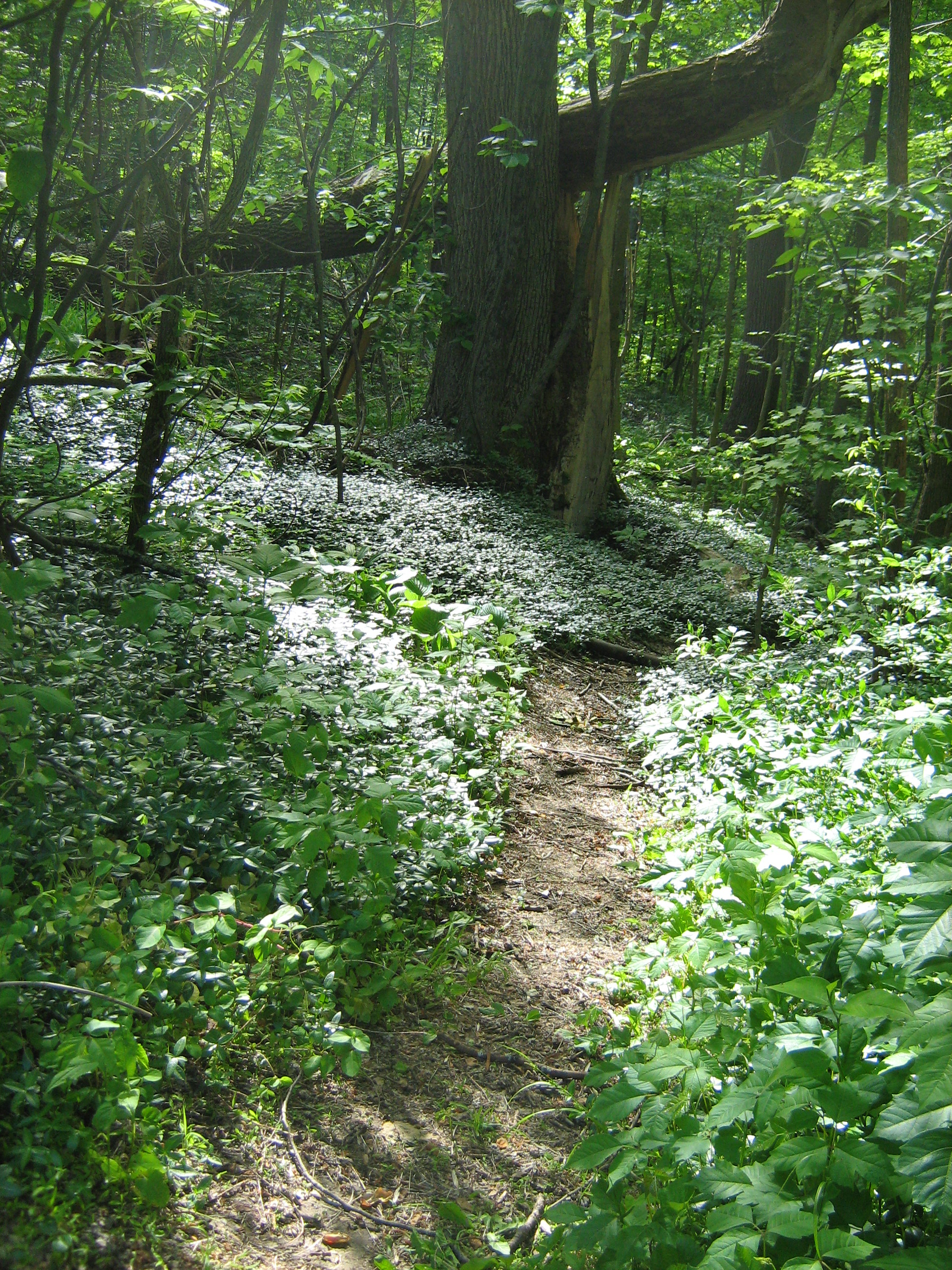
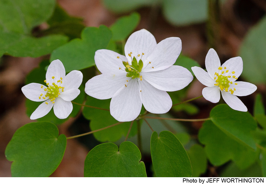
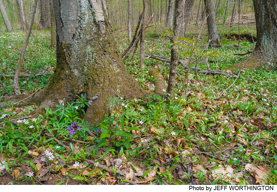
The forest is rich and varied. The 2003 survey found three species of birch, American hornbeam, beech, four different oaks, hickory black walnut, sycamore, and other trees. Ferns abound in the low areas along the creek, including Christmas fern, sensitive fern, and others. Trout lilies, yarrow, New England and other asters, spring beauties, and many other wildflowers lend their color to the woods in their season.
Do you have information about this trail?
Click Here to contribute.
-
The Alexauken Creek valley supported some of West Amwell’s early industries. Traces of old dams and mill races are still to be seen at spots along the creek, including a sawmill and flax seed mill. The valley was a refuge for Continental Army troops during the Revolution. Rocktown, just to the east of the preserve, is frequently mentioned in early Amwell history, first as the probable site of an Indian village and later as having a store, a tavern, and in 1847 its first post office.
Do you have information about this trail?
Click Here to contribute.
-
Photos

Videos