Mercer
Pennington
Pennington Loop Nature Trail
Pennington, NJ 08534


Last Updated: 03/04/2014
Overview of Selected Trail
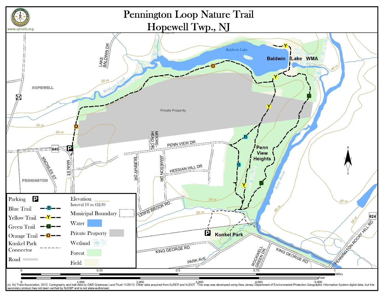
This trail arcs around the northeastern edge of Pennington Borough. This is not a loop trail, but walkers can connect the two ends of the trail route into a loop by walking the pleasant residential streets of the Borough of Pennington. The trail traverses a property owned by the D&R Greenway, a property covered by a conservation easement held by the Greenway, and a property owned by the State’s Division of Fish and Wildlife.
-
-
Distance:
1.5 miles
Time:
40 minutes
Markings:
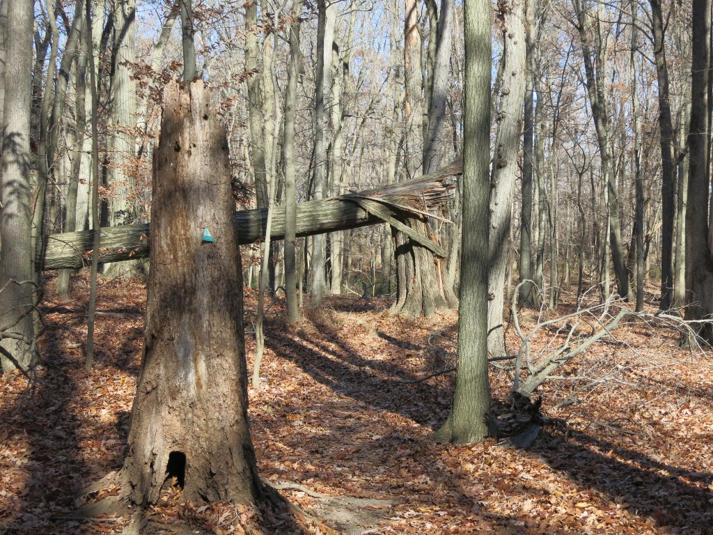
D&R Greenway green, yellow and blue triangular trail markings on trees.
Trail Usage:
Kunkel Park, which is next to the southeastern end of this trail, has a picnic area with tables and children’s play equipment.
Elevation:
Minimal
Difficulty:
Easy, although the floodplain portion may be wet, and after floods portions of the trail may be strewn with flood-borne debris.
Parking:
The southeastern end of this trail is accessed from Pennington Borough’s Kunkle Park, which has parking for a dozen or more cars. The northwestern end of the trail is accessed from North Main Street, where a couple of cars can pull off the road at the gap in the guardrail just east of the railroad overpass.
Tips:
Dogs permitted on leash. Please clean up after your dog.
This trail can be very wet in sections; users are advised to wear boots except during dry conditions.
Amenities:
Directions:
From Flemington:
Take Route 202/31 South, continuing on Route 31 when it splits from Route 202. Turn left at the traffic signal at North Main Street. Turn left onto East Franklin and then right onto Eglantine Avenue. Turn Left onto King George Avenue and proceed less than a mile to KunklePark on the left. After parking at KunklePark, walk down the hill to the Lewis Brook and look for the kiosk announcing the trailhead on the opposite bank of Lewis Brook.
From Princeton:
Take Rosedale Road to the traffic signal at the intersection with Carter Road. Turn right onto Carter and take it to Elm Ridge Road which is to the left. Proceed on Elm Ridge to its end and the Pennington/Rocky Hill Road. Turn left onto the Pennington/Rocky Hill Road and take it to the intersection with King George Road. Turn right onto King George Road, continue to bear right and look for KunklePark on the right. After parking in KunklePark walk down the hill to the Lewis Brook and look for the kiosk announcing the trailhead on the opposite bank of Lewis Brook.
-
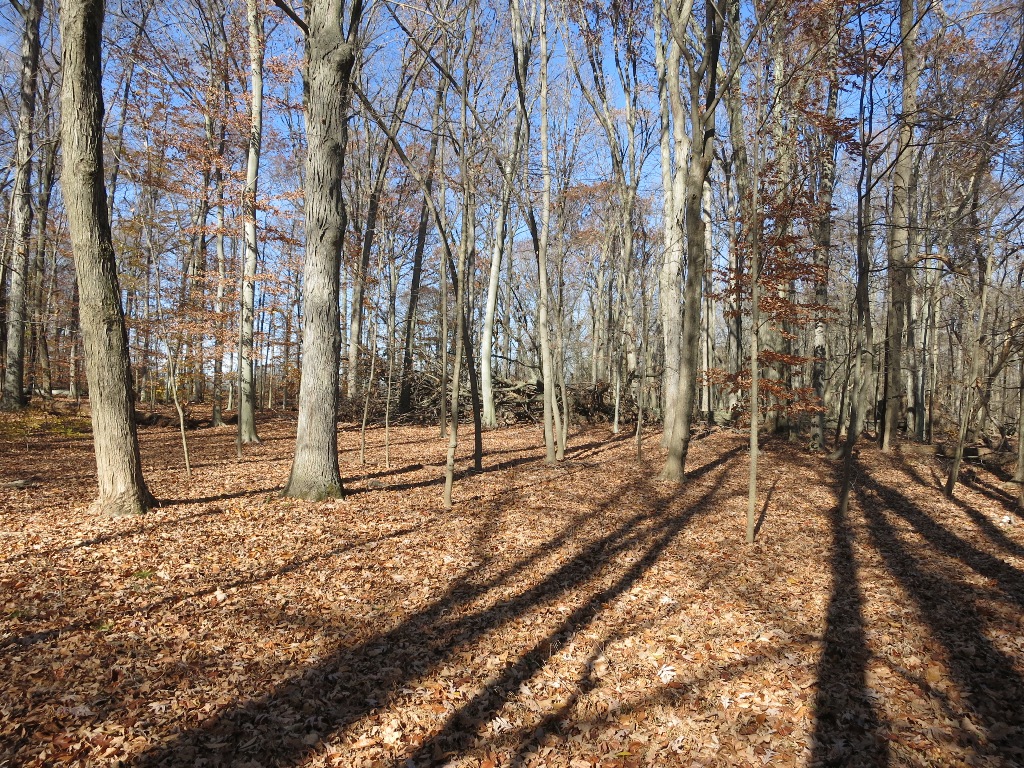
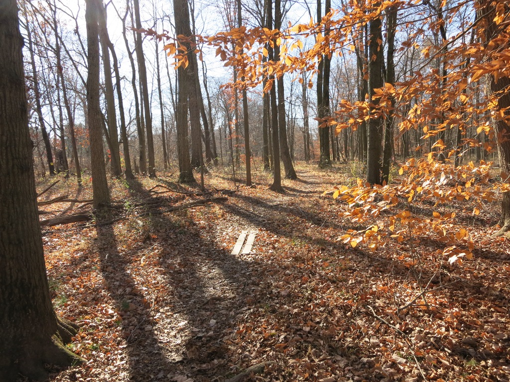
The main trail traverses a mature hardwood forest in the floodplain of the Stony Brook and the southern shore of BaldwinLake. A portion is along the edge of an agricultural field. Branch trails connect the trail to a residential development.
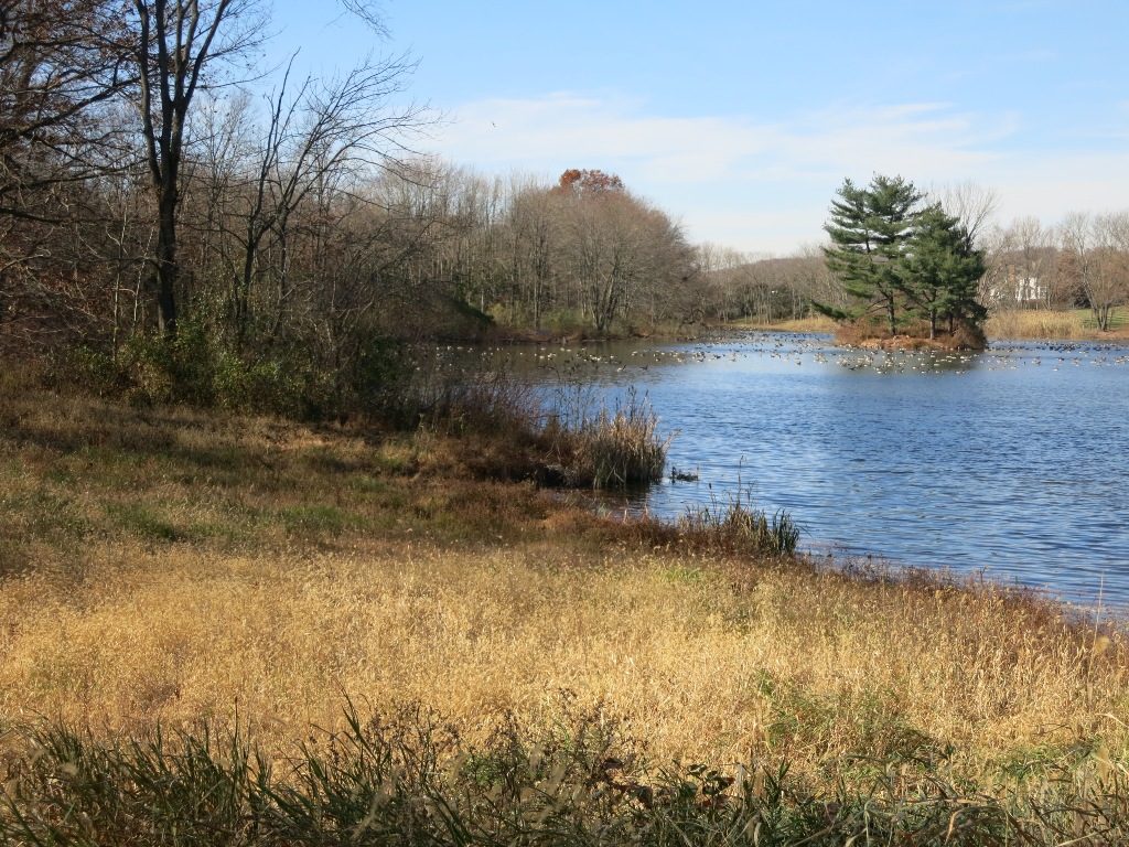
The lands through which this trail passes are valuable wildlife habitat. Great Blue herons and Wood ducks can be seen in the Stony Brook. Neotropical song birds use it to nest in spring or as a stopping place on their spring and fall migrations.
There are some remarkably large trees, particularly Pin oaks, here and there is a string of vernal pools along the base of an embankment that are valuable for frog and salamander life.
The main trail, which is marked with green triangular trail signs on the D&R Greenway property, begins near the intersection of the Lewis Brook with the Stony Brook. Access to the trailhead is by walking across the Lewis Brook but it is so shallow that it is not difficult, and a bridge made of two timbers can also be used. This trail follows the Stony Brook and then skirts the southern shore of BaldwinLake, an impoundment created for flood control in the Stony Brook system. Finally, it traverses the edge of an agricultural field and ends at the point where North Main Street turns sharply and crosses a bridge over railroad tracks. The section along BaldwinLake and out to North Main Street is actually a maintenance road, used by Fish and Wildlife personnel to patrol and maintain this property. Walkers here have almost constant views of the lake with its ever-present Canada geese and usually several pairs of swans.
The floodplain section of trail is often wet, but there is a branch trail—marked by yellow triangular D&R Greenway trail signs—that parallels the main trail but is higher and drier. There is also a branch of this trail—marked by blue triangular D&R Greenway trail signs—that connects to Penn View Heights Drive. This last trail segment gives access to the preserve directly from Pennington neighborhood streets, and can be used to create variants of the walk described here.
-
The lower section of this preserve is a floodplain forest of large deciduous trees, including Pin, Red and White oaks, Sycamore, Shagbark and Bitternut hickories, Tulip trees and Red maples. This property has a lengthy section of frontage along the Stony Brook. It is part of the Stony Brook Greenway that will connect Mercer County Northwest with the Stony Brook-Millstone Watershed Association and beyond.
There are some Winterberry and Arrow-wood viburnum shrubs and a few Musclewood understory trees. In spring this area has a remarkably large growth of wild leek. This section is relatively free of alien invasive plants. This is a classic example of woods over-browsed by deer, which are so plentiful that they are eating all of the grasses and forbs and nearly all of the shrubs and tree seedlings, threatening the future of the woods.
The upland areas are younger and more highly altered woods. There remain some fading Red cedars among the beech, ash, and maples. A profusion of invasive plant material: Garlic mustard, Multiflora rose, Japanese stiltgrass, Japanese honeysuckle and more dominates the lower levels of this woodland.
This is a good place for birdwatching. Both Stony Brook and Baldwin Lake offer good habitat for aquatic and wading birds and the forest is good habitat for migrating and nesting songbirds.
Do you have information about this trail?
Click Here to contribute.
-
This preserve has been a popular place for hikes and dog walks for many years. The parcel is 41 acres located on the edge of Pennington Borough in Hopewell Township, preserved in 1995 by D&R Greenway Land Trust and the New Jersey Department of Environmental Protection, Green Acres Program. The trails have largely been made by people who enjoyed the property before it was publicly available. In 2006 a local Eagle Scout candidate, Christian Thompson, laid out the main trail and marked it. In early 2007 the kiosk and trail markers were placed on the branch trails.
Do you have information about this trail?
Click Here to contribute.
-
Photos
Videos
