Hunterdon
East Amwell
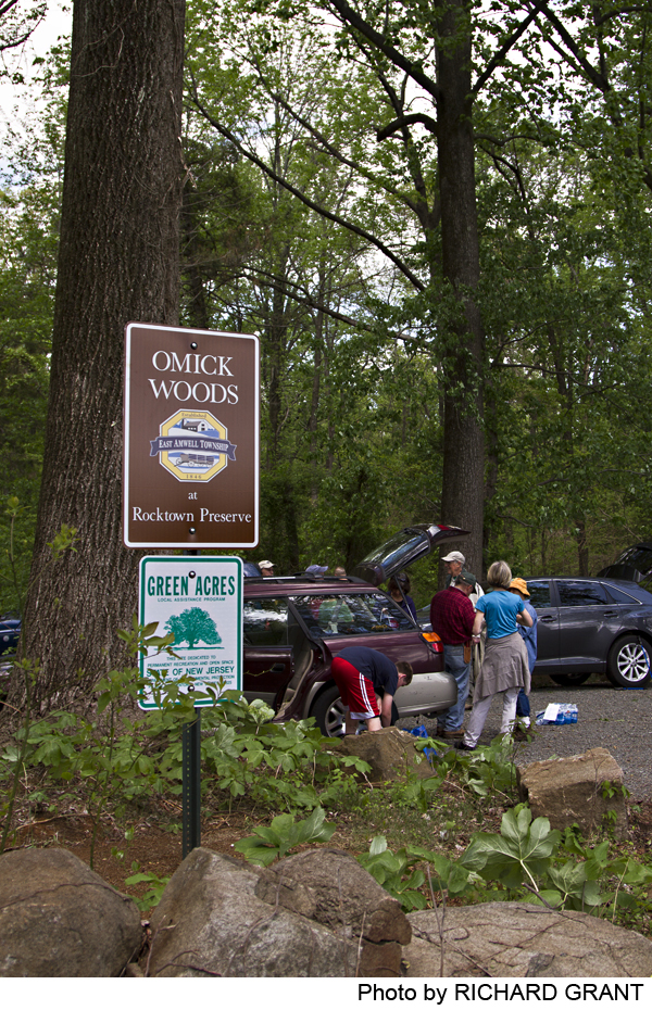
Omick Woods at Rocktown Preserve
East Amwell, NJ 08551

Last Updated: 05/14/2014
Overview of Selected Trail
The Omick Woods at Rocktown Preserve, in East Amwell, is at the western end of the Sourland Region, a 20-mile forested ridge stretching from Duke Farms in Somerset County to Lambertville in Hunterdon. The diabase rock underlying the ridge is an extension of the New Jersey Palisades across the Hudson River from New York City.
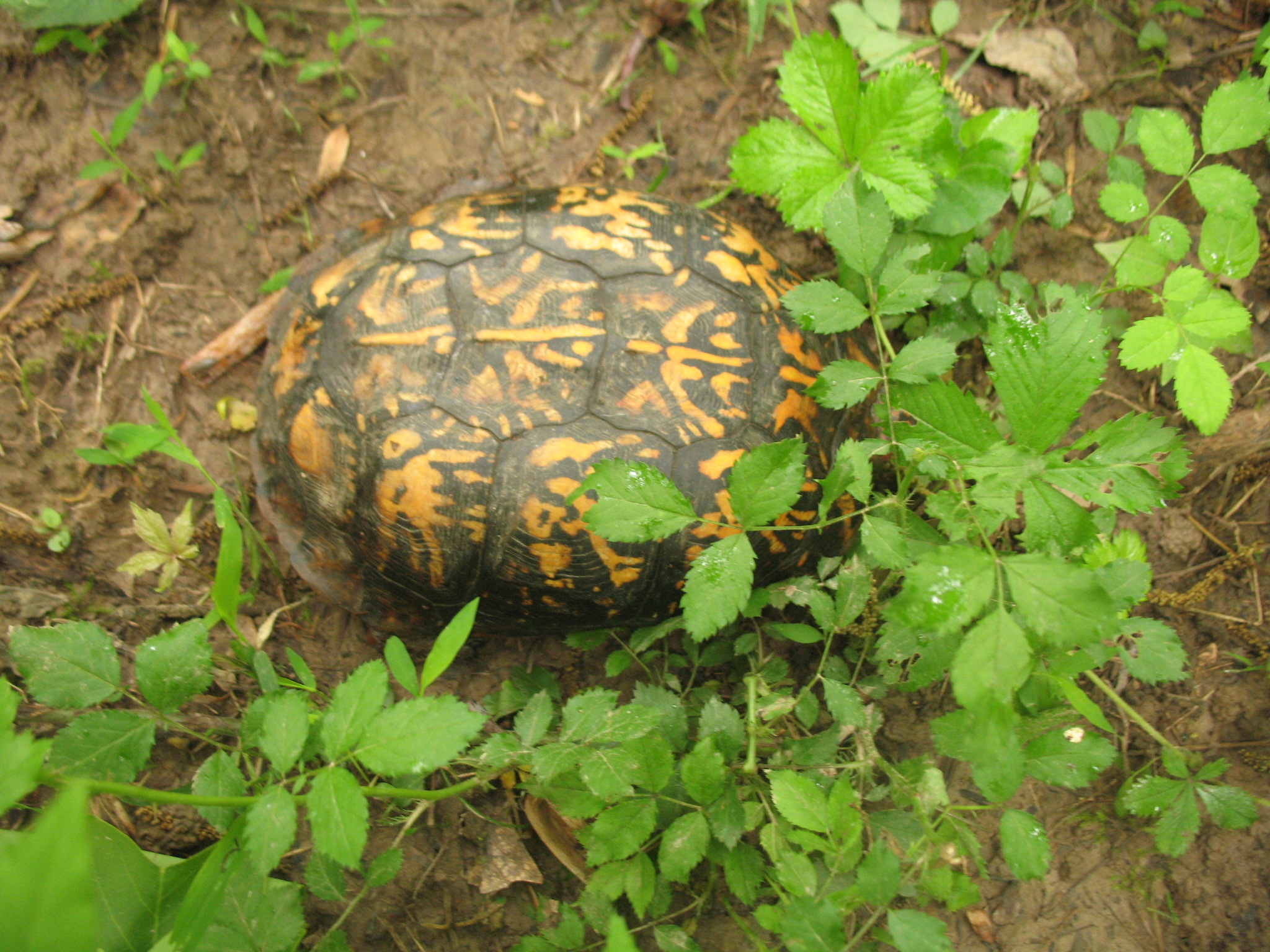
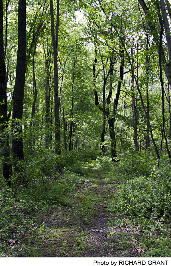
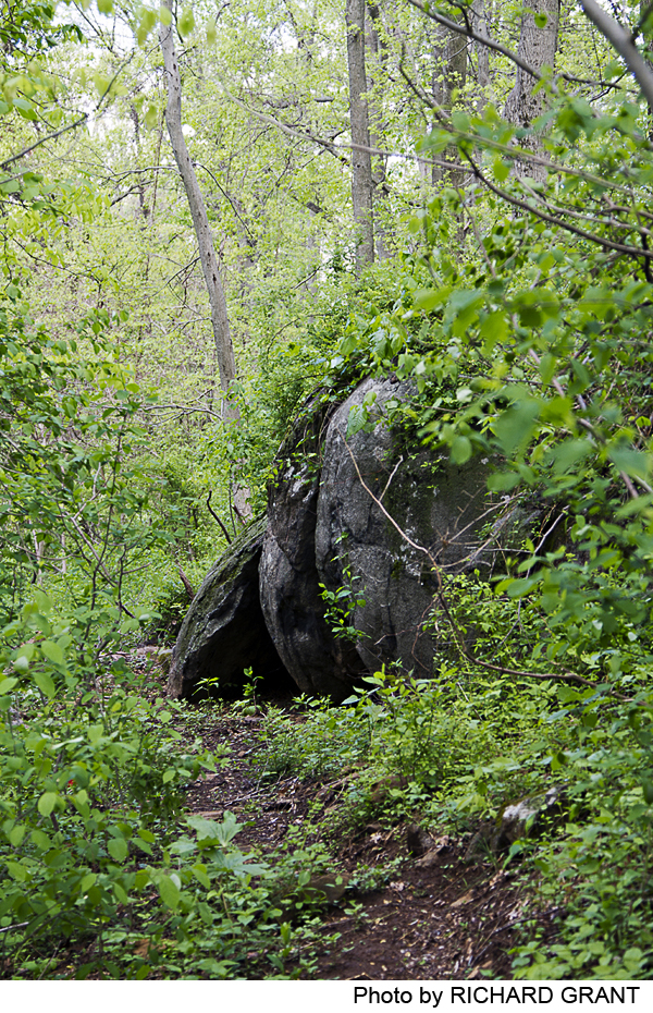
The Rocktown Preserve trail makes a 1.5 mile loop, with a stem from the parking lot crossing small Back Brook on a wooden bridge to a junction where the trail goes east or west. The eastern side of the loop has two stone crossings of the brook, reaching a high overlook with a broad view to the north over the Amwell Valley, and the southern edge of the Hunterdon plateau on the horizon. Heading southwest, the trail descends to an interesting side spur onto an old dam, ending with a view down to the brook that now cuts through the breach in the dam. From the entrance to this spur, the main trail continues generally south to the junction at the wooden bridge.
-
-
Distance:
The main loop trail is a total of 1.5 miles long.
Time:
A leisurely walk, with time to explore the old dam site, will usually take about an hour.
Markings:
The main loop trail, including the short entry trail from Rocktown Road, is marked with orange plastic blazes on trees. The short spur out onto the old dam is marked with white blazes.
Trail Usage:
Walking only. No bikes, no horses.
Elevation:
Elevations range from about 400 feet at the trailhead and at the northern viewpoint to about 325 feet near the old dam on the westernmost segment of the trail.
Difficulty:
Grades are moderate.
Parking:
There is a small parking lot for 4-6 cars at the trailhead on Rocktown Road. Park carefully to ensure others have room.
Tips:
Amenities:
None
Directions:
From I-95, go 10.1 miles north on Route 31, turn right (east) on Rocktown Road, and go .4 mile to parking on the left. From the north, take Route 202 to Route 31 south, go 1.25 miles, and make a left (east) on Rocktown Road to the parking .4 mile in. NOTE: In busy times of day, turning left on Rocktown Road from the southbound lanes of Route 31 requires extreme caution. An alternative when going south on Route 31: Turn diagonally right from Route 31 onto Rocktown Hill Road at 1 mile south of Route 202, and turn left onto Rocktown Road at the first 4-way intersection. Go out to Route 31 and cross it — but also with considerable caution, because sight lines are constrained.
From the east one can go north from the center of Hopewell on Greenwood Ave. which becomes Rileyville Road (aka Hopewell-Wertsville Road). After passing Hillbilly Hall on your right and Mountain Church Road on the left, make the next left on Mountain Road, and follow it several miles to a T-intersection at Rocktown Road. Turn left and look for the parking lot on the right, across from the vineyard.
-
From the parking lot on Rocktown Road, the trail curves down to Back Brook and crosses it on Tuck’s Bridge (named for the volunteer who led its construction). After the bridge, the orange trail loop goes both left and right. Going counterclockwise (right), the trail follows the north bank of the brook, and then easily crosses and crosses back on carefully positioned large boulders. Ascending slightly and then following near-level terrain northward, the path passes near the boundary of the preserve, with a nearby barn in sight, and then curves through a sparse cedar grove before climbing a bit more steeply to the high point of the trail at about halfway. A few steps off the trail towards an open field yield broad views across the Amwell Valley to the north. Note: The field is private; do not venture onto the field.
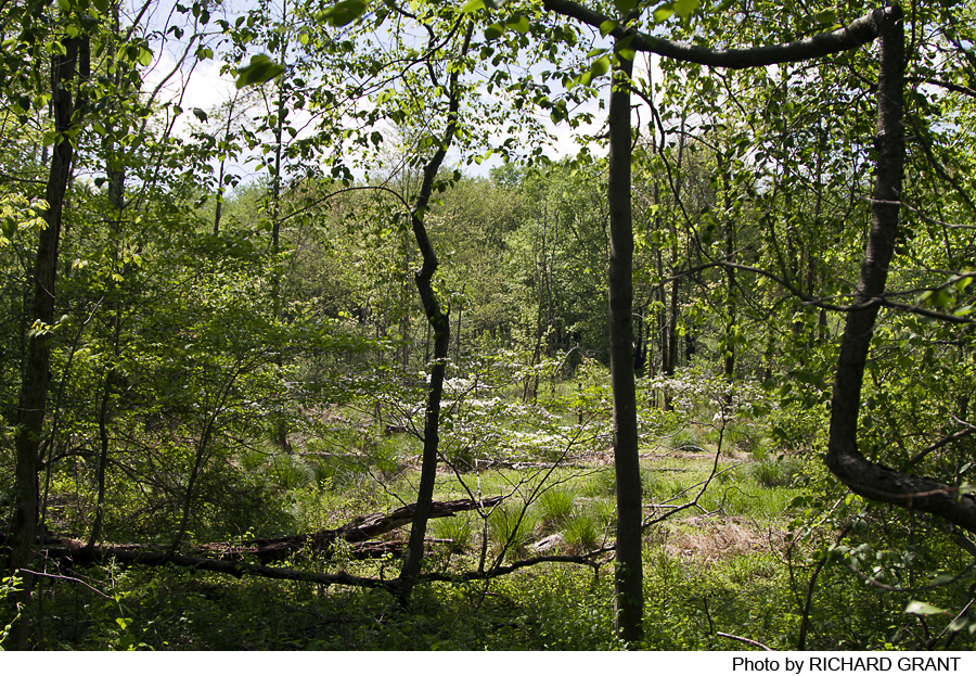
Descending from that high point, the trail follows a gentle contour down to an old wood road. The orange trail turns sharp left for its return to the trailhead, but directly ahead at this point is a white-blazed spur, beginning with stone steps through a tight portal between two towering tulip poplars. This short spur follows a short stone causeway and steps up onto the dam that contained an old farm pond, and ends at the gap where the stream that fed the pond now slices through the breached dam structure. Enjoy this piece of history and return to the main orange route. Note: An old wood road descends from near the spur entrance to a crude wooden bridge across the stream; it leads to private property, so please do not cross that bridge.
The main path then in part follows stretches of the old wood road, but leaves it to contour back up to the higher terrain, eventually returning to Tuck’s Bridge and the short entry path up to the parking lot.
-
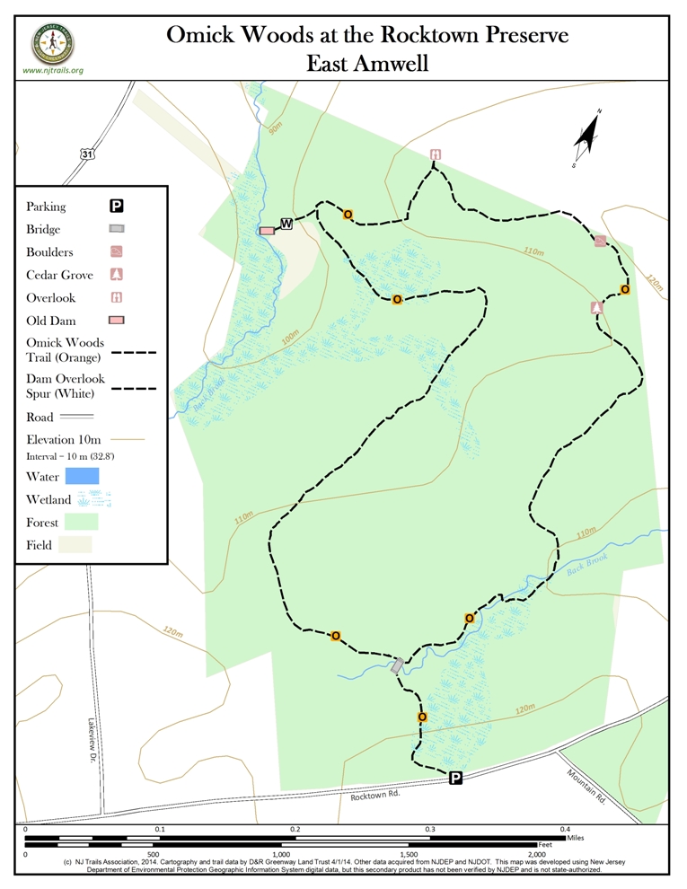
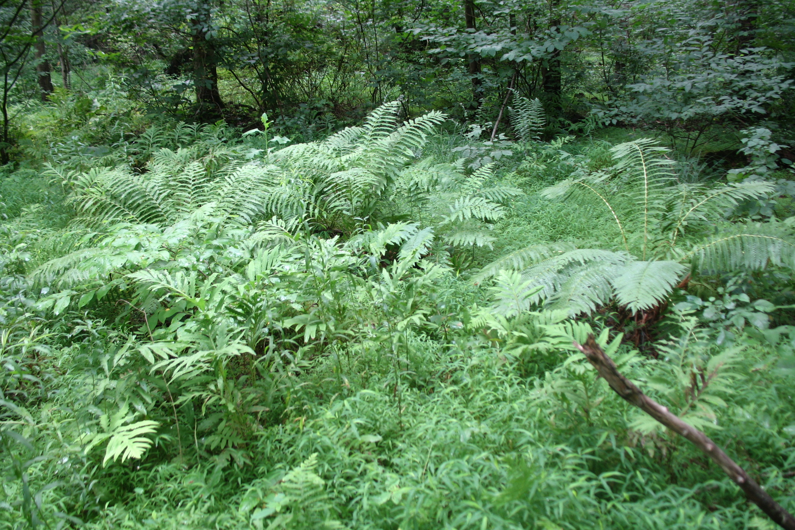
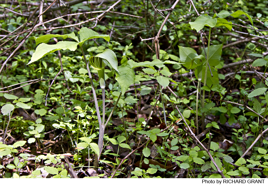
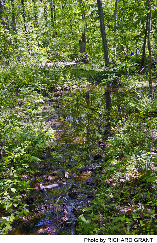
The Omick Woods at Rocktown Preserve offers some majestic eastern deciduous forest. Large tulip poplars abound, and particularly near the brook there is an abundance of muscular-looking ironwood (American Hornbeam), along with beech and their fungal companions, beech drops. The forest mix includes shagbark hickory, white oak, red maple, and some ash. The eastern portion of the trail passes through the remains of a stand of eastern red cedar, an indicator of a succession from a farm field. Some understory shrubs such as spicebush, sassafrass, and viburnum have survived the deer overbrowse. Invasive multifora rose are succumbing to the roseate virus and are being replaced by the native thorny vine, greenbriar. Ferns soften the stony banks of the brook dot the margins of the marshy site of the historic pond. In spring skunk cabbage brightens the scene, along with ephemerals such as bloodroot, rue anenome, spring beauty, trout lily, and may apple.
Do you have information about this trail?
Click Here to contribute.
-
The Rocktown preserve is surrounded by historical traces. Just across Route 31 to the west is the old hamlet of Rocktown, which was located near the Indian village, Wishelemensey on the Malayelick Trail. A stone house from 1739 still stands there today, but there were also a school, a tavern and a store in that period.
Since its early settlement, much of the Sourland Region was farmed in some way. Farmers raised crops, pastured herds, and tended orchards in the fertile Amwell Valley, and woodlots on the ridge supplied those farmers. The Preserve is crisscrossed with old stone walls marking field and property boundaries. The oldest trees in the Preserve are found along those walls and in forested wetlands.
Downstream from the old breached dam viewed along this trail (outside the preserve boundary) are other historical vestiges.The dam created a pond to support the Amwell Village complex of as many as seven mills, the first constructed in 1727. The village, sometimes known as Dawlis Mills for its first miller, William Dawlis, included two stone houses, a blacksmith shop, wheelwright and copper shop, and other small enterprises. With a tavern and general store nearby, the thriving community reached its peak around 1780. Gradually businesses moved out and the last mill ended operations in the 1920’s. In 1954 a great snowstorm took down the lower wooden mill which had been written up and drawn in the 1930s Federal Architecture survey. Today, one stone mill still stands along with the two stone houses–but they are not visible from the preserve.
Do you have information about this trail?
Click Here to contribute.
-
Photos
Videos
