Mercer
Lawrence Township
Mercer Meadows: Pole Farm, Rosedale Lake & Curlis Lake Woods
Lawrence Township, NJ 08648


Last Updated: 03/18/2015
Overview of Selected Trail
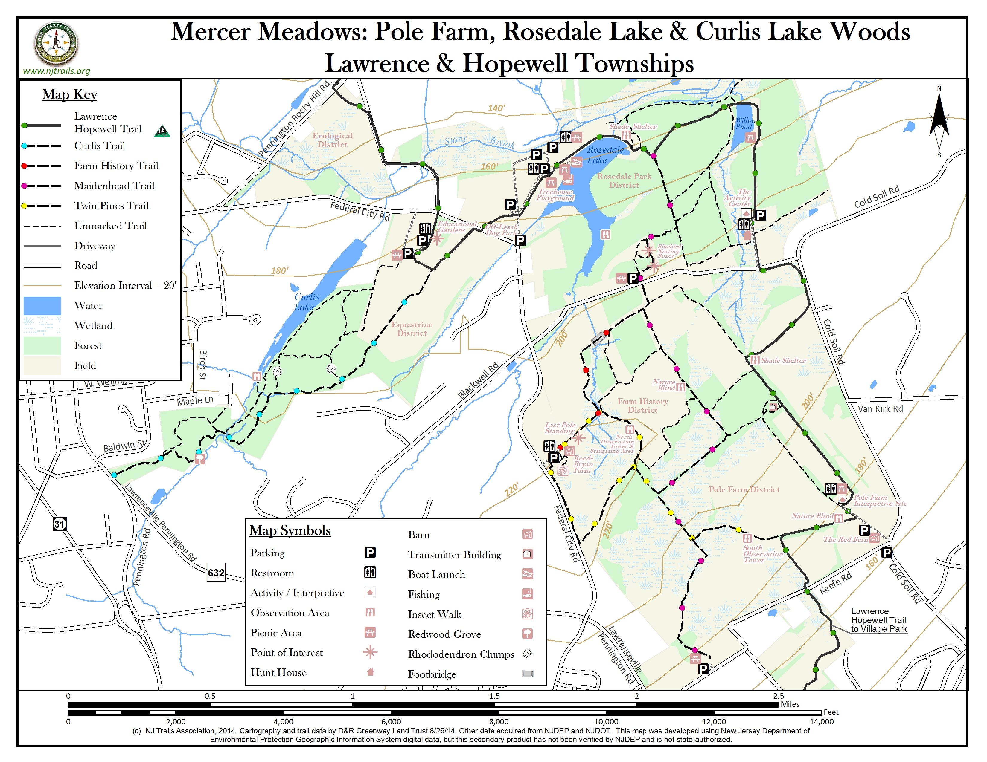
This park of more than 1600 acres is the result of Mercer County’s amalgamation of three county properties: Curlis Lake Woods and the County Equestrian Center; Rosedale Park; and the “Pole Farm.” Broad, well-surfaced trails wind through woods and open meadows, past park lakes, over boardwalks spanning marshy areas and small brooks, and past a large enclosed dog park where dogs can be let off leash. Historical background is documented on well-written marker signs—in particular about old farm houses and relics of early international telephone communications networks. For more information, see Mercer County’s website at https://mercercountyparks.org/parks/mercer-meadows.
Mercer Meadows is crossed by the 22-mile Lawrence-Hopewell Trail, a bicycle/walking loop that connects Lawrence and Hopewell Township areas (see www.lhtrail.org).
-
-
Distance:
A total of over 12 miles of trails, mostly constructed of stone base and fine stone top layer, which assure level and dry surfaces even in wet weather.
Time:
Using all sections of the park, one can easily do a long walk of several hours, or one can take an easy 15-30 minute stroll.
Markings:
Sign posts are positioned at most trail intersections, indicating points of interest to be found in each direction. Main trails have names, and these are included on the sign posts. Trails have colors, but there are no markings indicating those colors along the trails except at intersections, so the color distinctions are not easy to use.
Trail Usage:
Walking, bicycling, cross-country skiing. Dogs are permitted, but must be on leash to avoid disrupting or endangering ground-nesting birdlife.
Elevation:
Minor variations in elevation, and slopes where found are gentle.
Difficulty:
Terrain is quite flat and easy walking.
Parking:
There are many places to park, giving ready access to all sections of Mercer Meadows Park.
- Curlis Lake Section: Ample parking at the Mercer County Equestrian Center, entered on the south side of Federal City Road, about .75 mile east of its intersection with Pennington-Rocky Hill Road (East Delaware Avenue) on the eastern edge of Pennington. Informal parking for a few cars is also possible on the shoulder of South Main Street in Pennington at the entrance to the Curlis Trail just south of Baldwin Street.
- Rosedale Park District: Large parking lots are available, one right at the entrance off Federal City Road, another 100 yards in on the left, and several more near the picnic areas overlooking Rosedale Lake. There is also a parking lot on the north side of Blackwell Road midway between Federal City and Cold Soil Roads, and still another at the Hunt House, entered from Blackwell Road near its intersection with Cold Soil Road. These last two parking lots also give ready access to the Farm History and Pole Farm Districts.
- Farm History District: Parking is available at the site of the historic Reed-Bryan Farm, entered off Federal City Road about .5 mile north of Pennington-Lawrenceville Road.
- Pole Farm District: An ample parking lot is found beside the red barn at the intersection of Keefe Road and Cold Soil Road. Another is located on Keefe Road just east of Pennington-Lawrenceville Road.
Tips:
Mercer Meadows offers a “long walk” opportunity for the ambitious. One can walk from downtown Pennington to downtown Lawrenceville, entering Mercer Meadows on South Main Street, crossing the Equestrian District, following a variety of possible routes through the Rosedale Park and Farm History or Pole Farm Districts, and crossing Village Park into Lawrenceville, following the Lawrence-Hopewell Trail route. Total distance would be about 7.5 miles from the center of Pennington to Main Street in Lawrenceville.
Amenities:
Picnic tables are available in many locations near parking areas, and at Willow Pond in the Rosedale Park Section. Toilets can be found at most of the main parking areas (see symbols on map).
Directions:
Specific guidance to particular parking areas can be gleaned from the map, but general guidance for getting “onto the map” are as follows:
From I-95, take Exit 5 onto Federal City Road north, to Pennington-Lawrenceville Road. Going straight ahead, on Keefe Road, takes you to the two parking areas for the Pole Farm District. Going left on Pennington-Lawrenceville Road, towards Pennington, and then right on the continuation segment of Federal City Road, takes you to the entrances for the Historic Farm District and towards the Rosedale Park District.
From Princeton, take Rosedale Road out of town to its end, turn left on Carter Road, right at the light onto Cold Soil Road, and then left on Blackwell Road for access to parking for the Rosedale Park and Pole Farm Districts.
-
Mercer Meadows consists of four designated “districts” or sections with trails:
- Equestrian District, which includes the Mercer County Equestrian Center, and Curlis Lake Woods, with trails connecting South Main Street in Pennington to Rosedale Park and he rest of Mercer Meadows
- Rosedale Park District, with a trail link to the Equestrian District to the west, and a network of woodland trails to the east of Rosedale Lake, linking across Blackwell Road at two locations to the Farm History and Pole Farm Districts to the south
- Farm History District, whose trails mostly run through or beside open meadows with long views across the old Reed-Bryan Farm
- Pole Farm District, a mix of woodland and open meadow trails, featuring visible artifacts from the array of radio antennas that provided the infrastructure for early international telephone communications before, during and after World War II
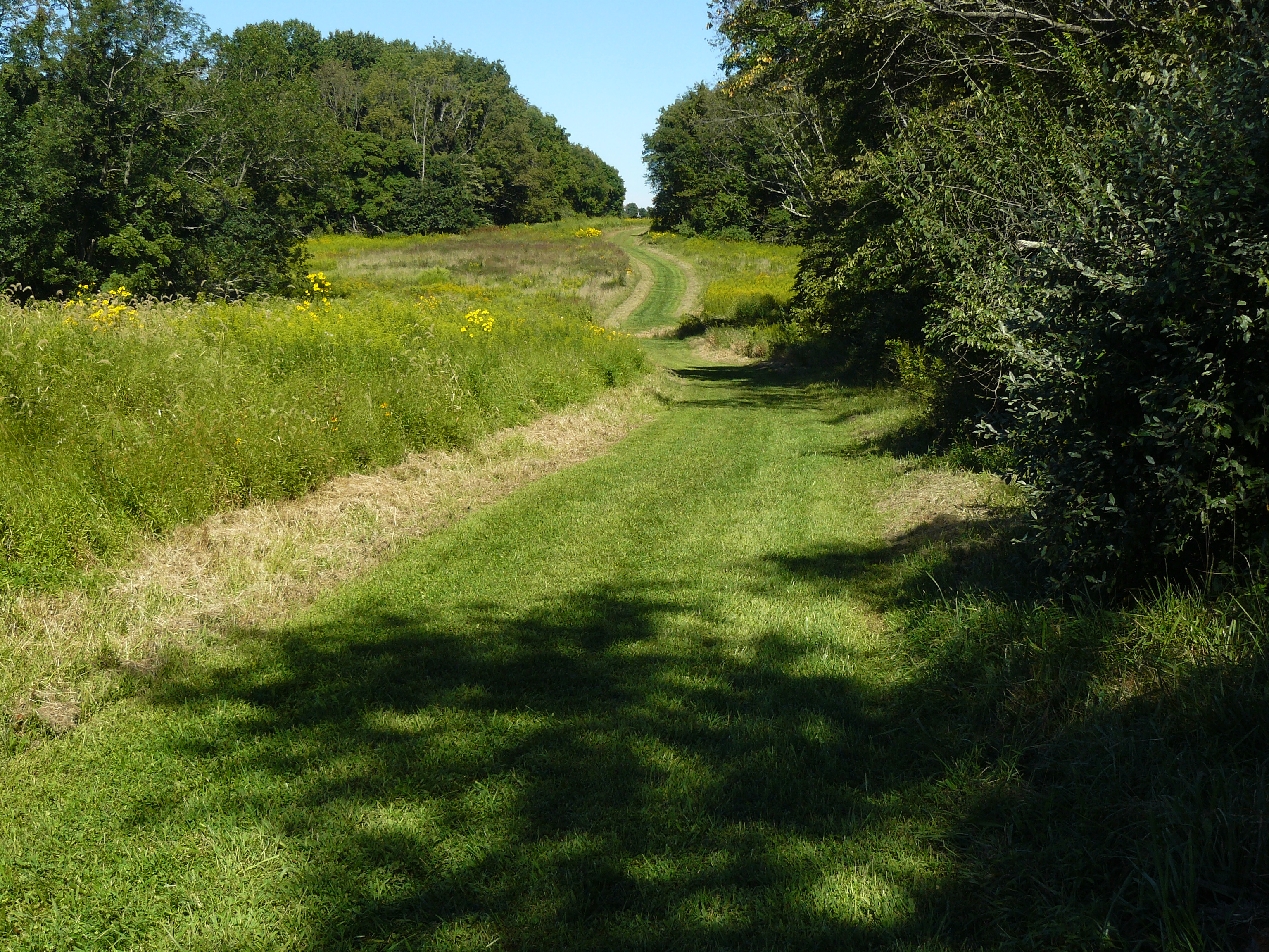
A web of primary trails forms the main “skeleton” of routes across these four districts. These trails re typically 8-10 feet wide, and some have surfaces of crushed stone dust raised above the surrounding terrain, which ensures that those trails are well drained even in wet weather. All trails are suitable for bicycling (with hybrid or mountain bikes).
- A major segment of the Lawrence-Hopewell Trail, or LHT (green) enters Mercer Meadows at its northwest corner from Pennington-Rocky Hill Road, winds through the equestrian center, crosses Federal City Road and runs past the dog park, and runs over the dam at Rosedale Lake. It continues east to the smaller Willow Lake, turns south past the historic Hunt House headquarters of the Park Commission, and crosses Blackwell Road into the Pole Farm. It runs southeast towards the picturesque barn at Keefe Road, then winds west and south to cross Keefe Road into Village Park and on into the village of Lawrenceville and beyond (total 4.2 miles, prepared surface).
- The Maidenhead Trail (purple) departs from the LHT east of Rosedale Lake, crosses Blackwell Road at the parking area, follows a broad pipeline corridor for a short distance, and then runs generally southeast mostly through woods, ending at the parking area on Keefe Road ner Pennington-Lawrenceville Road (total 2.3 miles, prepared surface).
- The Farm History Trail (orange) leaves the Maidenhead Trail where it turns off the pipeline corridor. It runs general southwest, first following the utility corridor, and then skirting the edges of fields to wind up at the site of the remaining artifacts of the Reed-Bryan Farm off Federal City Road (total .7 miles, mostly natural grass surface).
- The Twin Pines Trail (yellow) connects the Farm History and Pole Farm Districts. A loop around the old Reed-Bryan Farm is connected by a spur running southeast, partly joined with the Maidenhead Trail, to the LHT near the Keefe Road barn and parking (1.8 miles, prepared surface). A spur of this trail crosses Federal City Road, connecting to the soccer fields that front on Pennington-Lawrenceville Road, and providing access to Mercer Meadows for residents of Brandon Farms across that road.
- The Curlis Trail (blue) runs the length of Curlis Lake Woods from Pennington’s South Main Street to the equestrian center, where it meets the Lawrence-Hopewell Trail (1.4 miles, natural surface).
In addition to these main trails, there are numerous secondary, unmarked trails (shown in lighter dashed lines on the map). These secondary trails have somewhat more uneven surfaces, and may become muddy in wet weather, but can usually be combined with primary trails to form a variety of pleasant loop walks.
-
A Washington Crossing Audubon Society 1998 study of the Pole Farm documented 108 species of birds, including eleven rare bird species tracked by the New Jersey Natural Heritage Program: American bittern, great blue heron, osprey, northern harrier, Cooper’s hawk, peregrine falcon, savannah sparrow, grasshopper sparrow, bobolink, eastern meadowlark and American kestrel. Four of these are grassland birds—the savannah sparrow, grasshopper sparrow, bobolink and the eastern meadowlark, a species of special concern and a documented nester. These species were seen utilizing croplands, fallow and early successional fields. The American kestrel, another species of special concern, was documented to nest successfully on the property.
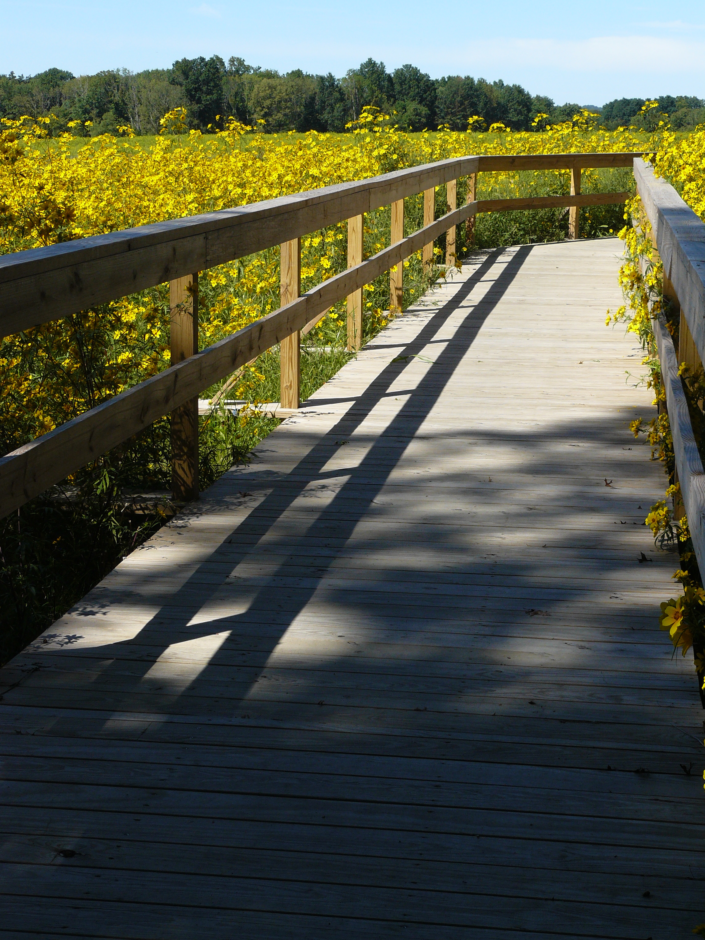
The Pole Farm also offers delightful wildflowers and butterflies. In the fall, goldenrod and brilliant blue asters shine in the sun, and milkweed scatters in the air. A total of 230 plant species were documented in the Audubon Society study, including 134 herbaceous plants, 36 trees, 31 shrubs, 11 vines 7 fern/fern allies, and 11 fungi. One State Listed Plant of Special Concern, the winged monkeyflower (Mimulus alatus), was documented along one of the tributaries to the Stony Brook in the northern part of the property. This plant is tracked by the New Jersey Natural Heritage Program within the Department of Environmental Protection.
Near its Main Street entrance, the Curlis District is thick with invasive multiflora rose and autumn olive, and many kinds of cherry trees, maple and ash. This area is excellent for birding in the winter and spring. Across the small brook, the dominant trees are hickory, ash and oak. By the 17-acre Curlis Lake the dominant species is beech, forming a dense canopy. Look for concentric groupings of successively younger beech trees around an older, center tree. Beeches reproduce by nuts (beechnuts) and suckering (sending saplings up from the roots). The concentric circles of young beech are caused by suckering. Many of the odd species (such as Rhododendron, Red Woods, Yew, Myrtle and Vinca) found in the woods and fields are the legacy of Mr. Howe’s nursery.
Around Curlis Lake, look for signs of fox, owls, and salamanders. Swans and osprey can often be seen on or around the lake. The huge snails in the lake are Japanese Pond Snails.
Do you have information about this trail?
Click Here to contribute.
-
Walking the trails of Mercer Meadows offers glimpses into the near and distant past. In the distant past, the Lenni Lenape Indians hunted the woods in this area, and may have cleared the land for fuel or a village site, or for growing corn or squash. English settlers arrived in the 1700’s. One of the first, Salathiel Pierson, built his home at the end of Van Kirk Road around 1762, and the land remained in farming for 200 years. His house was moved to its present location on Cold Soil Road in the 1920s.
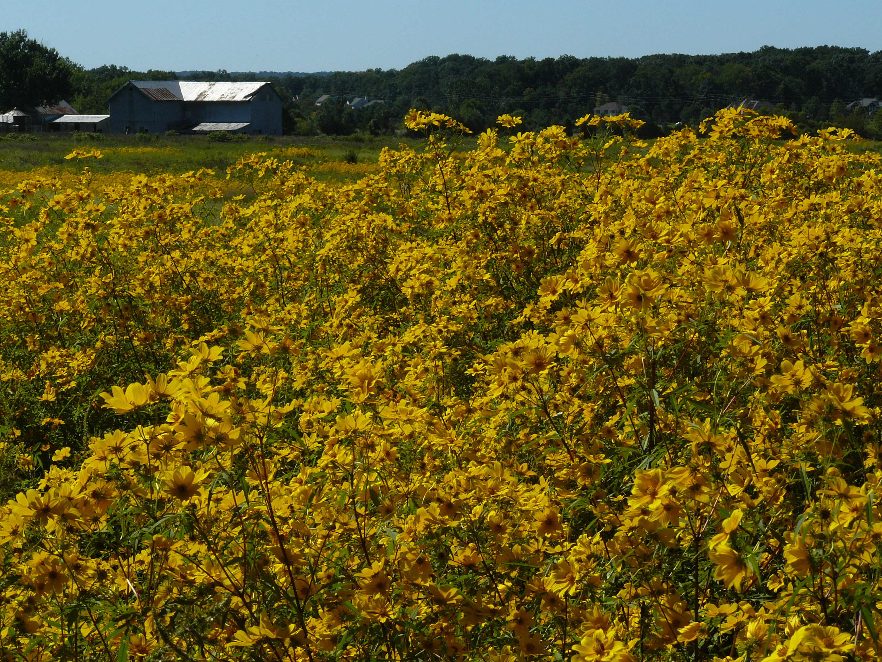
That move marked the beginning of the “Pole Farm.” American Telephone and Telegraph (AT&T) purchased the land where Pierson’s house had stood to build a short-wave radio station, closed to the public but replete with visible stands of transmission towers that fueled rumors about the purpose of the installation. In 1965 it was the largest radio telephone station in the world. A three minute call from New York to England cost $45. By the late 1960s, however, undersea cables had largely replace radio transmission for international communications, sharply reducing costs, and in the mid-1970s AT&T removed the last vestiges of their installation, leaving behind one pole and the concrete footings of massive radio towers, some of which are still visible in the Pole Farm District. At its peak, the installation had thousands of several thousand poles 80-12o feet high, supporting antennae each covering about 10 acres.
The western part of Mercer Meadows, in the Curlis District, was home to Howe Nurseries. Pennington had seen rapid growth in the decades after the railroad came to town in 1875, and William S. Howe, arrived in Pennington in 1910, was part of the continuing growth. He purchased several plots of farm land east and west of South Main Street, and began nursery operations. Along with his nursery business, he laid out several of Pennington’s current streets, and lined them with Norway maples. In 1919 he bought a large tract of land north of Curlis Avenue and extending far to the east, expanding his nursery operations and interweaving it with lots being used for new residential development. He donated the land for the present-day Tollgate School.
Do you have information about this trail?
Click Here to contribute.
-
Photos
Videos
