Mercer
West Windsor Township
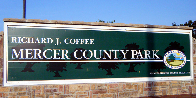
Mercer County Park
West Windsor Township, NJ 08550


Last Updated: 05/14/2014
Overview of Selected Trail
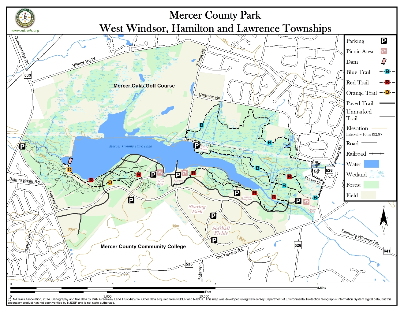
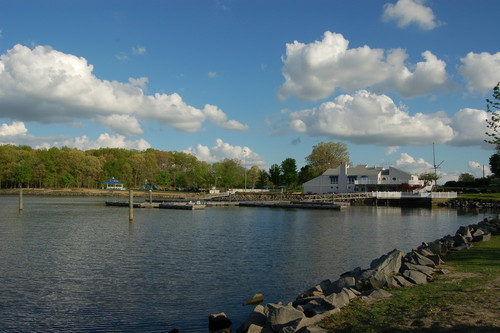
Mercer County Park is primarily in West Windsor Township with sections in Hamilton and Lawrence Townships. The Park totals 2500 acres, almost 4 square miles. There is a 2.5 miles long divided road between the main entrances on Hughes Drive and Old Trenton Road. Not counting the lake, about half of the park has tree cover and half is mowed fields and other facilities. Many community events are held here. The park includes a tennis center with indoor and outdoor courts, an ice skating center, a boat marina, a lake used for rowing with local and national events, picnic and playground areas, soccer, baseball, and cricket playing fields, basketball, bocce and volley ball courts, dog parks, paved paths and nature/bike dirt trails. Mercer County Community College is on the southern border and Mercer Oaks East Golf Course is on the northern border.
Special thanks to the Mercer Smart Bike Group for contributing to this trail guide and map data.
-
-
Distance:
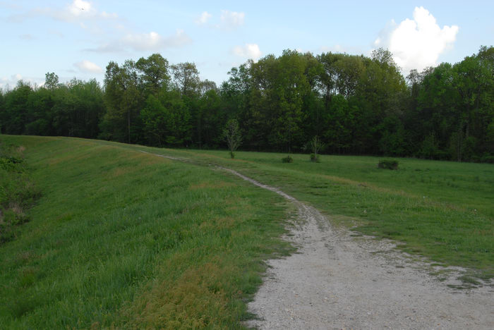
Approximately 8.5 miles of prominent dirt nature/bike trails (see Trail Descriptions for distance of each segment), many networks of lesser trails and 3.3 miles of 8 ft. wide paved bike/walking trails to explore.
Time:
Estimate 15-20 + minutes per paved path mile, and about 30-35 minutes per nature trail mile.
Markings:
Nature/bike trails have colored squares or diamonds or 3-tree markers on diamonds. Some trails are less well marked. Walkers can maintain orientation by noting the location of the lake, paved path, and divided park road. There are several networks of trails that are not marked. The paved path has periodic distance markers.
Trail Usage:
Walking/Hiking, Accessible by wheelchair and baby stroller, Dogs permitted on leash, Mountain biking
Elevation:
Terrain is flat – maximum 30′ feet elevation change
Difficulty:
Easy walking. There are some uneven dirt nature/bike paths with roots and depressions.
Parking:
East Picnic Area – There are 60+ parking spaces.
Marina – There are 230+ parking West Picnic Area – There are 220 + parking spaces.
Boat House – There are about 75+ parking spaces.
Tips:
In an emergency, Mercer County Sheriff Dispatch 609-989-6111 can contact park staff immediately. Ranger headquarters 609-443-8956. The park is open during daylight hours.
Parking is plentiful near trails and in general, but may be busy when an event is being held in a certain location.
Major events are listed at the park main east and west entrances.
Hikers may encounter bikers now and then. Hikers stay on right, bikers on the left.
Amenities:
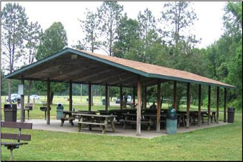
Restrooms are available at each of the parking areas noted above and at the softball fields, but are closed in freezing weather, except The Tennis Center’s which remains open year around. Playgrounds and picnic areas are at East Picnic Area, The Marina, the West Picnic Area and the near the softball fields.
Directions:
To western entrance:
From US Route 1, at the Quakerbridge Mall take Quaker Bridge Road east for 2.5 miles and turn left onto Hughes Drive. Proceed on Hughes Drive for .5 mile to entrance of Mercer County Park on the left.
From Route 295, take Exit 65A, Sloan Avenue. Go east on Sloan Avenue. After the 2nd traffic light, the name of the road changes to Flock Rd. Go left on 535 (Mercerville-Edinburg Rd.) Go left on Hughes Drive. The park entrance is on the right.
To eastern entrances:
From NJ Turnpike take Exit 8 at Hightstown. Follow Route 33 west and turn right on 571. Go 2.5 miles. Go left/south on 535 (Old Trenton Road). Go 4 miles, the main eastern park entrance is on the right.
To East Picnic Area and Boat House, From the main eastern park entrance, go left/north on 535 (Old Trenton Road.) Go left at 1st stoplight/Edinburg Rd. After 1 block the park entrance is on the left to go to the East Picnic Area. For the Boat House Parking continue past this entrance on Edinburg Rd., go 3 blocks, and make a left on Conover Rd., go 1.6 miles. Go left at South Post Road and left into the Boat House parking.
-
Trails from the East Picnic Area:
Eastern Red Loop, 1 mile. From the parking area, go back to the entrance driveway, and turn left. In about 300 feet the trail begins at the red post on the right. This trail winds through open woods of sweet gum, wild cherry, and red maple. Near the intersection with the Eastern Blue Trail, there is a large grove of Ailanthus or the Tree of Heaven. Notice the large compound leaves. Also in this area, there are large red cedars in groves. The northern part of the loop has some large black birch trees. A broken twig of these trees smells like wintergreen and was used to make birch beer and wintergreen oils in the past. The twigs are eaten by deer and rabbits. Note the variety of ferns where there is shade. In areas that are more sunlit the ground will be covered by the invader Japanese stilt grass in the summer and autumn. Go left at the paved path to return to the parking lot.
Eastern Blue Trail, 1.5 miles. From the parking area, go back to the entrance driveway, and turn left. In about 300 feet, the trail begins straight ahead at the blue post. The Eastern Red Loop intersects and several feet later the trail goes over a footbridge. About 30 feet later the trail forks; take the right fork for the primary trail. Walk around the boathouse.
Trail from the Boathouse Area:
Northern Blue Trail, ~3 miles. From the boathouse parking area, go right out of the driveway about 400 feet. Pass a marshy area and before the power lines go right at the blue three-tree marker. The trail here is about 8 feet wide and the total trail is well delineated but not marked. It is a windy dirt path through mixed hardwoods woods with 5 foot bridges crossing streams, sometimes near the edges of open fields and comes out at the power lines near the east park boundary. The trail ends here. To return to the parking lot, go left at the power lines, follow the service road for about 500 feet. Go right on walkway over the footbridge. Continue straight on street which is Bundsfield Drive for one block. Take a left on Darvel Drive and go for 1-½ blocks. Go right on Edinburg Rd. for about 3 blocks and go right into the park entrance to East Picnic Area.
Trail from the Marina:
Red Transverse Trail, 1.3 miles. From the southeast corner of the Marina’s parking lot, follow the paved path east for 500 feet. The entrance to the trail is at the red marker on the left. Follow the trail into the deciduous woods. There is a lovely picnic area overlooking the lake. Cross the open field and pick up the trail at the red marker near the finish line tower (used for rowing races). At this point you can follow the red trail or take the lesser trail along the lake edge, which connects to the red trail behind the tennis center. Note the large oaks in the woods as the trail passes behind the tennis complex. Continue following the red trail to the intersection with the paved path. Turning left will take you over the footbridge to the East Picnic Area. Turning right, the paved path will return you to the Marina.
Trails from the West Picnic Area:
Lakeside Paved Path, 1.3 miles. From the West Picnic Area, take the paved path west along the lake and woods of oak, ash and beech. There are great views of the lake from benches all along this route. There is a narrower paved path that loops through the woods and returns to the main paved path. There is a network of dirt trails in this area. The main paved path continues along the lake edge and intersects the Western Red Trail after 1 mile and the Western Orange Trail after 1.3 miles.
Western Red Trail, .7 mile. From the West Picnic Area, walk back on the right on grass along the parking lot entrance road. Enter the woods on right at the red three-tree marker. Go 75 feet and cross the ditch under the power lines and enter woods. Red three-tree markers are at path forks. The trail crosses the paved path, turns left and follows the lake through the woods. Near the lake one will find lots of birch and evidence of beavers. (Look for stumps that look like sharpened pencils. If the beaver work is fresh, there will be wood chips around the base of the stump.) If you are walking in the woods in the spring listen for the singing frogs at the vernal pools. The trail continues out of the woods to the dam bank, which is the intersection of the orange trail. Trail markers are infrequent and walkers can maintain orientation by noting the location of the lake, paved path, and divided park road. There are networks of lesser trails in this area. Returning along the orange trail will take the walker through young woods and an early field succession stage dominated by red cedar.
Western Orange Trail, 1 mile. From the West Picnic Area, walk back on the grass on the right along the parking lot entrance road. Pass the red three-tree marker, go another 50 feet and enter the woods on right at the faded silver (was orange) three-tree marker. Go 75 feet and cross the ditch under the power lines and go straight on the path to enter woods and go left after 40 feet. The younger woods consist of many small trees of sweet gum (Liquidamber) and black birch mixed in with pin oak, white oak, red oak and black oak. The sweet gum can be recognized by the ball shaped, prickly long stemmed fruit hanging on the tree or scattered over the ground. The seeds of this fruit are eaten by chipmunks, squirrels, songbirds and wild turkey. Look for high bush blueberries growing under the oaks and hickories. The trail crosses the paved path, continues straight and goes to the right along the maintenance road. The trail goes along the top of banked area in woods and meadow and intersects the red trail going off to the right into the woods along the lake. The orange trail continues on top of the lake dam to park boundary with the Van Nest Tract state park. This boundary is not marked but has a danger sign at the water outlet where the trail ends. The trail, throughout, is not well marked and walkers can maintain orientation by noting the location of the lake, paved path, and divided park road. There are other networks of lesser trails along this primary trail. When returning, the walker can take the red trail, marked with a three-tree marker at the edge of the woods next to the lake.
Special Thanks to the SMART BIKE GROUP for contributing map data and information to create this guide.
-
The land around the lake consisted of many farms in the late 1960’s when the land for the park was acquired. The abandoned farm fields went through many stages of succession to the present stage of young woods dominated by black birch, red maple and sweet gum. In the western part of the park there are white oak, pin oak, black oak, white ash and young beech trees coming into the woods, starting the next stage of succession. Large red oak and white oaks can be found in the woods by the dam. Dead and dying red cedars in the woods indicate a previous community when the fields were still open with lots of sunlight. Look for black cherry, sassafras, tulip trees, and hickories mixed in with the other trees. The under story and herb layer varies from blueberry, poison ivy, and mosses in the west to a variety of ferns in the eastern section of the park. Wherever there is enough sunlight, the ground in covered with the invasive Japanese stilt grass. On the Eastern Loop Trail there is a large grove of the Tree of Heaven (Ailanthus).
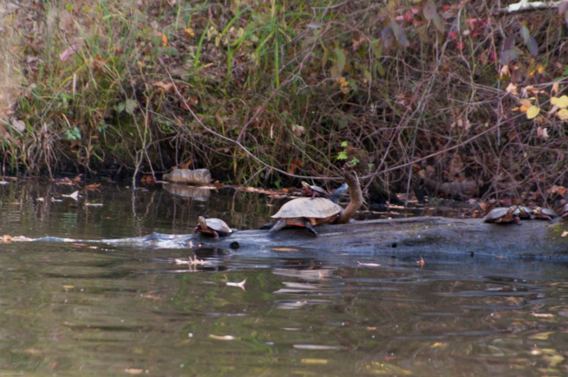
In the spring look in the vernal pools (temporary ponds) for wood frogs and salamanders. Because the park has such a variety of habitats one can expect to see woodchucks and rabbits in the fields, deer, gray squirrel, and chipmunks in the woods and signs of skunks, raccoons, opossum and beaver in the woods near the lake.
This is an excellent area to look for migrating songbirds and waterfowl as well as residents. Look for swallows, vultures and hawks over the athletic fields and mowed grass areas. Herons, geese, ducks and swallows can also be seen over or in the lake.
Do you have information about this trail?
Click Here to contribute.
-
The West Windsor area was originally explored in 1634 by an English captain by the name of Thomas Yong as part of the Delaware Bay. During Yong’s stay, he met and traded with Lenni Lenape Indians that inhabited the area. The indigenous people were hunters, fishers, and agriculturalists. Evidence of their existence continues to be found in discoveries of weapons and domestic tools along the banks of the Assunpink Creek, the small waterway through the Park named by them. West Windsor was initially established in 1682 when William Penn signed a treaty with the Lenni Lenape. In 1731, the area was known as New Windsor Township and it included Princeton Township, Princeton Borough, and East Windsor. In 1737, the area was sold by Penn’s heirs to the Schenk and Covenhoven families who were Dutch farmers. In 1751, it became the Township of Windsor. Princeton was its downtown and was a part of West Windsor during the formation of Princeton University and the revolutionary war. In 1797, West Windsor Township became incorporated and then included only a portion of Princeton Township and Princeton Borough. In 1838, Mercer County was established and in 1855, the current borders for West Windsor were defined containing 26.84 miles. Today, West Windsor can still identify the six farming villages that were a part of the area. The land for Mercer County Park was acquired between the late 1960’s and the early 1970’s. It consists of 50-plus pieces of property, which included many farms. Ground was broken for the lake in June 1971. Because of the construction of Routes I-95 and I-295, the lake basin was excavated at no cost to the county. The county sold the gravel to the highway contractors, which in turn helped excavate the basin now known as Lake Mercer. At a time during excavation there was one truckload of gravel leaving the area per minute from 7:00AM until 7:00 PM, six days per week.
The dam for the lake was built to control flooding by the Assunpink Creek to protect certain sections of the city of Trenton. This project turned a marsh into a man made lake for boating and fishing which led to the development of the boathouse/rowing center and marina and eventually the entire surrounding park.
The boarded up shell of the Rogers House, built in 1761 stands within a fenced no admittance area near the West Picnic Area. On the east side of the house, there is a white picket fence around a tiny grave area with 2 grave stone markers. Attached is an undated photo of better times for the house.
Sources: Mercer County website (Mercer County Parks) and West Windsor website (www.westwindsornj.org)
Do you have information about this trail?
Click Here to contribute.
-
Photos
Videos
