Hunterdon
West Amwell Township
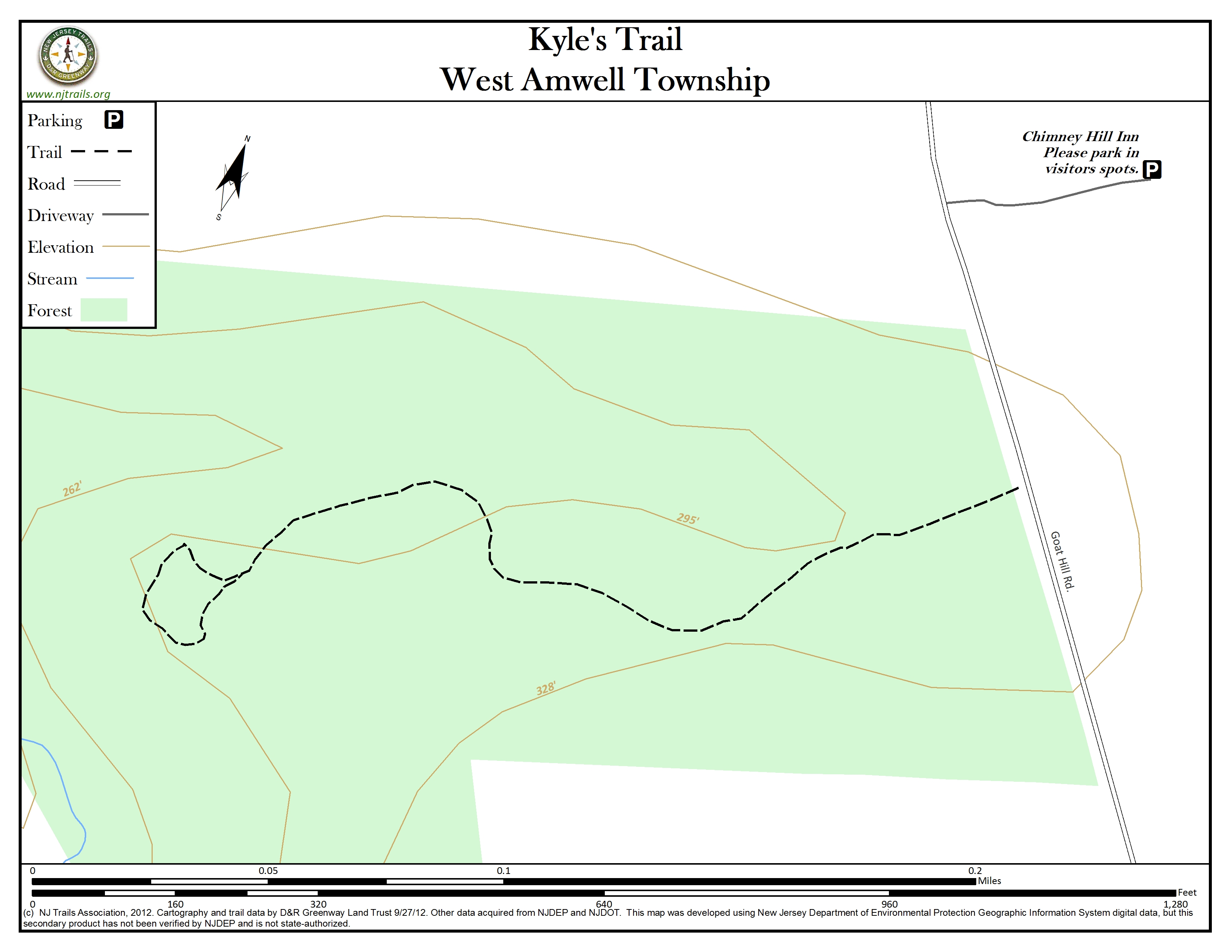
Kyle’s Trail
West Amwell Township, NJ 08530


Last Updated: 01/16/2013
Overview of Selected Trail
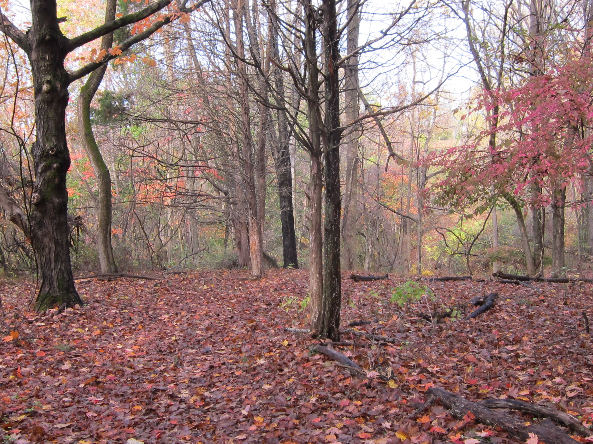
The trail descends gradually through mature woods to a tranquil end point. The woods are part of a 34-acre farm along Goat Hill Road not far from the “Washington Rocks” property, the location from which General George Washington viewed the Delaware River in planning the Christmas crossing of the Delaware in 1776. A low rectangular boulder behind the Dondero homestead (a private home adjacent to the woods and not open to the public) is said to mark the site from which Cornelius Coryell and General Washington surveyed the Delaware River below.
-
-
Distance:
Approximately 1/2 mile
Time:
20-25 minute leisurely walk
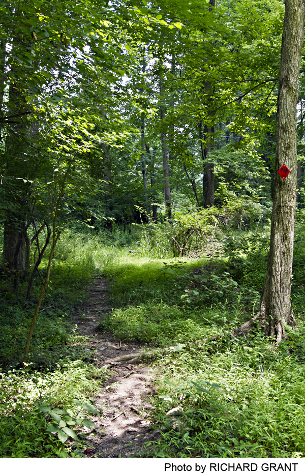
Markings:
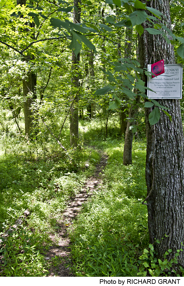
Red diamond trail markers with Hunterdon Land Trust Alliance (HLTA) posted on trees. D&R Greenway Land Trust beige signs mark boundaries with neighbor next to stream. Please stay on trails.
Trail Usage:
Walking/Hiking, Dogs permitted on leash
Elevation:
Approximately 340 feet, but no steep hills
Difficulty:
Easy
Parking:
There is no parking on Goat Hill Road. However, the Chimney Hill Farm Inn at 207 Goat Hill Road, on the opposite side of the road, allows walkers to park in the visitors’ spots. Pull in driveway and follow sign for parking. Turn left for visitor’s spots. Please let the innkeeper, Richard, know that you are parking there for the duration of your hike. If the guests are using all rooms, and there are no parking, please check with the innkeeper for parking guidance.
Tips:
Some areas of the trail may be wet or muddy after heavy rains or during spring thaw, so wear appropriate shoes. Where the trail crosses the wooden bridge, the logs may be slippery.
Amenities:
None.
Directions:
From Princeton:
Take Route 206 North to Route 518 West towards Lambertville. As Route 518 bends left on its way down into “Lambertville, make a left onto Swan Street. Take the second left onto Studdiford Street, which after 4/10ths of a mile becomes Goat Hill Road. Almost immediately you will see a white horizontal fence on the left that indicates the Chimney Hill Estate Inn. Turn left and follow to parking area. Park in visitor’s spots and tell the innkeeper you are parking to walk on Kyle’s Trail. Walk down driveway and turn left. There is no shoulder, so beware of cars traveling faster than they should. You will see a large rock opposite a private residence called High Meadows that marks the beginning of Kyle’s Trail.
From South Jersey:
Take 195 to 295, then to 95 South. Take Route 95 South to Exit 1 – Lambertville-Trenton. Exit onto Route 29 North. Travel approximately 7 miles. Look for ‘Howell Living Farm’ sign. Turn right onto Valley Road, travel about a 1/2 mile. Make your first left onto Goat Hill Road (the sign may be missing). Travel 1 1/2 miles. The parking area for Kyle’s Trail is located at the Chimney Hill Estate, 207 Goat Hill Road, on the right. Follow directions above to trail.
-
This trail is named in memory of Kyle Donnelly who died in 2006 on Goat Hill Road. Kyle and his family are longtime Lambertville residents and Kyle was about to be deployed to Iraq.
From the trailhead, marked by a large rock, the path enters a dense canopy of woods. The trail is lined with fallen branches and red diamond trail signs are posted on trees along the path. The path is fairly level, but a bit rocky and gradually slopes downhill. You will cross over a wooden bridge through a wet area. The logs can be slippery after rains. The trail winds down to a stream that flows into the D&R Canal and Delaware River watershed area. The trail ends near the stream; beyond this point is private property. Follow the same route back up the slope to Goat Hill Road.
-
Kyle’s Trail is a treasure chest of natural resources including fragile wetlands, springs and numerous wildlife and plant species. The trail meanders through mature woodlands of oak, maple, ash, walnut, sycamore, dogwood. spicebush and hickory. The mature woods provide habitat for woodpeckers, black-capped chickadees and dark-eyed juncos. Several acres contain a stand of white pines that offer important habitat for owls, Cooper’s hawk and other raptors.
Do you have information about this trail?
Click Here to contribute.
-
Kyle’s Trail lies on the homestead of Dr. David and Peggy Dondero, who preserved it in 1999, working with D&R Greenway Land Trust and Hunterdon Land Trust Alliance. The balance of the property is actively farmed as it has been since 1750. The house on the property was built around 1750 and maintains much of its historical integrity. The wood peg barn is made of mortise and tenon construction with hand hewn beams. The homestead, still a private residence, was the estate of Cornelius Coryell, aide to General George Washington during the Revolutionary War. A low rectangular boulder behind the Dondero house is said to be the site where Cornelius Coryell and General Washington planned strategies for the now famous Christmas crossing of the Delaware River. Washington’s armies had retreated from New York to Pennsylvania, and Washington secretly crossed back to New Jersey and was led up Smith Mountain (now Goat Hill), a spot from which he could confirm that British troops would not be able to see the boats he had hidden on the Pennsylvania side to carry his troops in the Christmas attack.
Do you have information about this trail?
Click Here to contribute.
-
Photos


Videos
