Mercer
Hopewell Township
Kate’s Trail
Hopewell Township, NJ 08525


Last Updated: 12/11/2014
Overview of Selected Trail
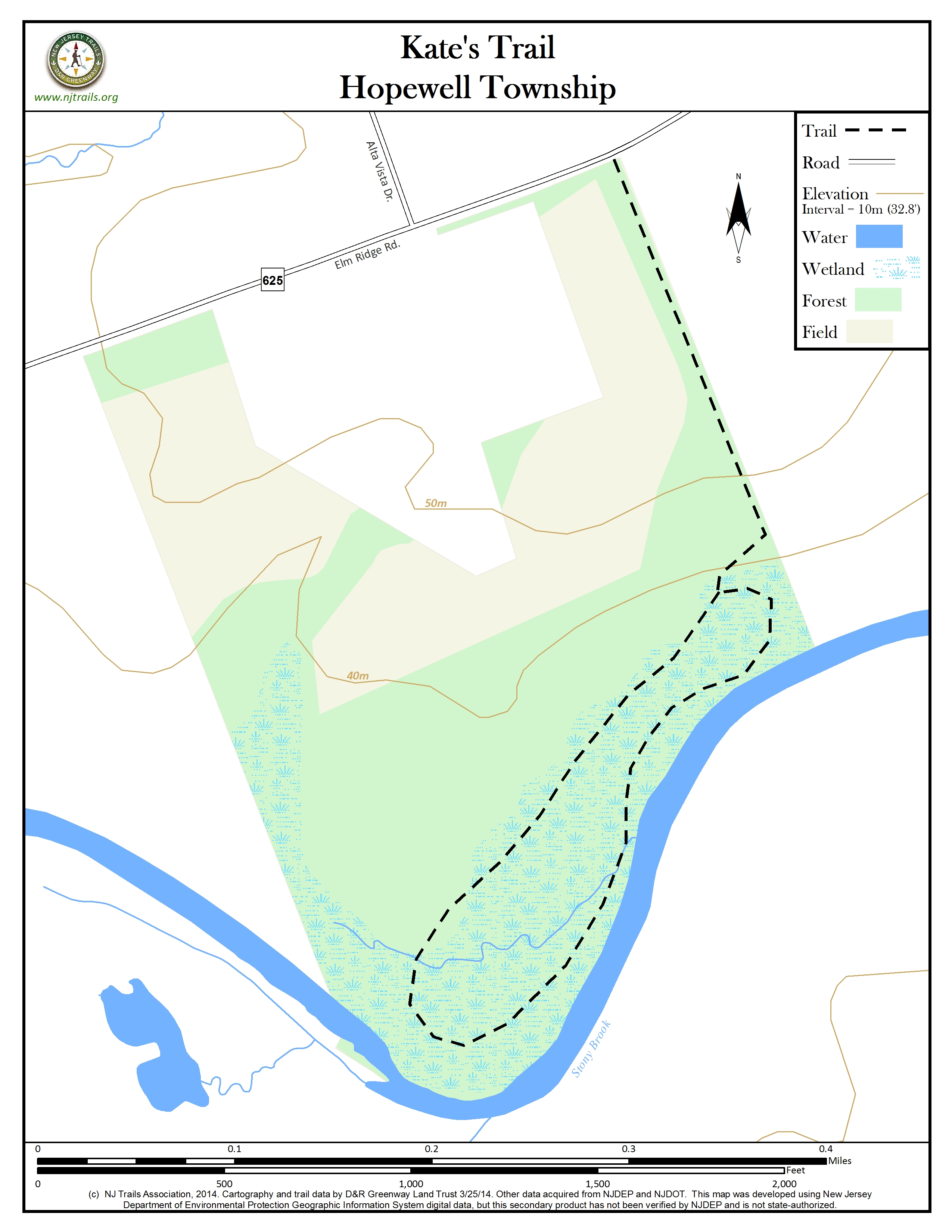
Kate’s Trail is on a 60 acre conservation easement held by D&R Greenway Land Trust. See D&R Greenway Land Trust.
The area of the easement with the trail and public access covers 20 acres. The remaining 40 acre easement does not allow public access but will remain as permanent open space. If you stay on the path you will not trespass on the eased area that is not open to the public. The distance from the road to the Stony Brook is about 1/4 mile.
-
-
Distance:
1.1 miles
Time:
Approximately 30 minute walk
Markings:
D&R Greenway Land Trust green trail markers on trees
Trail Usage:
Walking/Hiking, Dogs permitted on leash
Elevation:
Minimal
Difficulty:
Easy – trail is fairly flat
Parking:
There is enough room for 2-3 cars on the shoulder of Elm Ridge by the trail kiosk. Please do not park in front of the gate on the neighboring property right near the kiosk. It is marked with a no trespassing sign. Coming in on Elm Ridge from Carter Rd. there is a small hard-surface strip along the shoulder before you get to the trail kiosk. You can also park on Alta Vista off Elm Ridge Rd. and walk the short distance back to the trail head.
Caution: Speed limit is 50 mph on Elm Ridge Road. Use care when turning off road or walking along side of road.
Tips:
No bikes or horses permitted. Dogs on leash are permitted. Please clean up after your pets.
Amenities:
Trail head has kiosk with map.
The park is near other preserved lands and watersheds. See Stony-Brook Millstone Watershed Association.
Directions:
From Princeton:
Take Rosedale Road west to Carter Road. Turn right, heading north on Carter. Take left, heading west on Elm Ridge to first road on the right, Alta Vista. Park on Alta Vista. Use Caution walking along Elm Ridge Road – cars travel quickly on this road. Walk a short distance, 200 feet, on shoulder of Elm Ridge back (towards Carter) to trail head, where you will see a trail kiosk.
From Pennington Borough:
Drive eastward on West Delaware Avenue, following it as it bends northeast and changes its name to Pennington-Rocky Hill Road. Turn right at the first traffic signal (Elm Ridge Road). Drive approximately 2 miles and turn left onto Alta Vista Drive (or proceed another 400 feet and park on the shoulder of Elm Ridge.)Use caution walking along Elm Ridge Road. Cars travel quickly through this area.
-
Kate’s Trail is on a 60 acre conservation easement held by D&R Greenway Land Trust. See D&R Greenway Land Trust.
The area of the easement with the trail and public access covers 20 acres. The remaining 40 acre easement does not allow public access but will remain as permanent open space. If you stay on the path you will not trespass on the eased area that is not open to the public. The distance from the road to the Stony Brook is about 1/4 mile.
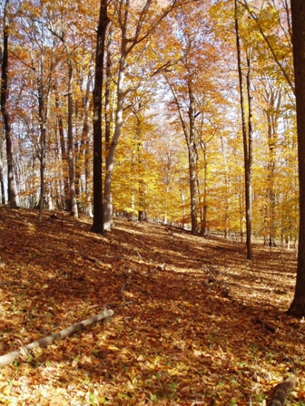
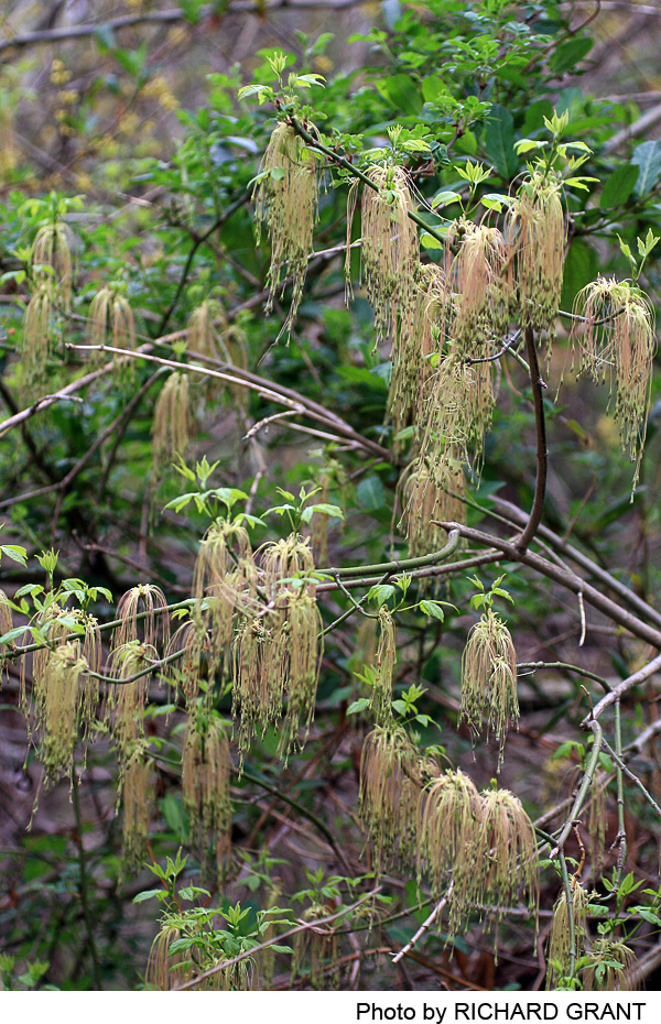
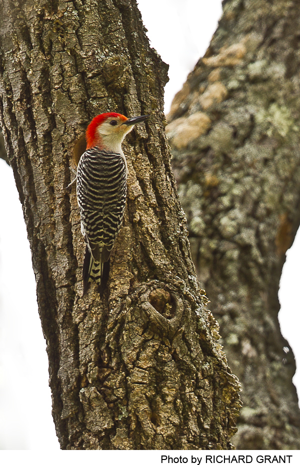
This is a wonderful walk in the woods, just 10 minutes from downtown Princeton. It is not uncommon, in season, to spot a great blue heron, wood ducks, a box turtle, scarlet tanagers and Baltimore orioles. A Northern Harrier was seen across the river one fine day. Close to 1/4 mile of the trail follows close to the Stony Brook. Take a look at the American bladdernut trees as you take the stone steps down the ridge toward the river.
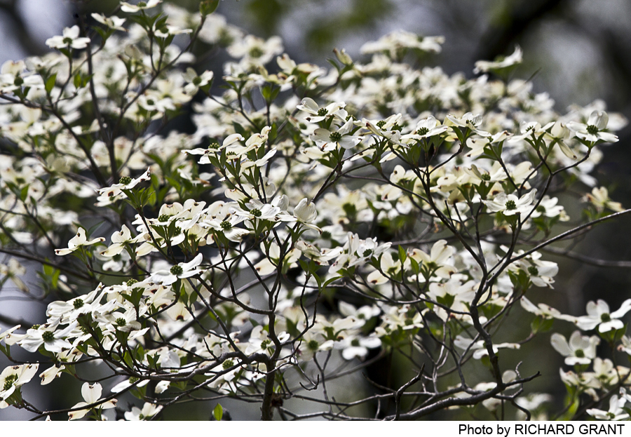
The upper section of the trail follows a ridge under the shade of a beech/oak forest, with patches of Penn sedge in sunny spots. The lower part of the trail is on a floodplain and is occasionally subject to the scouring action of a flash flood after an unusually heavy rain. The forest under-story is open. Large tulip trees, swamp white oaks and pin oaks are found here, along with smaller boxelder, a common floodplain tree. Wet areas in the center of the trail loop shelter green dragon, sensitive fern and tall sedges.
Transcontinental Gas Pipeline Corporation owns the property across the Stony Brook from Kate’s Trail.
-
The upper section of the trail follows a ridge under the shade of a beech/oak forest, with patches of Penn sedge in sunny spots. The lower part of the trail is on a floodplain and is occasionally subject to the scouring action of a flash flood after an unusually heavy rain. The forest under-story is open. Large tulip trees, swamp white oaks and pin oaks are found here, along with smaller boxelder, a common floodplain tree. Wet areas in the center of the trail loop shelter green dragon, sensitive fern and tall sedges.
Do you have information about this trail?
Click Here to contribute.
-
Kate’s Trail is on a 60 acre conservation easement held by D&R Greenway Land Trust since July 2000. The area of the easement with the trail and public access covers 20 acres. The remaining 40 acre easement does not allow public access but will remain as permanent open space.
The preserve contains wetlands, woodlands and habitats for wildlife in a relatively natural and undisturbed area.
D&R Greenway Land Trust’s mission is to preserve and protect our land. Our board of trustees, staff, volunteers and numerous supporters are working tirelessly to ensure that as many acres as possible are saved. We preserve these acres to allow a healthy and diverse enviornment to flourish, which in turn replenishes our water suppply, provides wildlife habitat, and enables recreational opportunities by creating parks, trail networks, and an accessible wilderness.
Transcontinental Gas Pipeline Corporation owns the property across the Stony Brook from Kate’s Trail.
Do you have information about this trail?
Click Here to contribute.
-
Photos

Videos
