Mercer
Princeton
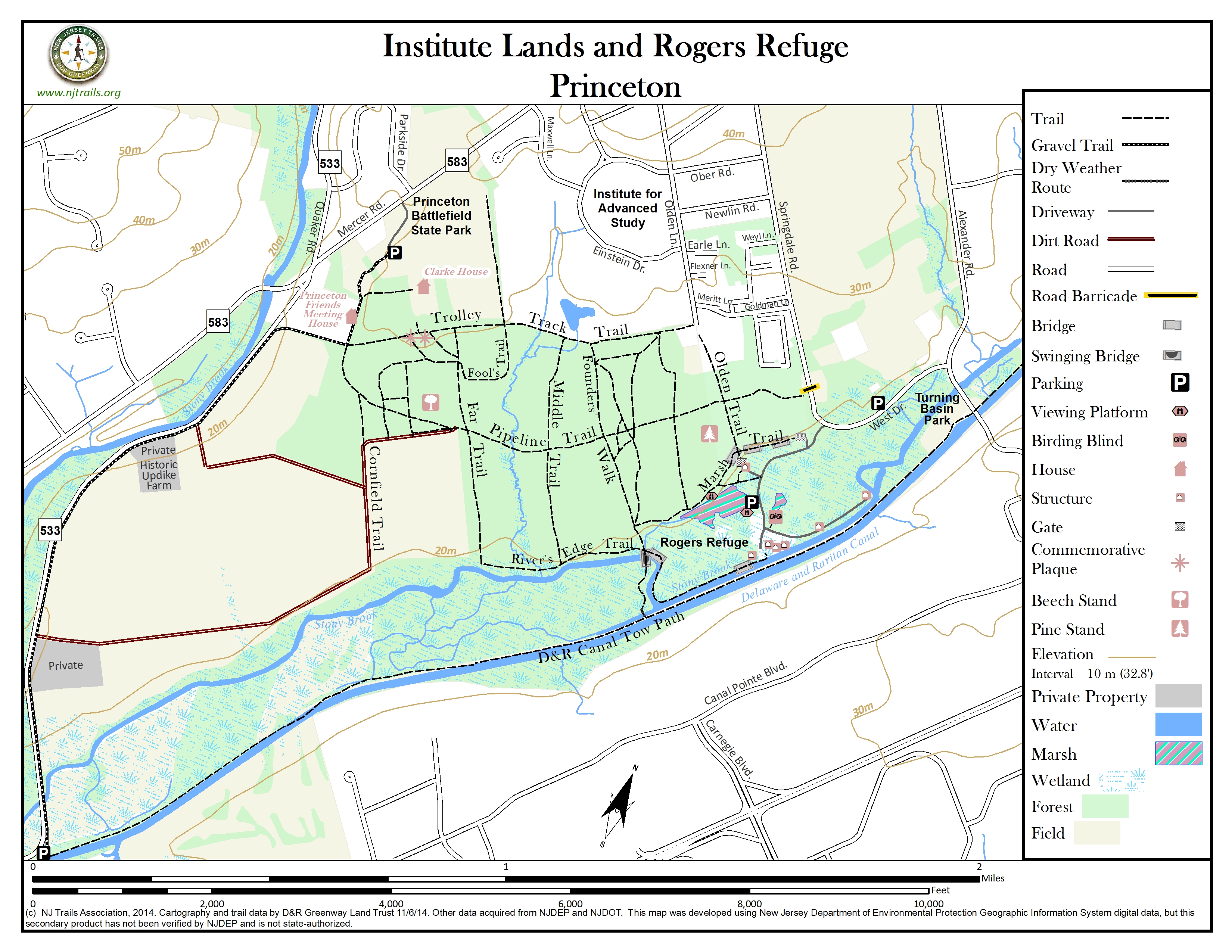
Institute Lands and Rogers Refuge
Princeton, NJ 08540


Last Updated: 12/08/2014
Overview of Selected Trail
A coalition of nonprofit organizations, with support from the New Jersey Department of Environmental Protection Green Acres program and Princeton Township, in 1997 preserved as open space a 589-acre property owned by the Institute for Advanced Study. With the cooperation and ongoing financial contribution of the Institute, the coalition protected the Institute Woods and adjacent farmlands. These lands remain under Institute ownership and are not a public park, but the Institute graciously allows members of the public to use the Institute Lands under terms of a conservation easement signed on April 15, 1997. The conservation easement preserved the lands in perpetuity and provides public access on the pathways through the woods and fields. Walkers will see permanent markers that list many of the organizations and citizens who spearheaded the preservation of the Institute Lands.
-
-
Distance:
A total of 13 miles of trails
Time:
Anything from short ten minute walks to several hours
Markings:
Trails unmarked except for stone posts with signs at several trail junctions; metal markers on trees at Rogers Refuge.
Please keep your dog on a leash at all times!
Trail Usage:
Walking/Hiking, Dogs permitted on leash
Elevation:
Flat
Difficulty:
Easy – maybe muddy in spots after periods of rain. Hiking shoes are recommended. Trails in Rogers Refuge can be quite narrow, and sometimes overgrown.
Parking:
There is ample parking at Princeton Battlefield Park, Rogers Refuge, on West Drive, and at the D&R Canal towpath junction with Quaker Rd.
Tips:
There are historic plaques just inside the woods from the Clarke House. There is great bird watching at Rogers Refuge, especially during spring migration (late April- late May); the tall oaks, vines and understory on both sides of the gravel road offer some of the best birding in the area.
Amenities:
The Princeton Battlefield State Park is adjacent to the Institute Lands. Just across Stony Brook on Alexander Rd. and adjacent to the Towpath is Turning Basin Park, with numerous picnic benches. Across the road one can rent canoes and kayaks.
Directions:
From Nassau Street in Princeton
For the Institute Woods, take Route 583 (Mercer Street) south towards Lawrenceville for 1.3 miles, and turn left into the Princeton Battlefield State Park. Park in the lot at the Thomas Clarke house, and walk up the tree-lined old drive past the Clarke House to the trail leading into the woods, or take the gravel bike path at the SW end of the lot to reach the Friends School, the open fields or the bike path leading to the D&R Canal towpath.For the lot off Quaker Rd. where the end of the bike path meets the D&R Canal towpath, remain on Mercer St. a short distance and turn left onto Quaker Rd. Go about 1-1/2 miles and park where the road takes a sharp right.
For the Rogers Refuge, take Alexander St. out of town towards Route 1, and turn right onto West Drive just before the Stony Brook bridge. After ¼ mile, park on West Drive or turn left onto the gravel driveway, and park in the small lot next to the first viewing platform.
-
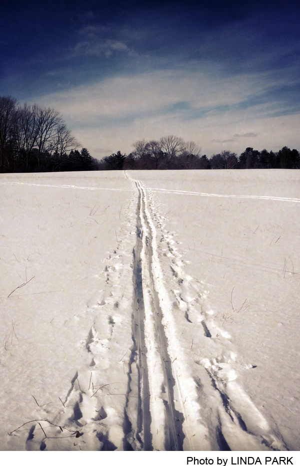
Flat trails, ideal for leisurely walks, jogging, and cross-country skiing (no wheeled vehicles), lace through the majestic woods and farmlands that offer vistas unchanged since the American Revolution, and run along the Stony Brook. Walkers can go from the Institute Woods to the D&R Canal towpath by crossing a swinging bridge and an arm of the Stony Brook (when dry), and climbing a small berm. They can also take advantage of the Charles H. Rogers Wildlife Refuge, a contiguous but separate preserve of 39 acres, owned by the New Jersey American Water Company, which operates several wells there for public use. A conservation easement was granted to Princeton Township in 1969, and here, also, the public is permitted to use the trails. The Refuge is a well-known bird sanctuary. A 10 acre marsh with two new viewing platforms along the edges and a smaller marsh equipped with a blind are flooded each spring to encourage bird visits.
At the very back of the lawn behind the Clarke House, a path leads into the woods and immediately takes the walker onto the charming allee of the east-west Trolley Track Trail, which begins at the end of Olden Laneand passes behind the pond and buildings of the Institute for Advanced Study. At its west end, the trail joins the gravel bike path coming from the parking lot and runs along the south edge of the Friends School to Quaker Rd, which it parallels all the way to the D&R Canal towpath.) This and two other east-west trails can be combined with north-south trails to make loops of varying lengths. The Pipeline Trail runs as a broad green swath through the center of the Woods. The River’s Edge Trail hugs the Stony Brook from the edge of the farm fields on the west to the Swinging Bridge at a sharp bend in the brook. Near the bridge, the Marsh Trail-just a narrow footpath–heads northeast along the Rogers Refuge marsh, past one of the viewing platforms.
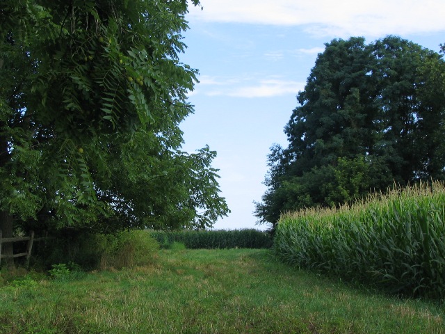
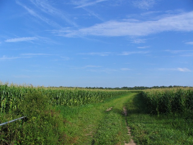
North-south trails link and cross the east-west trails, some just short connectors or loops, others long avenues through the forest. The Olden Trail runs directly from the south end of Olden Lane into the marsh, connecting with the Refuge driveway near the first viewing platform. The Swinging Bridge Trail runs from the Trolley Track Trail to the bridge, crossing the Pipeline Trail, and also connects with the Marsh Trail and the trail through the Rogers Refuge. The Far Trail runs south to the Stony Brook from the Trolley Track Trail near the Battlefield Park entry to the woods. The Cornfield Trail, runs south from the Quaker Meeting House almost to the Stony Brook, becoming an old farm road on the way, at which point another farm road goes off to the west through the fields before passing the side of historic Updike Farm and ending at Quaker Rd. Further along, another farm road runs east along the fields, and finally the Cornfield Trailbends around to the west and runs through scenic farm fields to Quaker Rd,,passing another farm on the way.
-
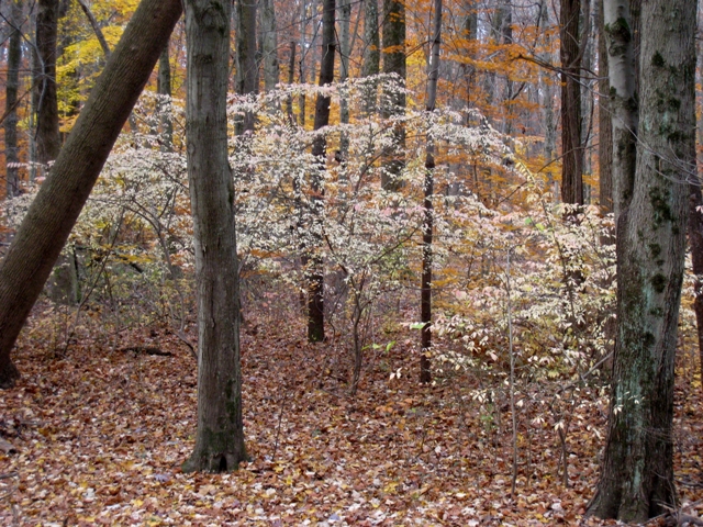
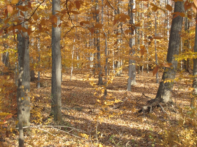
The Institute Lands consist of various tracts farmed as early as the late 17th century by members of the Friends’ community of Stony Brook. Sections of land now part of the Institute Woods were abandoned as farmland in stages in 1727, 1875, 1920, 1935, and 1940. The woods also encompass varied soils, from dry upland to the swampy floodplain of the Stony Brook. The diverse dates of abandonment and soil conditions create a laboratory for studying forest succession. Various sections of the forest are dominated by different species: beech on tracts abandoned in 1727 and 1875, tulip trees festooned with vines where an orchard was abandoned in 1920, oaks and hickories and red maples in other areas. Ash, flowering dogwood, and birch fill the understory, along with black cherry, sassafras, and spicebush.
The upland forest, open fields, stream banks, and marsh make the Institute Lands and the adjacent Rogers Wildlife Refuge a major way station for migrating birds. Some 42 species make their homes in the woods, and as many as 200 species can be found during migration. Warblers abound, as well as bluejays, rufous-sided towhees, and wood thrushes. Bright flashes in the woods are likely to be northern orioles, rose-breasted grosbeaks, and scarlet tanagers.
The Lands are also home to significant plant diversity, with more than 80 native species. Cattails, arrowhead, pickerel weed and wild rice flourish in the marsh. Many varieties of oak, tulip poplar, black gum, sweet gum, and beech grow in the adjacent woods. In the spring, yellow trout lilies, violets, and spring beauties (along with highly invasive lesser celandine) carpet the woodlands and yellow iris blooms in pools at the edge of the marsh. Swamp milkweed, boneset, joe-pye-weed and ironweed form a pattern of mauve and purple beside many of the walks in the summer. In the fall, red osier dogwood is in fruit, along with elderberries, rose hips and the tall brown spikes of the cattails.
Do you have information about this trail?
Click Here to contribute.
-
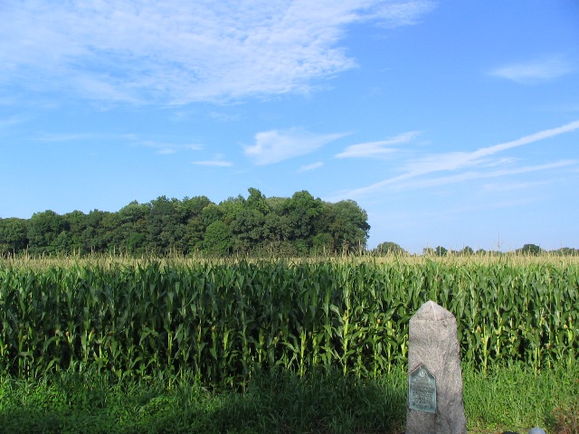
George Washington marched his troops through the fields, woods, and wetlands of this area on January 3, 1777. The weary Revolutionary Army, having overwhelmed the Hessian troops in Trenton and taken them as prisoners across the river to Pennsylvania, recrossed the Delaware River and was squared off against British troops on opposite sides of the Assunpink Creek.
Seeking to disengage in the night and mount an attack on the British in Princeton, Washington left campfires burning and sentries in place as a deception, and quietly moved his soldiers over what is now Quaker Bridge Road towards Princeton. British General Cornwallis was moving most of his 4th Brigade south to Trenton for a counterattack, leaving two regiments in Princeton as a rear guard.
Washington surprised the British on the banks of the Stony Brook, scattered their troops, and destroyed a wooden bridge over the brook to impede British reinforcements coming from Trenton. Washington’s army then marched up the old Sawmill Road behind the current location of the Institute for Advanced Study and the site of the University s graduate college to Nassau Hall. (A stone marker on the Trolley Track Trail marks the route of this march.) The patriots captured the British attempting to defend Nassau Hall, the main University building, and then moved on towards Morristown, eluding Cornwallis’s troops.The historical significance of the lands and buildings has been recognized by their inclusion in the Princeton Battlefield/Stony Brook Village Historical District in the State and National Registers of Historical Places. See Battle of Princeton.
The Princeton Wildlife Refuge was created in 1968 as a conservation easement granted to the Township of Princeton by the Elizabethtown Water Company. In 1977, the name was changed to honor Charles H. Rogers, a nationally known ornithologist who played a key role in establishing the sanctuary and who died that year.
In an attempt to keep the aquifer more constantly replenished, the water company had for many years maintained a pump to bring water from the Stony Brook into the adjacent marshy area with the expectation that a portion would seep down through the soil and shale below into the aquifer. Although not the original intention, a consequence of this project was that a fairly steady water level was maintained in the marsh, making the area highly attractive to birds. Wood Ducks, Herons, Egrets, Tree Swallows and Purple Martins were regulars at the marsh, and a stunning variety of brilliantly colored warblers dropped down in spring migration. Birders from all over came to visit the area.
Do you have information about this trail?
Click Here to contribute.
-
Photos
Videos