Somerset
Montgomery Township
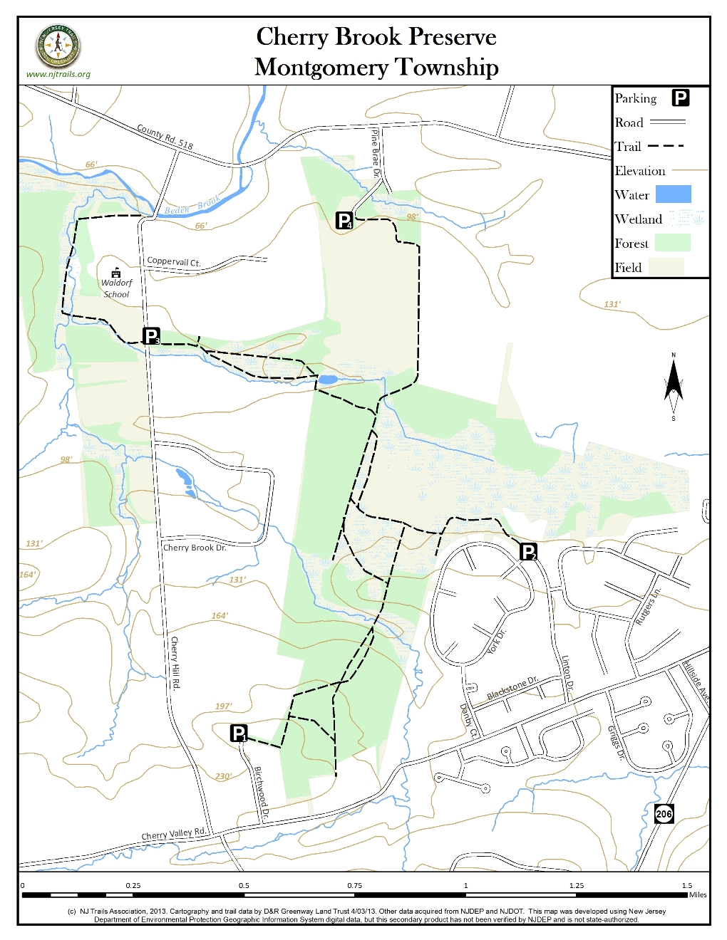
Cherry Brook Preserve
Montgomery Township, NJ 08540


Last Updated: 06/24/2013
Overview of Selected Trail
This is an area of several hundred acres, made up of various parcels acquired by Montgomery Township over the years. Parts of it are heavily wooded, while other parts have been farmed for many years and are now being reforested by the Montgomery Township Open Space Committee. Cherry Brook and two tributaries run through the property, and there are substantial wetlands. A small but scenic pond is centrally located, and can be reached from several directions.
-
-
Distance:
Currently about 5 miles of trails.
Time:
3 hours to walk all trails
Markings:
Trails are presently not marked, except for occasional signposts (Montgomery Pathways) at the beginning of segments.
Trail Usage:
Walking/Hiking, Horseback riding, Dogs permitted on leash
Elevation:
Mainly flat trails
Difficulty:
Many of the trails are actually old farm roads, some badly eroded, but none are particularly challenging. One exception is behind the Waldorf School, where the official trail makes two difficult crossings of Cherry Brook. If needed, stay on the east side.
Parking:
P1) The first parking area is at the end of Linton Drive, 0.6 mile west of Route 206 on Cherry Valley Rd., and holds 12-15 cars (park on the right side of the road).
P2) The second parking area is at the end of Birchwood Drive, 0.8 mile further west on Cherry Valley Rd. (Park in the cul-de-sac).
P3) The third area is on Cherry Hill Rd., 0.4 mile south of Route 518 or about a mile north of Cherry Valley Rd. A small gravel parking lot on the east side holds about 6 cars.
P4) The fourth area is on Pine Brae Drive just east of the Beden Brook crossing on Route 518. Keep to the right and park in the new lot just short of the swim club.
Tips:
Allowed usages include hiking, biking, horseback riding, and cross country skiing. Hunting is also permitted during the season, which runs from September to February, on the Nicolaysen and Opatut portions of the property only (primarily bow hunting). Hunting is never permitted on Sundays. Except for a very short stretch from Birchwood Drive, there are no paved trails on the property, and it is not appropriate for wheel chair access.
The best times to walk these trails are the summer and early fall, when the ground is dry and before hunting season begins.
Amenities:
There are benches along several of the routes, and particularly around the pond, which makes an attractive lunch spot.
Directions:
To reach the area, which is just north of Cherry Valley Rd. and east of Cherry Hill Rd. in Montgomery Township, go north from Princeton, or south from Somerville, on Route 206. Cherry Valley Rd. is the third traffic light south of Route 518, which runs from Kendall Park on the east through Hopewell to Lambertville on the west. There are currently four entrances/ parking areas.
-
From Linton Drive, walk straight ahead along a raised berm surrounding a detention basin. At the marker post, after the berm turns sharply to the left, descend the right side of the berm and follow the markers into the woods, immediately crossing an old farm road that runs to the left but ends after 100 yards. The large open field to the right is being reforested. Where the trail exits the woods, continue in the same direction along the edge of the field. At the far end, follow the markers around to the right and back into the woods. In a short distance, the trail deadends at an old farm road. Go to the right along the road, and then turn left at another marker. (Going straight ahead at this point will lead to the new trail to lot P4.) After about 200 yards, as you pass a pond on the right, go right across the outlet stream to remain on public land (continuing in this direction will bring you out into open farm fields). The pond is a highpoint of the walk, and a lovely spot for lunch, with benches and a picnic table. From here, the trail turns west again, passing through swampy areas on sections of boardwalk, and running along the edge of a mature cedar forest. (A new trail leaves from further around the pond and runs through cedar and fir woods on a drier parallel route, rejoining the old route before a deadend side road comes in from the right. The trail passes a viewing area with a bench on the left and then comes to the small parking area off Cherry Hill Rd.
At this point it’s possible to continue across the road and follow a trail (sometimes wet) around the Waldorf School for 0.6 mile. The trail follows the stream coming from the pond to where it meets Cherry Brook. At certain times of year it is still possible to follow the original route, crossing the brook twice, but there are no stepping stones; often it is necessary to detour by staying on the near side. To complete a loop, one must return to the parking area by walking down Cherry Hill Rd. for about ¼ mile.
To access the southern part of the Nicolaysen property, one way is to follow the above directions from Linton Drive to the point where you first enter the open field, but instead of continuing straight ahead, go left along the far side of a smaller field. There is no trail until you come to the far end of the field; look for it just past a bench in the upper right corner. The trail is another old farm road, partly overgrown, that drops down to cross Cherry Brook (shallow, but no stepping stones), and then climbs the other side. Part way to the brook it meets the other farm road leading from the large open field. Just beyond the brook, the road, which is badly eroded here, forks and then reunites further on. At this point, a trail goes left but deadends after less than 100 yards; a trail also goes to the right, the first of two remaining segments (the township maps show four) running 0.1 mile over to a parallel trail. After another 0.1 mile or so, the latter trail turns sharply to the right and runs on pavement out to the cul-de-sac at the end of Birchwood Drive, which is the other way to access this property. The farm road continues to a tree line behind a home on Cherry Valley Rd., where it enters private property.
A new gravel trail, financed by Bloomberg, Inc. and Gibraltar Rock Quarry, runs from the P4 lot for ¾ mile across farmland to the old farm road mentioned above. To reach the pond from this trail, go right at the marker after ¾ mile.
-
The section of the park formerly owned by the Nicolaysen family has undergone reforestation. With technical assistance from Andropogon Associates, native trees and shrubs have been planted to fill the large opening in the forest which was previously farmed. Saplings were planted in spring and fall of 2007 to help provide habitat for song birds that require contiguous forest to survive and breed.
Walkers may see red fox near the woods (several fox holes are evident). In the pond area it is possible to see Great Blue Heron and other wading birds.
Do you have information about this trail?
Click Here to contribute.
-
The Cherry Brook Preserve is located along a very historic road. Cherry Valley Road was once known as the Pennington Road to Rocky Hill Mills and existed as early as somewhere between 1710-1720. It was apparently a major route to the mills as documented in an early letter written by a resident of Pennington to a member of his family. A section of land along Cherry Valley Road and the Great Road became, after the French Revolution, a new place of settlement of refugees. A section of Princeton, known as Cherry Grove, is particularly associated with them. Richard Stockton of Princeton owned vast acreage on the south side of Cherry Valley Road.
Part of what is now called the Cherry Brook Preserve includes land formerly owned by the Nicholaysen family. The agreement to purchase the 109 acre parcel off of Cherry Valley Road was finalized in 2007, with the non-profit Montgomery Friends of Open Space contributing $400,000 of its grant funds to help Montgomery Township preserve the land. Over the years, various other properties, including the Opatut holdings, were added to the original preserve. In 2012, a new trail running south from Pine Brae Drive to the pond was constructed using funds donated by Bloomberg, Inc. and material donated by Gibraltar Rock Quarry.
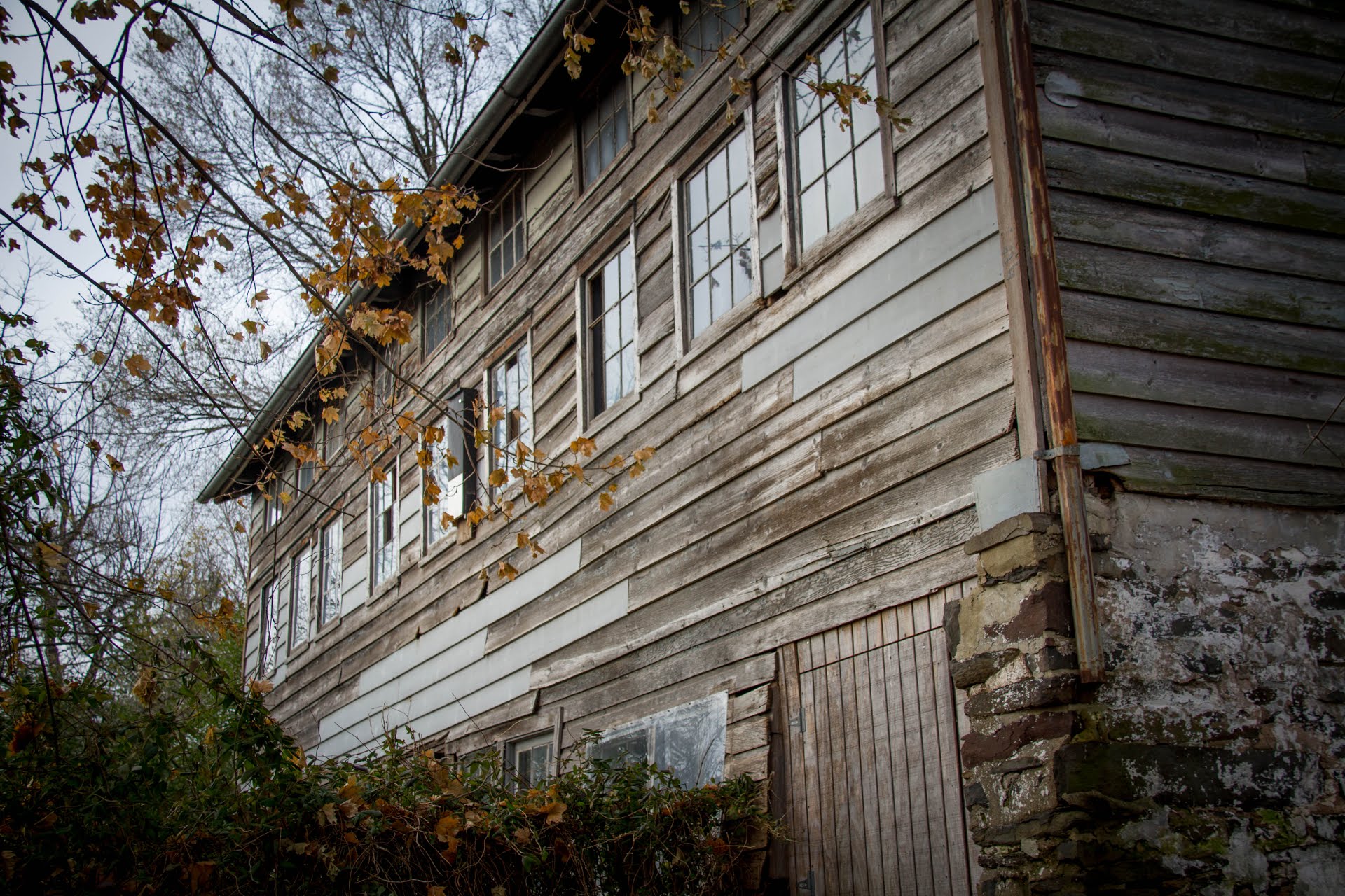
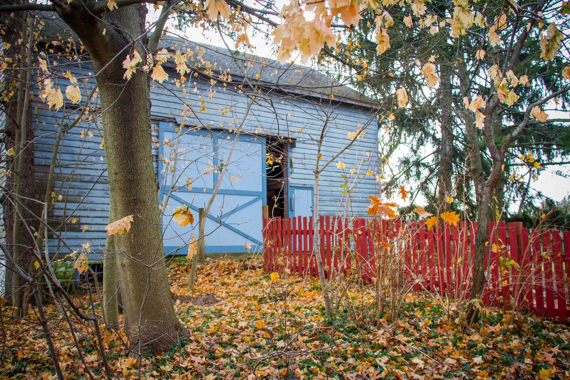
When entering the trail network on Cherry Hill Road, one will notice The Waldorf School of Princeton. The school is a coeducational, non-sectarian school serving 265 children from early childhood through eighth. The 20-acre campus is an old farm site near Princeton, New Jersey. With its rolling fields, old barns, woods and stream, the school retains a country atmosphere in an area that is changing from rural to suburban.
Do you have information about this trail?
Click Here to contribute.
-
Photos
Videos
