Mercer
West Windsor Township
Trolley Line Trail
West Windsor Township, NJ 08550


Last Updated: 05/27/2014
Overview of Selected Trail
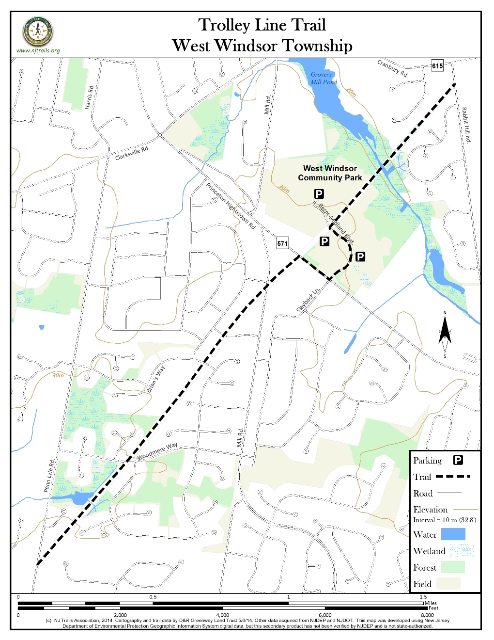
The Trolley Line Trail is a 2.5 mile straight, paved pathway between Rabbit Hill Road and Penn Lyle Road in West Windsor suitable for walking, jogging, and biking. It lies under the PSE&G power lines. The Trail is on the bed of the Fast Line electric trolley that connected Trenton and New Brunswick early in the 20th century. The Trail passes through West Windsor Community Park where there are picnic facilities, play equipment, soccer fields, baseball fields, tennis courts, dog parks, basketball courts and rest rooms, as well as the West Windsor Community Waterworks swimming pools and the West Windsor Community Skateboard Park. Elsewhere, the Trail passes behind many residential areas, beside undeveloped wetlands and crosses Big Bear Brook. The paved trail is bounded everywhere by well-mowed grass. There are signs at each end and ground level plaques each half mile. A map can be viewed at the intersection with Bernt Midland Blvd.
-

-
Distance:
2.5 miles
Time:
Markings:
The trail runs as a straight paved trail with the power lines overhead. There are signs at each end and ground level plaques each half mile.
Trail Usage:
Walking/Hiking, Accessible by wheelchair and baby stroller, Dogs permitted on leash, Mountain biking
Elevation:
Flat
Difficulty:
Easy
Parking:
There are many paved parking spaces in West Windsor Community Park. However, the park is far from the ends of the Trail and there is no nearby parking at either end.
Tips:
The power lines are far above the people using the trail, and PSE&G is generous to allow a trail to pass near them. Do not touch the posts which are a fair distance from the trail, but nevertheless use caution and respect near them.
Amenities:
Trail passes through West Windsor Community park which has picnic areas, play equipment, rest rooms and basketball courts.
Directions:
Users unfamiliar with the area should enter West Windsor Community Park via Bernt Midland Blvd. from Route 571. This road is at the intersection of Route 571 and Slayback Drive, controlled by a traffic signal. This intersection is the second light east of the intersection of Route 571 and Clarksville Road. More generally, it is about two miles east of the intersection of Route 571 and US Route 1.
There are many paved parking spaces in West Windsor Community Park. However, the Park is far from the ends of the Trail, and there is no nearby parking at either end.
-
The power lines and posts are dangerous. PSE&G has been very magnanimous in permitting the Trail to pass near them. The power lines are far above the people using the Trail. The posts, which are well-separated from the Trail, must be treated with caution and respect, and should not be touched. And always alert fellow Trail users when overtaking them.
While the presentation goes from north to south, it could equally well be made in reverse.
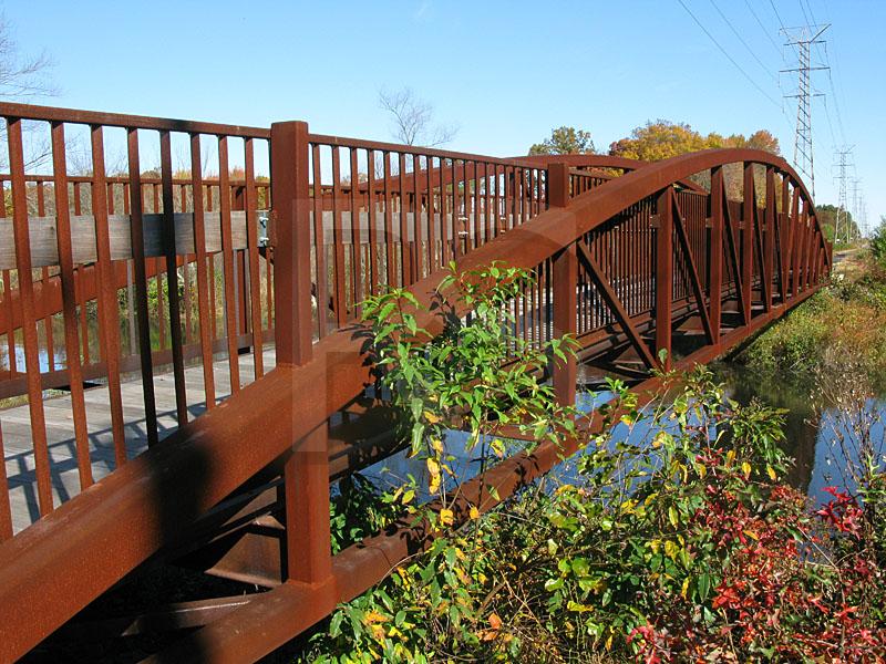
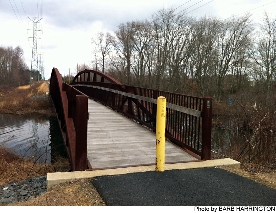
● North of Community Park: One end of the Trail is at Rabbit Hill Road about 100 feet from the intersection of Rabbit Hill and Cranbury Neck roads. There are bike paths and sidewalks along Rabbit Hill Road from the trail toward Route 571, but not from the Trail toward Cranbury Neck Road. The Trail passes between the Kings Mill (west) and Brookshyre (east) residential areas and through the wetlands along Big Bear Brook. (The wetlands between Kings Mill and the Brook are owned by the Township and unimproved trails through them can be accessed via paths descending the steep embankment beside the Trail. The Brook forms Grover’s Mill Pond.) The Pig Town Bridge over the Brook is 0.4 miles from the Trail beginning. Beyond the Bridge, the trail rises steeply to parallel a ravine on one side and a sediment pond on the other side. (The sediments were recently dredged from Grover’s Mill Pond.)
● Community Park: The Trail enters West Windsor Community Park at 0.5 miles where it is marked by a ground level plaque and a green tipped post. It crosses under the power lines and intersects Bernt Midland Blvd at 0.75 miles. There is a Trail map and a memorial to Bernt Midland at this intersection. The Trail passes through playgrounds and ball fields and past rest rooms, leading to the intersection with Route 571 at 0.9 miles. A traffic signal and crosswalk enables safe passage across busy Route 571. (Two alternative trails through Community Park start at the intersection of the Trail with Bernt Midland Blvd. A westerly trail loops around the park buildings and rejoins the Trail. An easterly trail leads to the skateboard park and loops around the basketball courts and Canine Commons. Each of these trails is about 0.75 mile long.)
● South of Community Park: The Trail follows a sidewalk in front of Windsor Business Park north along Route 571 back to the power lines, where the Trail turns away from Route 571. At 1.25 miles the Trail crosses South Mill Road. No crosswalk marks this intersection, so care is needed in crossing. The Trail continues straight for 1.25 miles to Penn Lyle Road, crossing Rumford Way, Brian’s Way and Woodmere Way. There are crosswalks at these crossings and these roads are lightly travelled. Residential back yards and wetlands areas can be seen from the Trail. The power line posts are about 0.1 mile apart. The Trail ends at Penn Lyle Road, midway between Cedar Court and Village Road West. The end is marked by a sign and green tipped post. There are no sidewalks along Penn Lyle Road at this point. A paved off-road path leads into the Le Parc residential area on the other side of Penn Lyle Road.
Beyond the Trail: The Township has a grant for bike path on South Post Road from Village Road to Lake Mercer, and Village Road can be reached from Le Parc, which can be accessed from the south end of the Trail. Beyond the north end of the Trail, a bike path along Rabbit Hill Road leads to Bennington Drive. Soon after a right turn onto West Kincaid Drive, there is a paved off-road path that leads to Davenport Drive. This road intersects Southfield Road very close to McCaffrey’s and the Southfield Retail Center.
-
The trail passes behind many residential areas, beside undeveloped wetlands and crosses Big Bear Brook. The paved trail is bounded everywhere by well-mowed grass.
Do you have information about this trail?
Click Here to contribute.
-
At the Pig Town Bridge over Big Bear Brook there is a plaque providing much history about the Fast Line Trolley, which ceased activity in the 1930s. (Pig Town was the Trolley stop at Route 571. Orson Wells is reported to have used a Trolley schedule to choose Grover’s Mill for the site of the 1938 ‘War of the Worlds’ radio drama.) Later the tracks were removed and PSE&G installed the power lines. The upper structure of the bridge across Big Bear Brook was removed along with the Trolley Line Tracks. The West Windsor Community Park was established in the 1980s. The present bridge was built in 2007 using the old abutments.
Do you have information about this trail?
Click Here to contribute.
-
Photos
Videos


