Hunterdon
West Amwell Township
Dry Run Creek
West Amwell Township, NJ 08530


Last Updated: 11/28/2012
Overview of Selected Trail
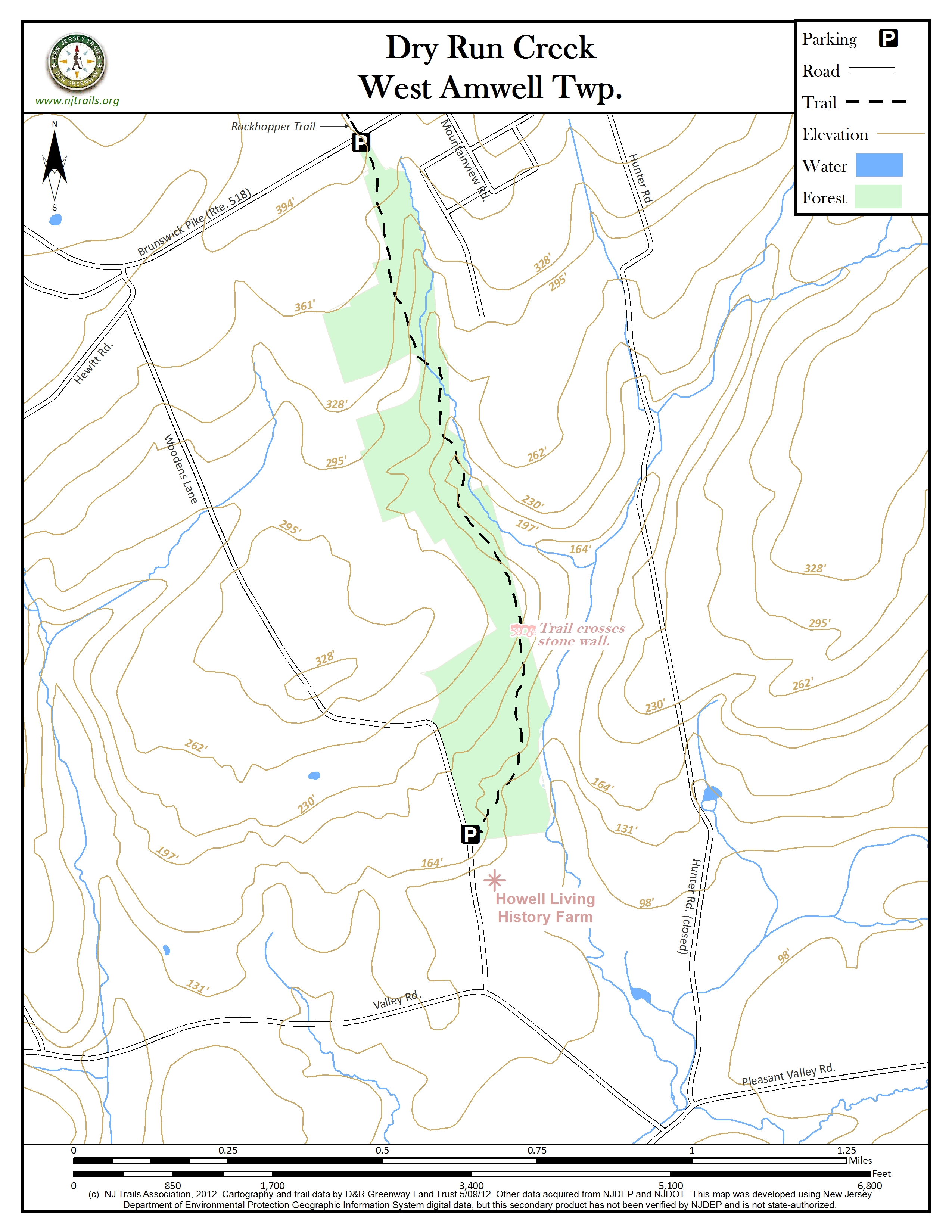
The trail descends through woods into the steep-sided valley of the Dry Run Creek, a tributary of Moore’s Creek. It then gradually climbs north, sometimes skirting the charming ledge-bound creek, passing over three rustic bridges and an old dam. The trail climbs up out of the creek valley, sometimes on stone stairways, to its north end at Route 518. The Rockhopper Trails directly across Route 518, continues 2.3 miles to the edge of Lambertville.
-
-
Distance:
1.2 miles
Time:
Leisurely one hour walk up the trail and back to Woodens Lane. New Parking lot on Route 518 enables use from the north end walking south.
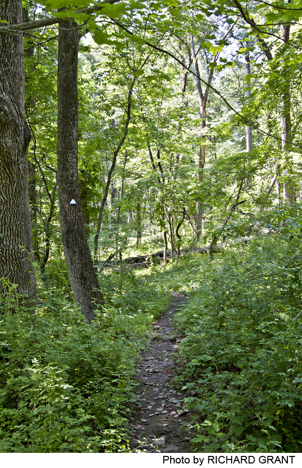
Markings:
Trail marked with blue plastic blazes on trees. Please stay on trail at all times.
Trail Usage:
Walking/Hiking, Dogs permitted on leash
Elevation:
Trail climbs gradually about 230 feet from Woodens Lane to Route 518.
Difficulty:
Moderate
Parking:
Parking lot for four cars on the east side of Woodens Lane, about 150 yards north of the entrance to Howell Living History Farm. Parking lot for six cars at northern end on the south side of Route 518, .4 mile west of Rock/Hunter Road intersection.
Tips:
Some areas of the trail may be wet or muddy after heavy rains or during spring thaw, so wear appropriate shoes. Where the trail crosses streambeds, there may be substantial water flow right after heavy rains, so proceed with caution.
Amenities:
Howell Living History Farm is nearby in Hopewell and offers horse drawn wagon rides, maple-sugaring and craft days for families on weekends. Restrooms are available at the Howell Living History Farm just south of the Woodens Lane trailhead, when the Farm is open.
Directions:
To southern trail head: From Lambertville, take Route 29 south 2.5 miles and turn left on Valley Road, and after 1.4 miles turn left on Woodens Lane. From Pennington, take Route 31 just .25 mile north, turn left on Pennington-Harbourton Road. Go 2.8 miles to Route 579, cross it (road name changes to Pleasant Valley Road). After 3 miles on Pleasant Valley Road, turn right on Valley Road, and go just .3 mile to Woodens Lane on the right. Trail head is .25 mile up Woodens Lane, just about 200 yards past the entrance to Howell Living History Farm.
To northern trail head on Route 518: From Lambertville, take Route 518 east 2 miles to parking lot on the right (about .4 mile beyond a broad curve where Hewitt Road joins Route 518 from the right). From Route 31, take Route 518 west 5 miles to parking on the left, just .4 mile past the intersection of Route 518 with Rock Road and Hunter Road.
-
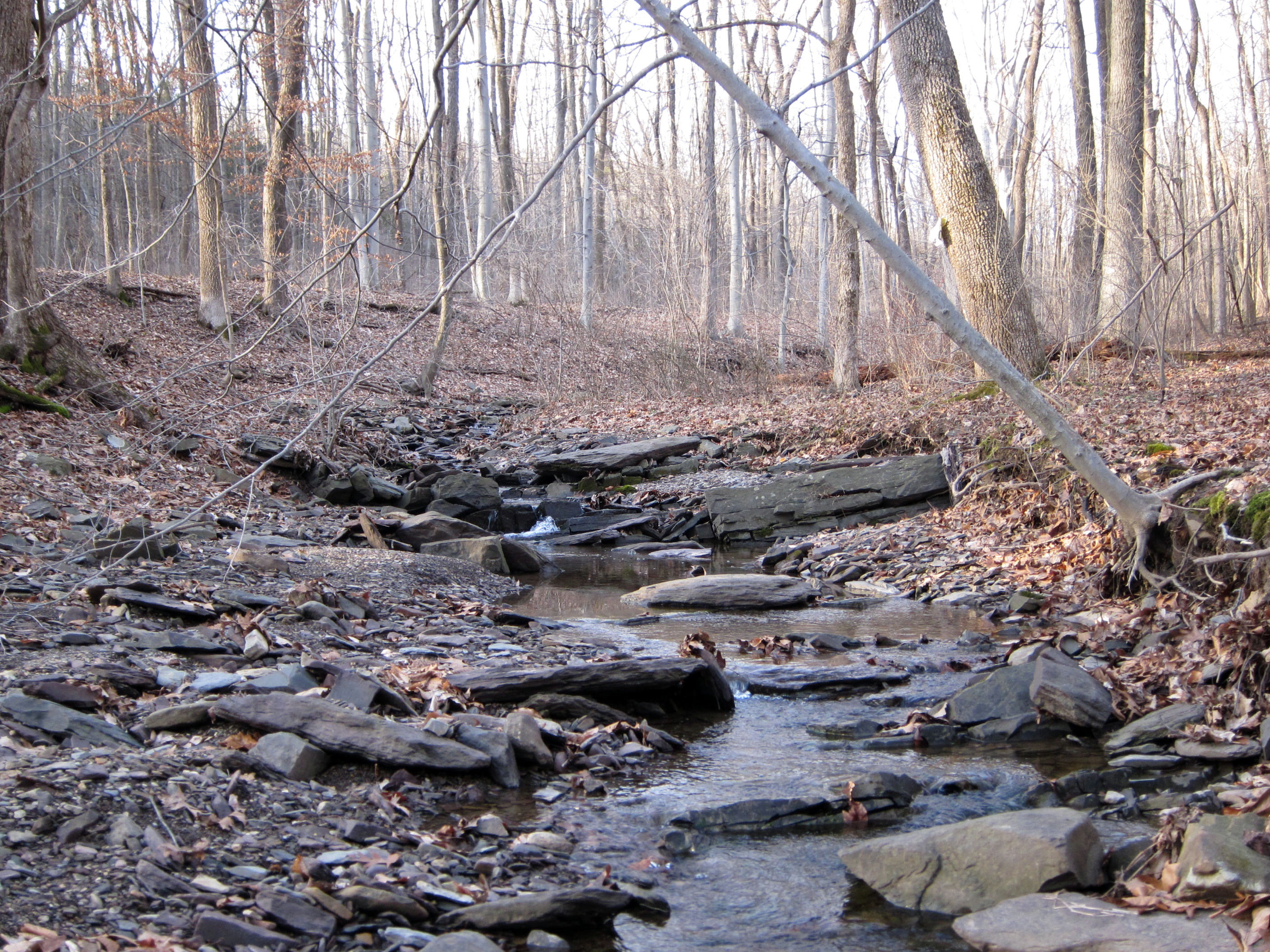
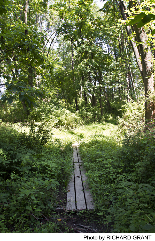
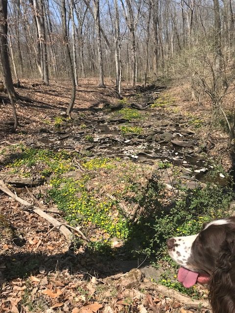
From the southern trailhead, the narrow footpath first descends to and crosses a small drainage that is usually dry, then curves through a cool, dense stand of cedars, crossing two small intermittent drainages on simple footbridges. The trail then climbs gradually north along the side of the Dry Run Creek valley, with striking views down to the stream, crossing another small ravine on rough stone steps, and contours up to a high point above an old stone wall. The trail then descends gradually, crossing still another small ravine on stone steps, and leads walkers across a wide gravel- and stone-strewn stream bed just above the point where it feeds into Dry Run Creek. Just north of this streambed there are lovely stone ledges in Dry Run Creek.
From this point the trail climbs along the west bank of the Creek, soon reaching the face of an old, breached earthen dam, which it climbs on cedar log steps. The path traces along the top of the dam to a footbridge made largely of red cedar cut and shaped on the site, crossing an old overflow channel from the old pond formed by the dam. It then climbs, sometimes on rustic stone steps, up the west side of the valley, reaching a small parking lot on Route 518.
-
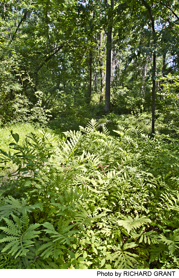
There are a nice variety of landscape features along this trail. Starting at the southern end, you will enter a dense grove of red cedars, which rather abruptly ends when you cross a drainage ditch and enter a more mature deciduous forest, from which you have a splendid view down to the floodplain of Dry Creek. Dry Creek is not always dry, and when it is flowing it delightfully cascades over a series of rock ledges. The path passes through 19th century stone walls, follows an old logging road for a brief period and skirts a former farm pond.
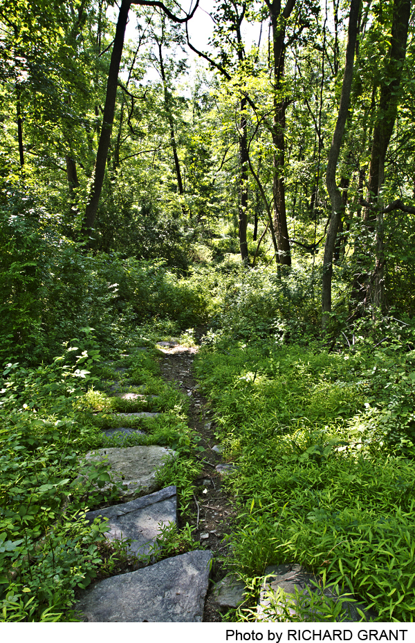
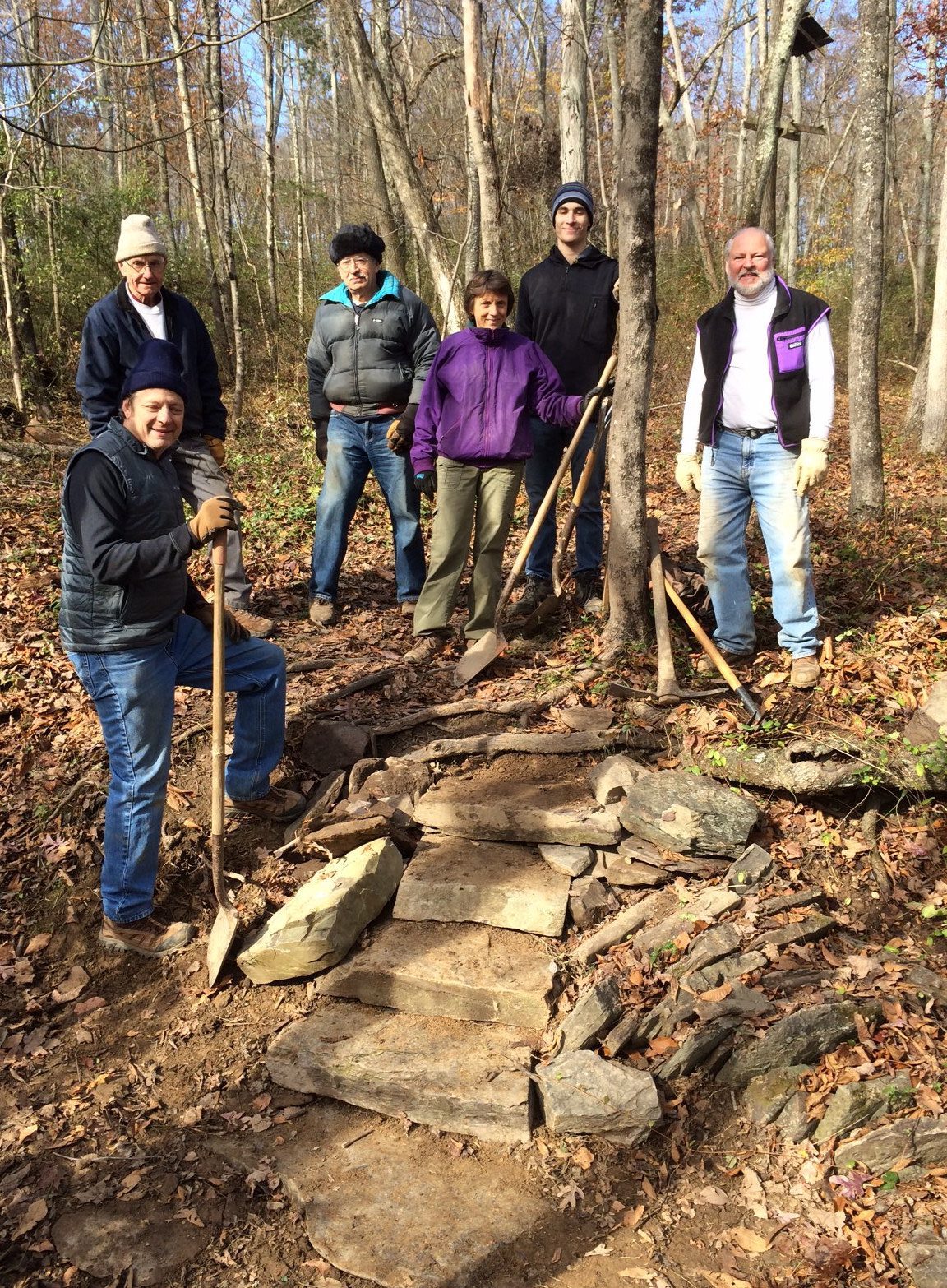
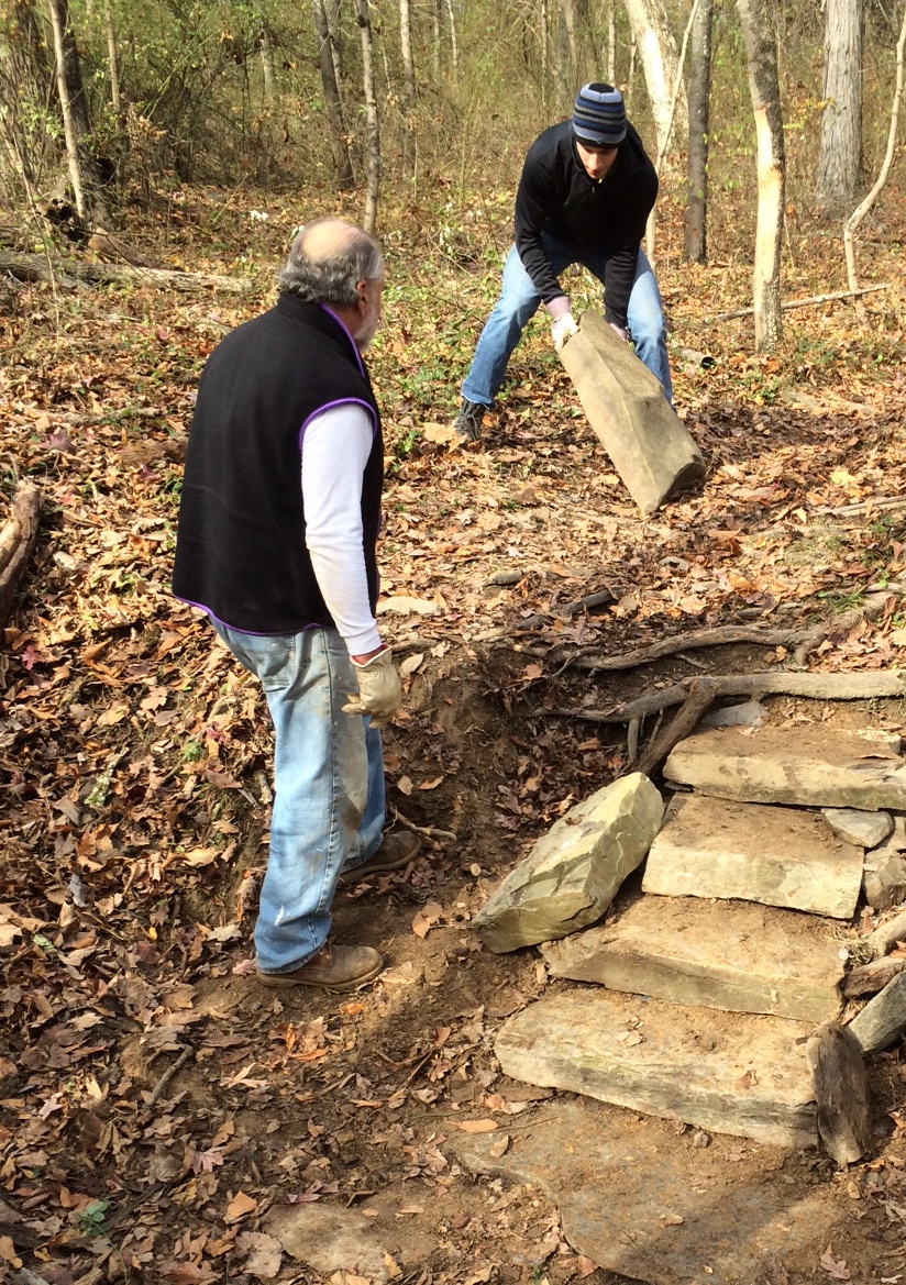
While the deciduous forest is clearly second growth, there are a number of striking grandfather trees, including several Red oaks that have stood for more than 200 years. The trail also features a number of newly-built stone stairs, stepping stones placed to help the hiker through wet areas and a bridge hewn from local cedars.
Do you have information about this trail?
Click Here to contribute.
-
Signs of earlier land usage are evident along this walk. Old stone walls slice down the slopes toward the creek, and along the valley sides, suggesting earlier property boundaries and perhaps field clearances. Parts of the trail follow or cross an old woodland road, and at one point the trail, skirting an old wall, passes a line of ancient oaks. Origins of the earthen dam near the northern end of the trail are unclear; the presence of nearby Lake Drive to the east suggest that the housing there was developed when a lake still backed up behind the dam.
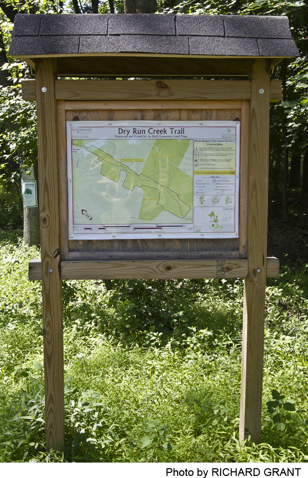
Dry Run Creek Trail meanders through an area of West Amwell Township, Hunterdon County that has been preserved by fee simple or by conservation easements. Hikers should stay on the marked trails and respect any private property signage along the way. Historic farms are located along Hunter Road and Woodens Lane that in some cases remain intact today. D&R Greenway Land Trust, a regional land trust whose mission is to preserve farmland and forests and carefully steward the land, spearheaded the trail design and construction. D&R Greenway is grateful to the many volunteers who worked on most weekends for almost two years to complete this trail.
Do you have information about this trail?
Click Here to contribute.
-
Photos
Videos
